Record heat and fire danger to start the weekend

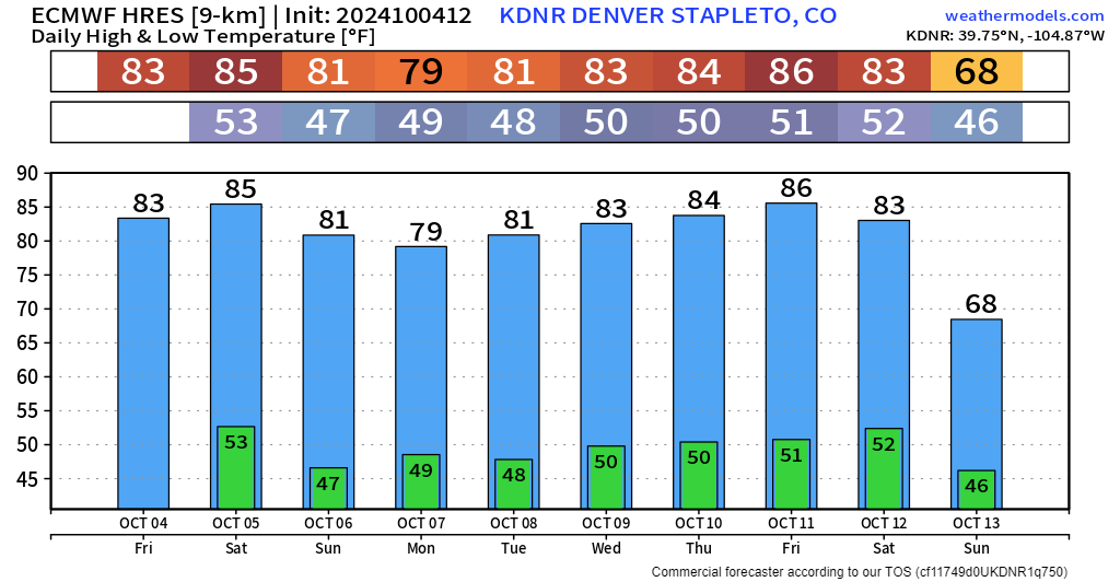
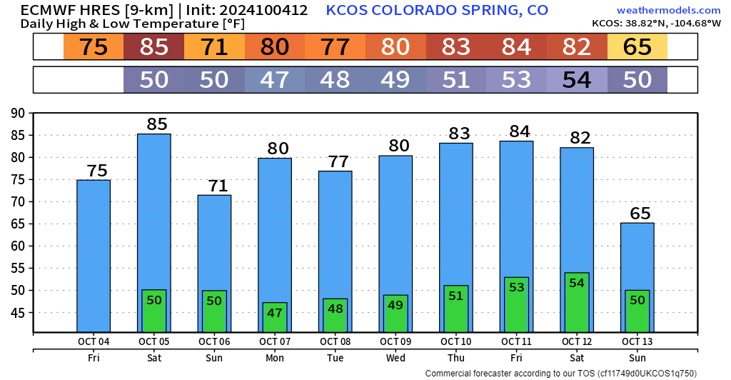
We've been talking heat for a while now, and that trend seems like it's going to keep rolling along for the foreseeable future. Temp trends for Denver and Colorado Springs show very little relief from this heat over the next 10 days.
Both cities have a chance to see record high temperatures broken for the date tomorrow. For Colorado Springs, a high of 85 would break the record of 83 (2020). In Denver, 86 is the record, set back in 1997.
The ridge looks to flex to start this weekend, with a weak trough passing overhead Monday, with the ridge strengthening again late next week. Getting into October, we tend to dry out the atmosphere and kick up a bit more wind.
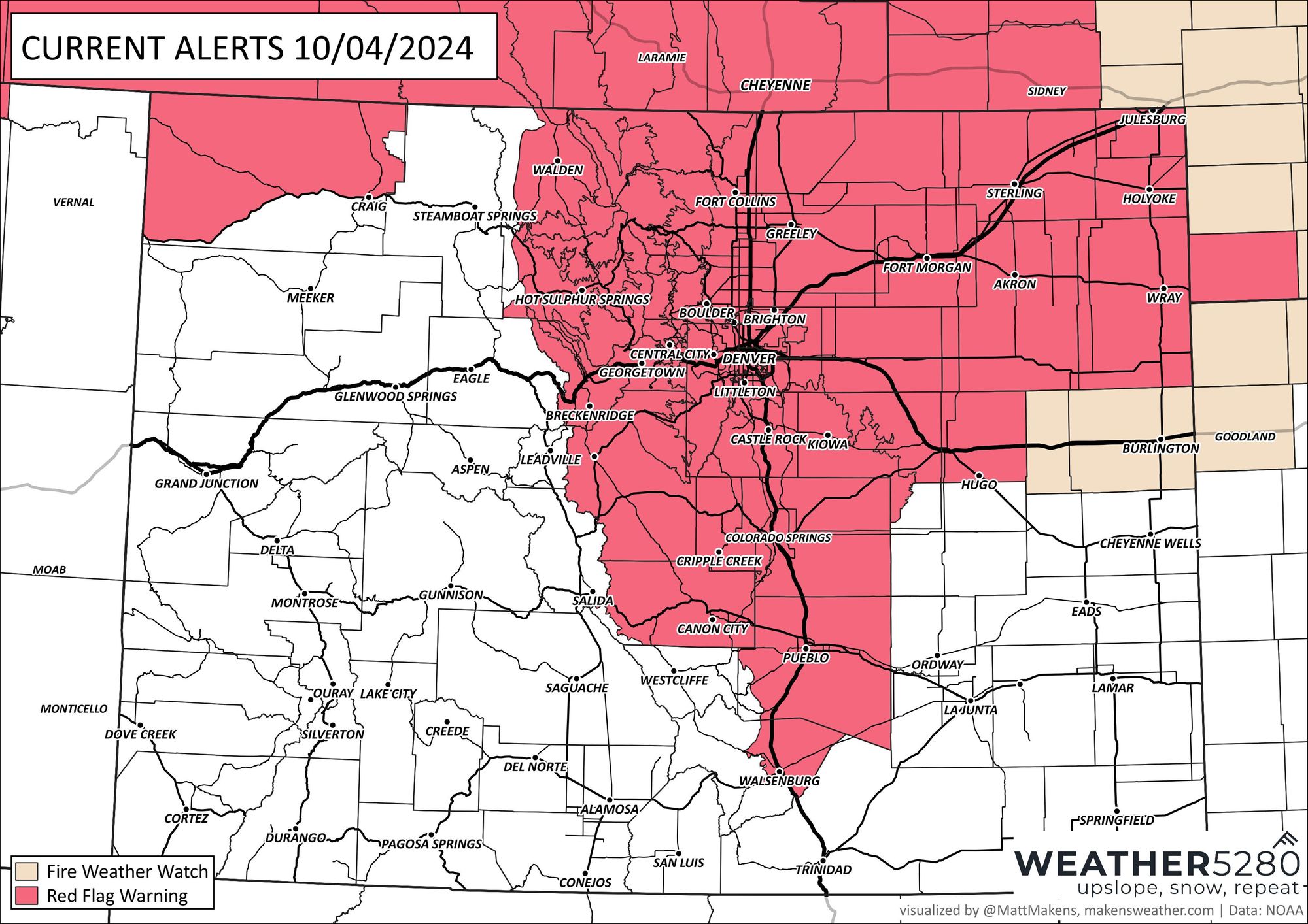
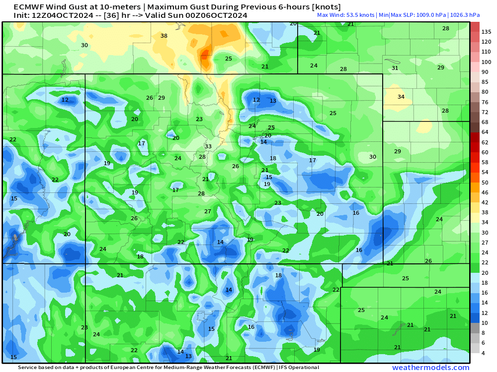
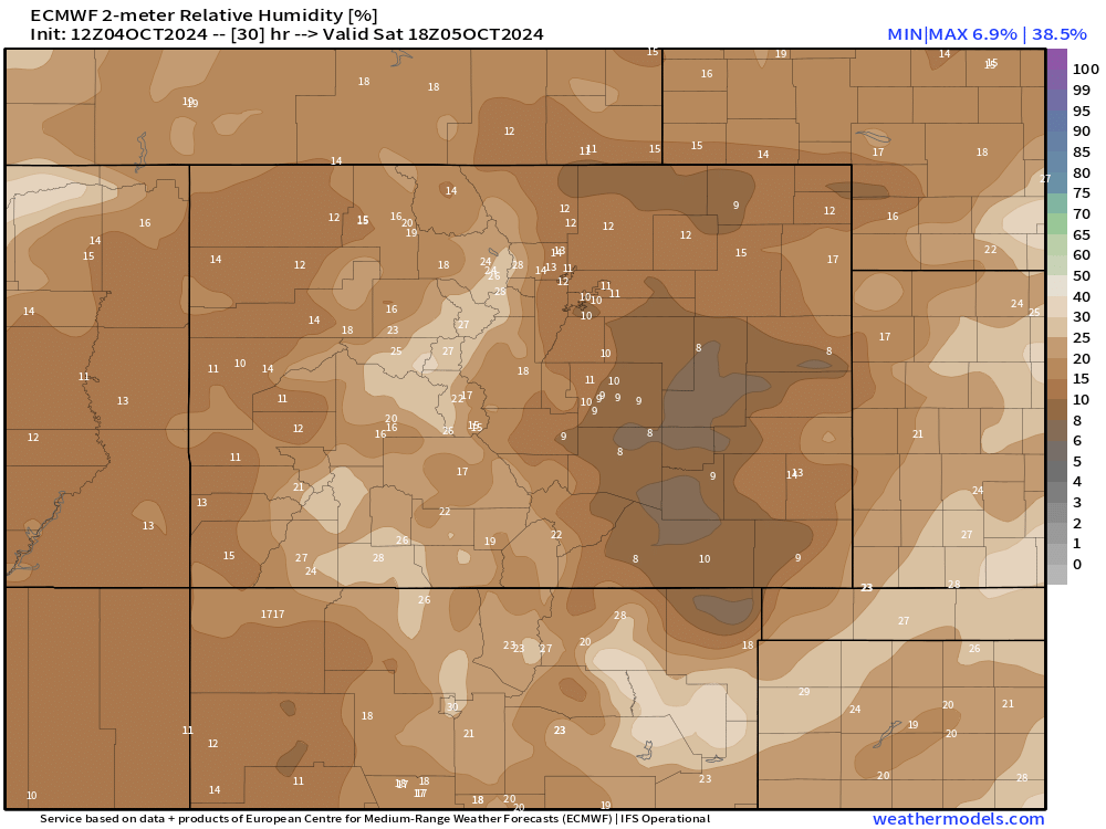
With that, we're going to see fire danger ramp up on Saturday. Gusty winds between 20-30 mph, with relative humidity values in the single digits combined with drying vegetation will create conditions for rapid fire spread and growth. We're also seeing this threat extend all the way up to the eastern flank of the continental divide.
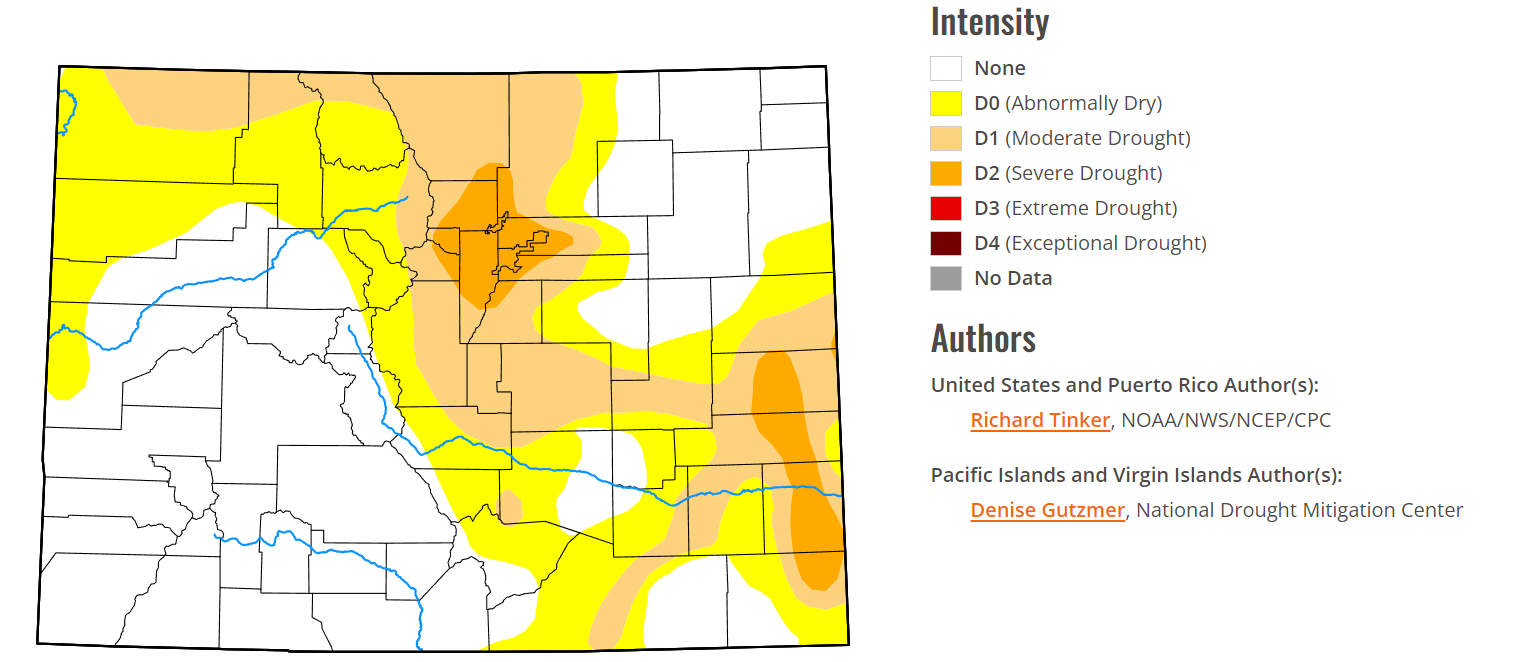
The latest drought monitor is starting to get a bit bleak for us too. A large chunk of the Denver Metro and foothills are now considered to be under "severe drought".
WHEN WILL WE FINALLY SEE THAT BIG PATTERN CHANGE?...
It may very well be another 2 weeks of mostly above normal, dry weather for the state. The main storm track looks to stay locked up north in Canada with the ridge holding strong through mid-October.
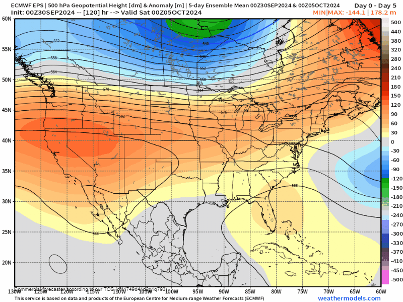
That loop above isn't just the next 7 days either. That's a 46-day loop! We see the ridge finally begin to buckle by late October and especially into November. At some point, growing snowpack and shorter, cooler days to the north will allow the weather pattern to moderate down a bit... but it seems like it will take its sweet time this year.
Some other indices are showing some signs of life too. We've shown you an MJO chart before. Essentially, you want all those lines to cycle into the upper-left quadrant of that chart (zone 7 and 8) for Colorado to have a better chance at active weather.
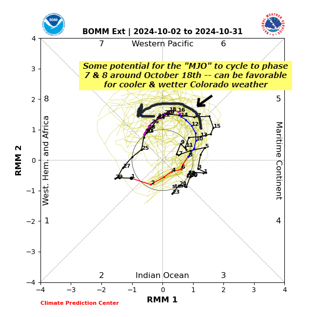
Translating that mess of lines above, we're basically seeing the MJO cycle towards 7 and 8 around October 18th, which means we could potentially see activity ramp up around the 3rd week of October.
No weather data is ever a total guarantee, but we'll take whatever we can get at this point! We'll walk you through changes going forward... but for right now, plan on hot, dry October weather sticking around.