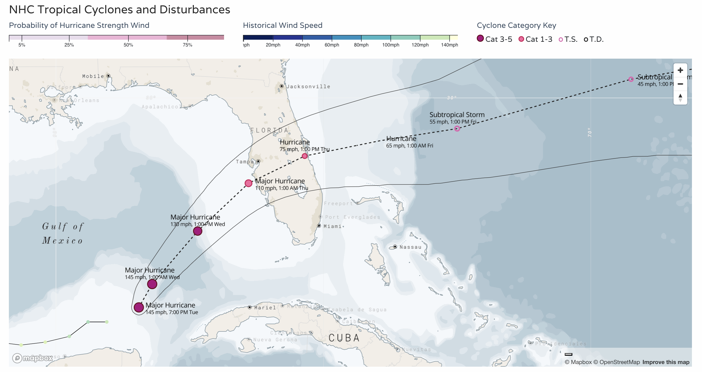
Hurricane Milton takes aim at Florida, closer to home the weather remains warm and quiet

An absolutely devastating couple of weeks it's been across the Southeast United States and things are only set to get worse across Florida as major hurricane Milton takes aim at the state.
Satellite imagery this evening is stunning, to say the least.
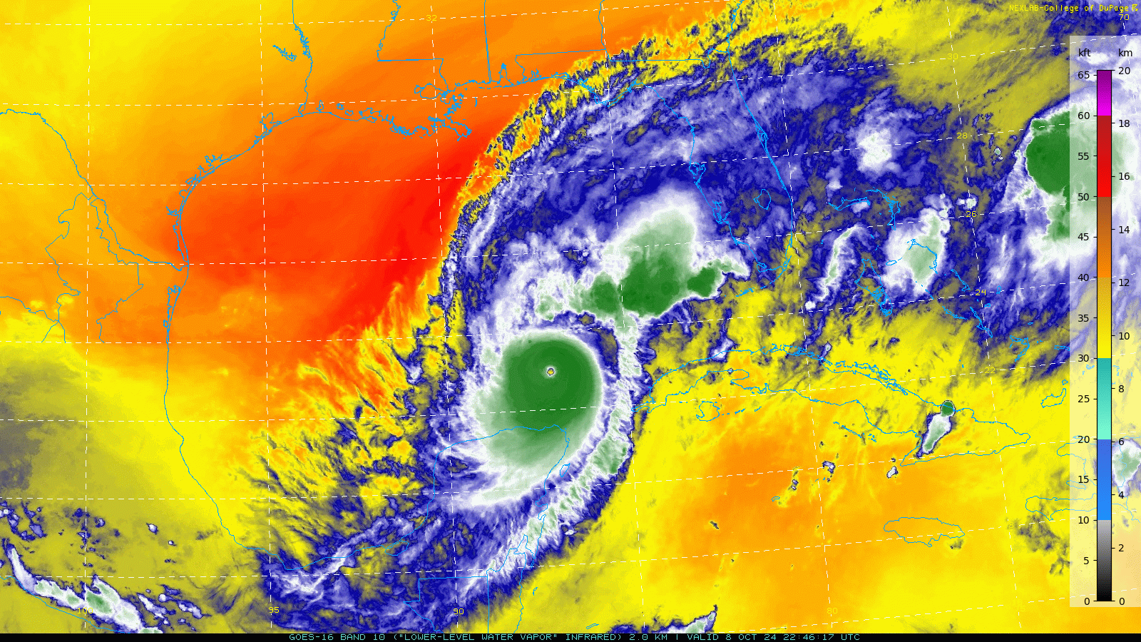
After undergoing an eyewall replacement cycle earlier today Milton has again strengthened into a category 5 monster in the the Gulf of Mexico.
While it's expected to weaken slightly Wednesday before landfall, Milton is forecast to remain a major hurricane as it slams the west coast of Florida Wednesday night.
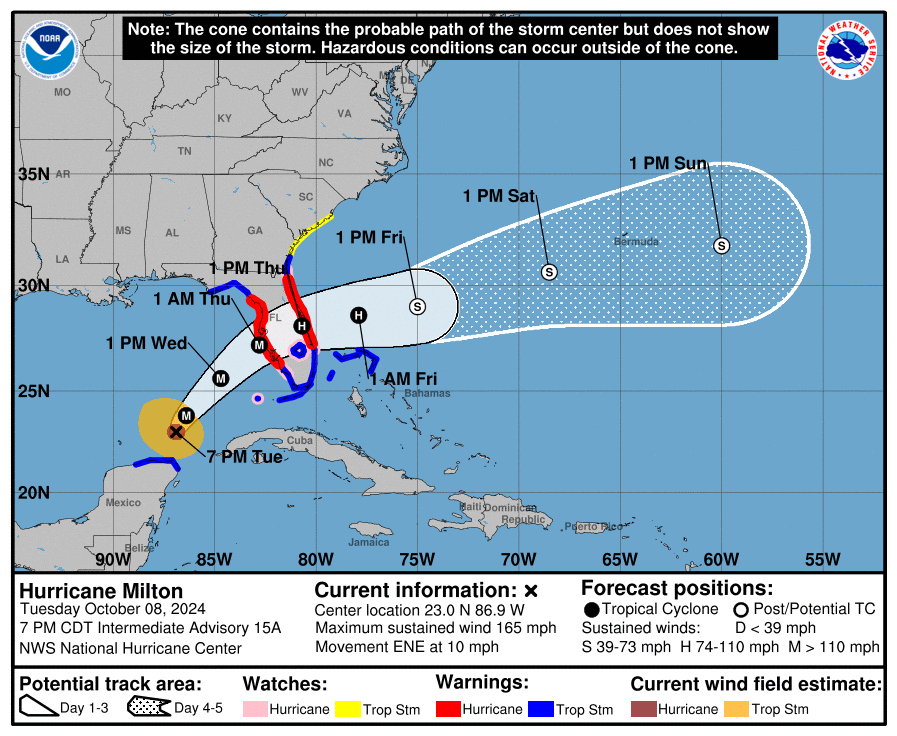
This evening's key takeaways from the NHC:
1. A large area of destructive storm surge, with highest inundations of 10 ft or greater, is expected along a portion of the west-central coast of the Florida Peninsula. If you are in the Storm Surge Warning area, this is an extremely life-threatening situation, and you should evacuate today if ordered by local officials. There will likely not be enough time to wait to leave on Wednesday.
2. Devastating hurricane-force winds are expected along portions of the west coast of Florida, where a Hurricane Warning is in effect. Milton is forecast to remain a hurricane as it crosses the Florida Peninsula and life-threatening hurricane-force winds, especially in gusts, are expected to spread inland across the peninsula. Preparations to protect life and property, including being ready for long-duration power outages, should be complete by tonight.
3. Heavy rainfall across the Florida Peninsula through Thursday brings the risk of catastrophic and life-threatening flash and urban flooding along with moderate to major river flooding, especially in areas where coastal and inland flooding combine to increase the overall flood threat.
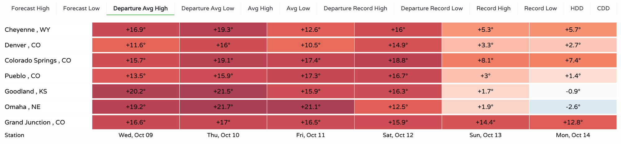
While all eyes are on Milton in the Gulf, and Florida over the coming days, our weather remains mostly unremarkable, but warm.
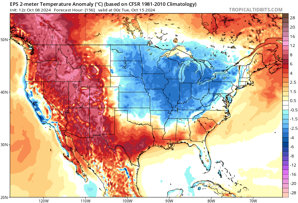
The average high for this time of year in Denver is just about 70-degrees, and we'll be a good 10 to 15 degrees warmer than that in the Mile High City through the end of the week. Here's a look at forecast highs departure from average from across the region:
You'll notice by the second half of the weekend we start to get closer to those average daily highs (woo!) with even a few cooler-than-average values showing up by next Monday across Nebraska and Kansas.
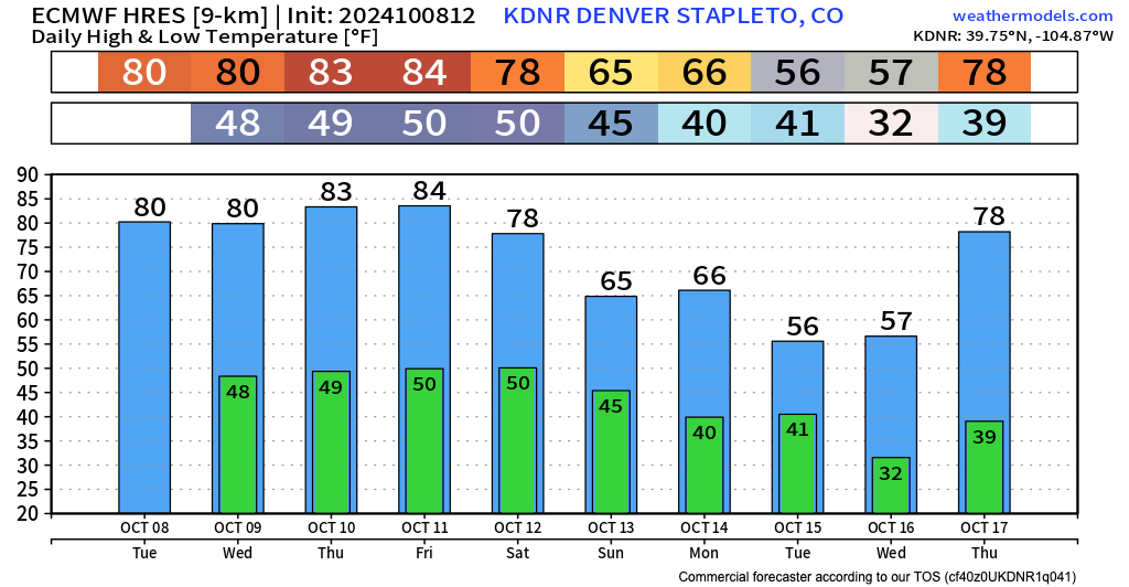
I'm cautiously optimistic this really means cooler weather for us. The European model certainly agrees with this idea, dropping highs into the 50s and 60s by early next week (and hey, evening a FREEZING overnight low!), but the brunt of the trough may try to pull east of our area, so definitely not a done deal.
Nevertheless, here is the European model forecast for Denver through next Thursday:
With the ridge we've been cooking under retrograding a bit as a large trough carves itself out over the eastern U.S.:
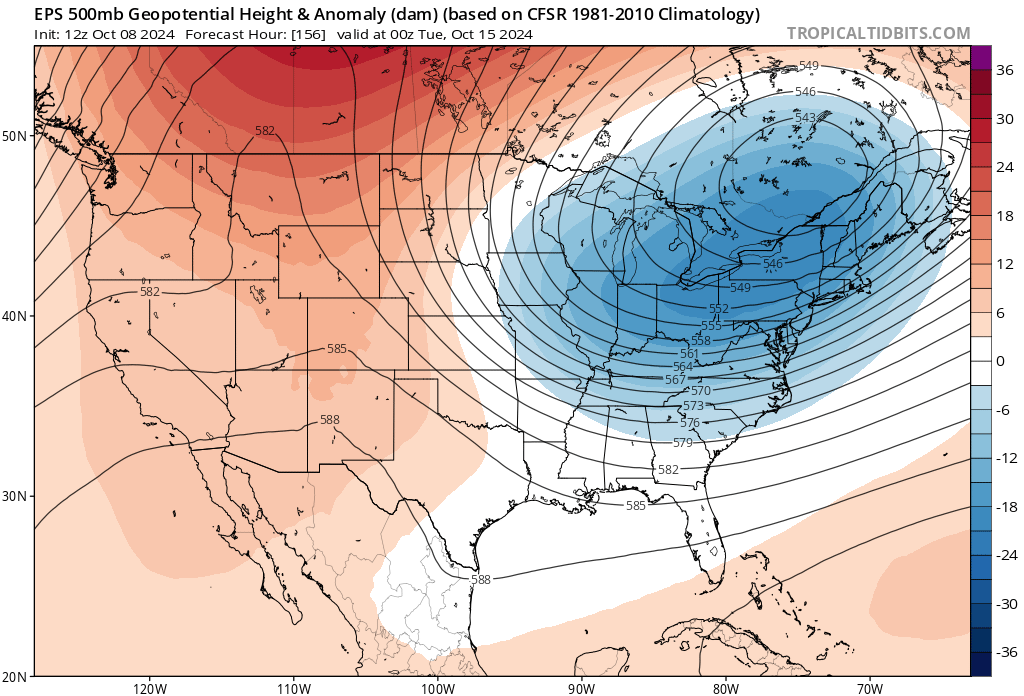
Perhaps pulling some cold (cool? near average?) air down along the Front Range as it does.
Thoughts to all those in the path of Milton over the next several days, and we'll check in soon.