Colorado weather: First lower elevation freeze and odds we see snow later this week?

There's no way around it. If you're a fan of the cooler season, this October has not been kind to you so far!
We briefly discussed a possible pattern change around the 18th in one of our posts earlier this month -- and like clockwork, looking upstream is at least going to try to pay potential dividends.
Breaking down the large scale pattern: for now, we stay under the influence of high pressure, keeping things dry and warm for most of this week. By Friday and Saturday, we will start to see changes to our weather.
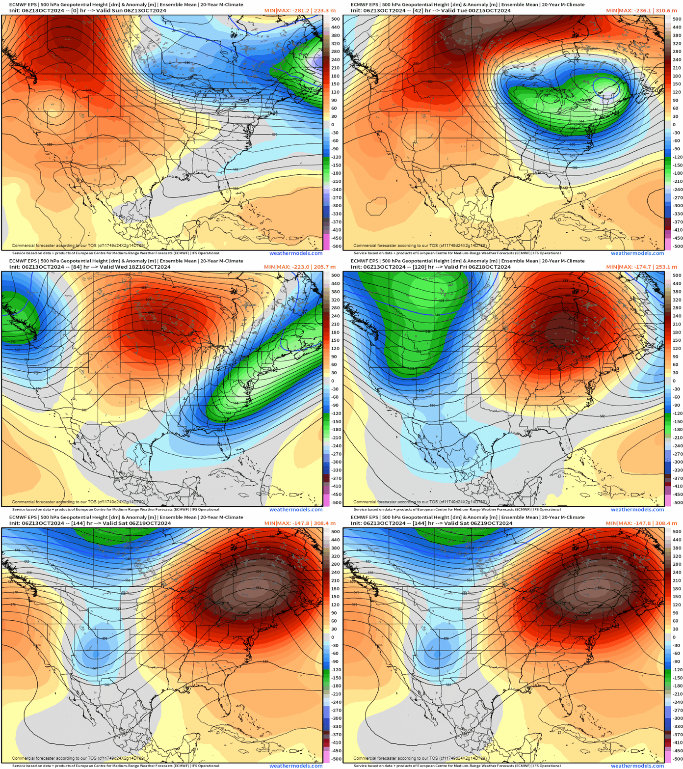
A strong push from the pacific jet stream will crash onshore of the northwest US, bringing cold air to most of the western states. Models are a bit back and forth on how much (if at all) that energy is able to spin up a low pressure system in the Rockies. If you've been weather model watching, you'll know the global models (GFS, GEM, and EURO) have been printing out everything from heavy rain, heavy snow, our coldest air so far this season, to at times not much of anything at all, and everything in between that.
We're still quite a ways out but we're attempting to get a clearer image of what might play out later this week.
The most important aspect will be the placement of the potential trough.
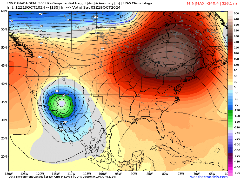
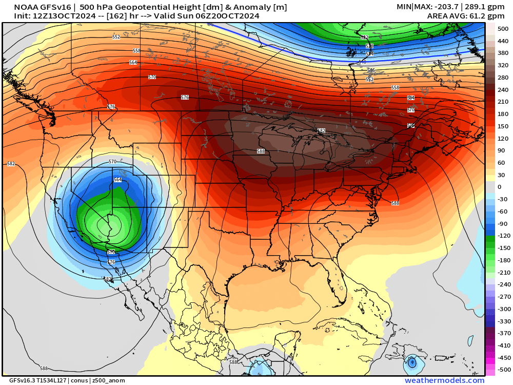
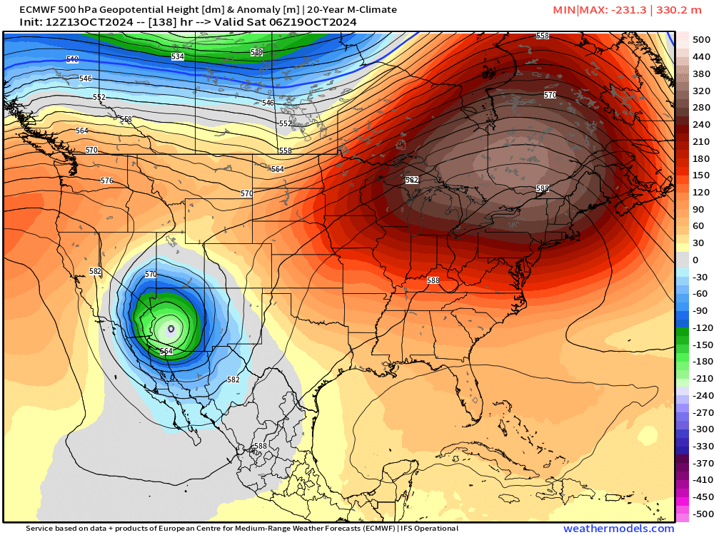
The three images above are possible outcomes of this trough Friday into Saturday. The GFS (American), GEM (Canadian) and EURO (European) all show a big "bowling ball" type trough that spins itself out between Arizona, California and Nevada... never quite getting the worst of the system into our backyards in Colorado.
The data above is just one sample from each of those models.
We've talked about ensemble modeling before, which takes an average of a data set from these models. The latest from the Euro's ensemble members shows the center of troughing further north towards the four corners. That indicates that there still is some background data skewing the average further north.
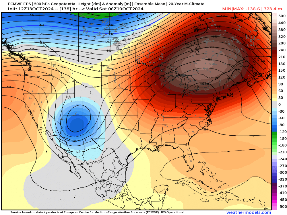
Regardless... the data are going to see big shifts this week as the models try to pin down an end product.
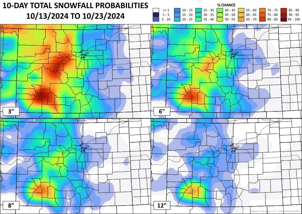
Now, let's say the ensemble has a good idea on the track of this storm... what is it printing out in terms of snow/cold potential? Well, for a first potential snow, it's not too shabby. At this range, this seems like a storm that would slow down mountain travel for sure... and potentially lead to a coating of snow for the front range. Some rough estimates on timing would put this storm in our area some time between Friday evening and through the day Saturday.
The GEFS is particularly bullish:
The Euro is less so, and perhaps a bit more in line with its deterministic as of today – showing about a 30 to 40% chance of 1" of snow in Denver this weekend, which isn't epic, but would count for the first snow event of the season if we could pull it off!
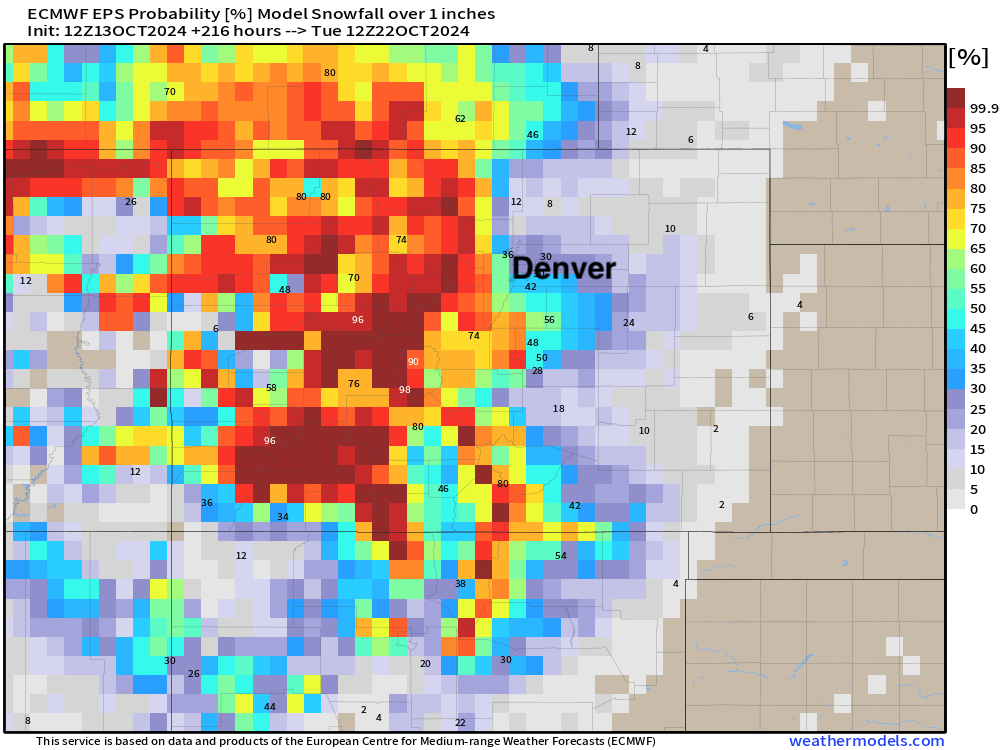
We shall see! Friday is Denver's average first snowfall, so if we can pull it off it'd be right on time!
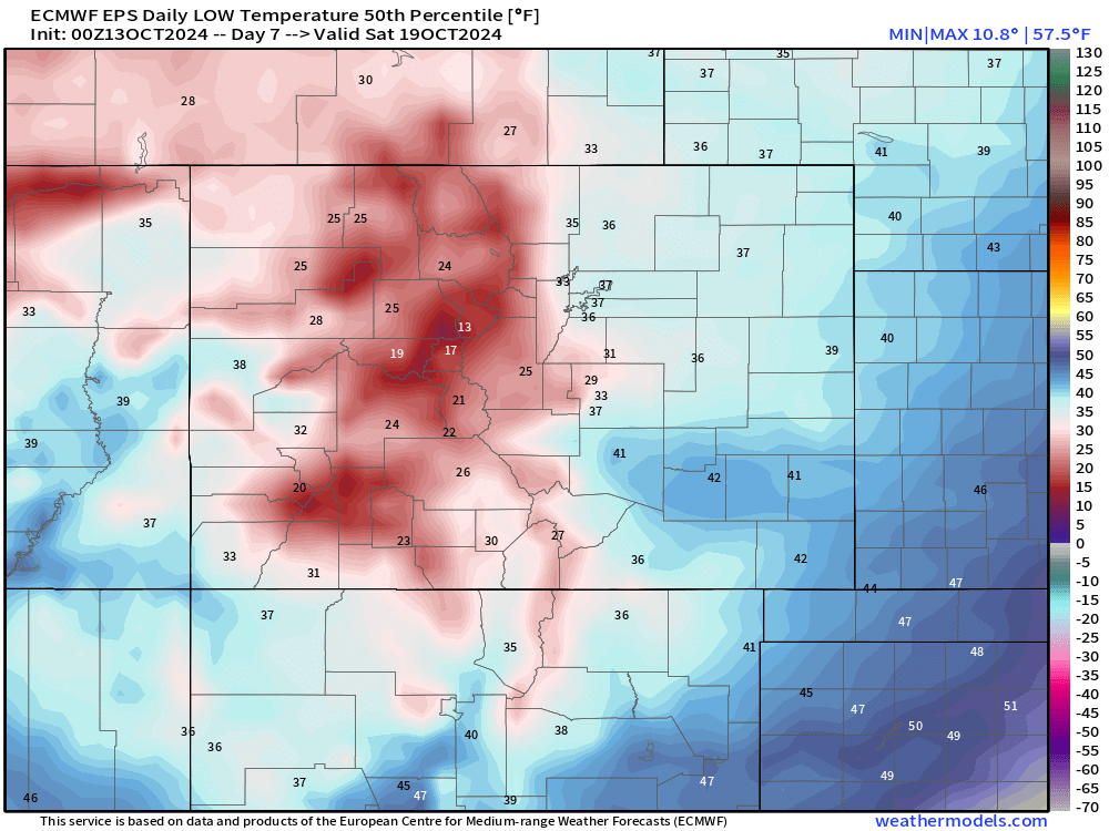
As for those low temperatures this weekend, depending on strength/placement of the low, frost/freeze potential will need to be monitored. Above is the "most likely* scenario as of now for coldest temperatures by Saturday morning. Plenty of 10s and 20s in the mountains, with 20s and 30s along the front range by Saturday morning.
So, quite a bit to figure out still, but at least the weather is trying to be interesting... We'll continue to update throughout the week as this storm approaches the region! Subscribe to the e-mail list to get the next article as soon as it comes out!
