Colorado Weather: Weekend storm trending warmer, beneficial rain possible, mountain snow

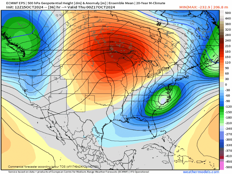
We've still got a significant pattern change loading up as we close out the work week. A powerful trough looks to dig into the four corners region, bringing widespread rain, snow and much colder air starting Friday.
Key messages for this storm
1) The trend has been to keep the core of this system's cold air too far west for significant Front Range snow.
2) It's still far enough east to provide beneficial rainfall places like Denver, Colorado Springs and parts of the eastern plains.
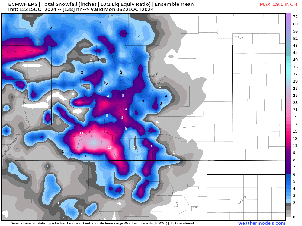
3) Mountain travel will be tough and potentially dangerous this weekend, ESPECIALLY over the San Juans.
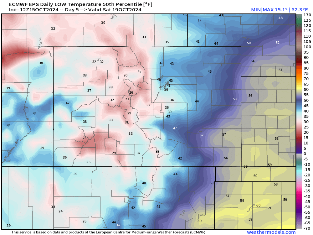
4) It will be much colder, especially Saturday where highs may only get into the 40s for many along the Front Range
Timing the storm
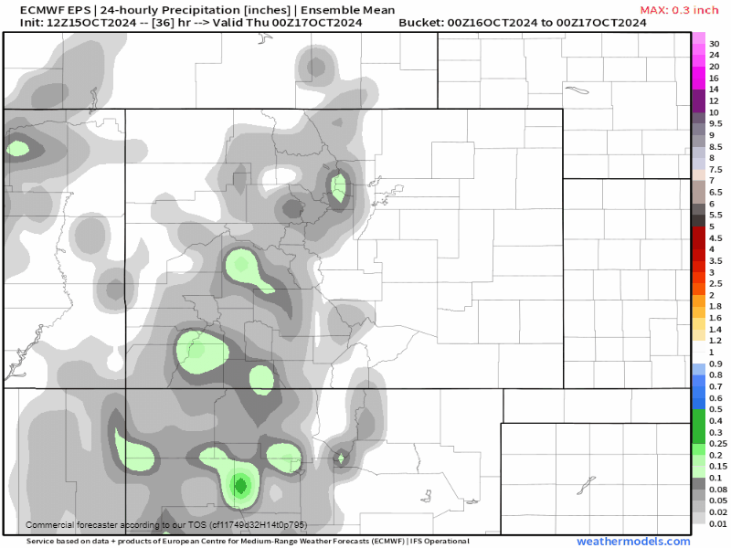
Colorado will begin to see the influence of this storm as early as Thursday with rain and snow beginning to fly in the mountains. As the storm begins to pivot east, we'll begin to see moisture move into eastern Colorado, especially Friday night and through the day on Saturday.
If you have plans this weekend, Saturday is likely going to be a cold, raw day to be out and about, especially for areas south of the Palmer Divide. Lingering moisture is expected on Sunday with mountain travel slowly improving.
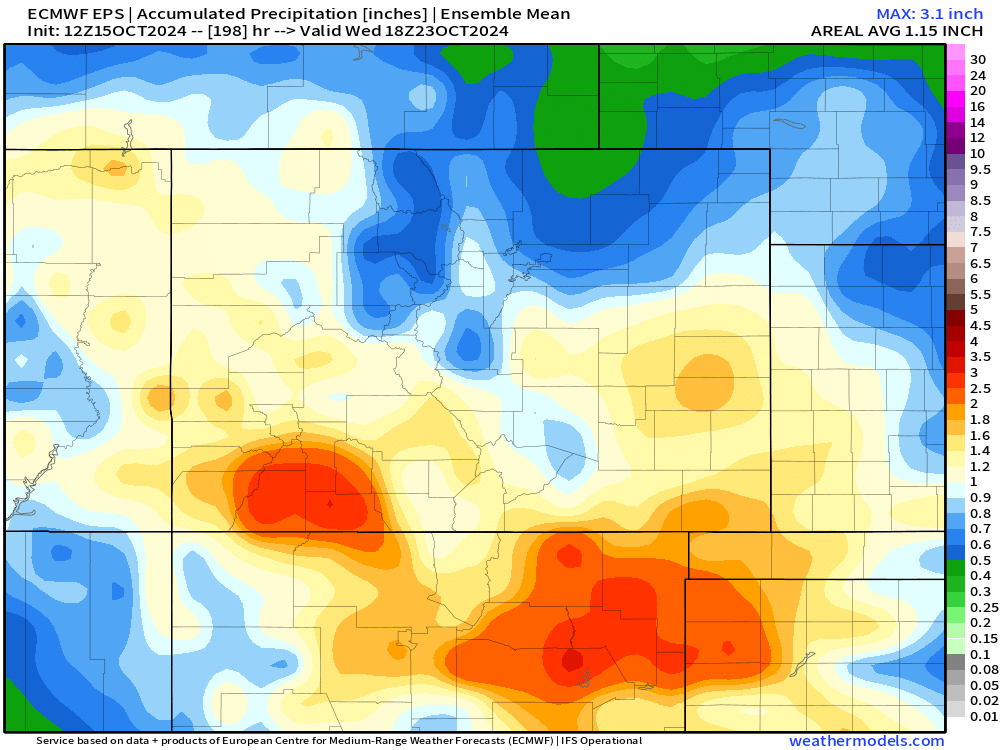
From Friday night through Sunday, upwards of 0.5" to 1"+ worth of liquid is possible across much of the state. Areas over southern Colorado looked to be favored for more moisture due to the track of the low-pressure system.
Will there be any snow out of this system for Denver?
It will be tough... but some flakes aren't out of the question. As it stands now, the best chance for snow will be in the mountains Friday into Saturday, with some slushy accumulations possible on the Palmer Divide and on the west side of Colorado Springs.
Low temperatures on Saturday and Sunday are most likely to hover in the mid to upper 30s and low 40s at the lower elevations. Shifts in track/strength of this system could certainly influence snow chances at this range, and with the system still 3-4 days out, some changes are still possible.
We'll have more specific details about this system in the next few days... for now, let's keep fingers crossed that moisture prospects remain good! Subscribe now and we email you our updates...easy peasy.