Weekend update: Cool and unsettled for Northeast Colorado, heavy snow to hit the southwest

We celebrate the date of Denver's average first snowfall today with a near-miss, oh-so-close storm system set to swing through the region over the weekend, but likely with no snow for the metro areas. And, perhaps not much rain either for many!
The layman's summary: A cold front is about to hit, meaning it'll be much colder today through tomorrow. With this system comes widespread rain and snow to Colorado this evening through Sunday morning, with the snow staying in the mountains for the most part. Heavy snowfall, talking feet, will hit the southwestern mountains. Then, we get warmer with drier conditions returning early next week. Here's a timeline of the shower activity:

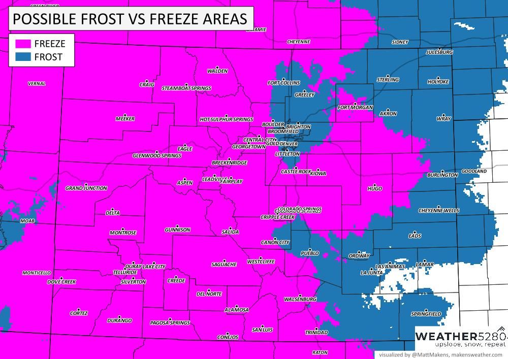
If you are worried about the potential frost or freeze for your area, here's a quick look at the possible frost vs freeze zones.
In the weeds
The trough responsible for delivering this change to our weather has dug its way into the Great Basin this morning and is already delivering rain and snow to parts of the state this morning.
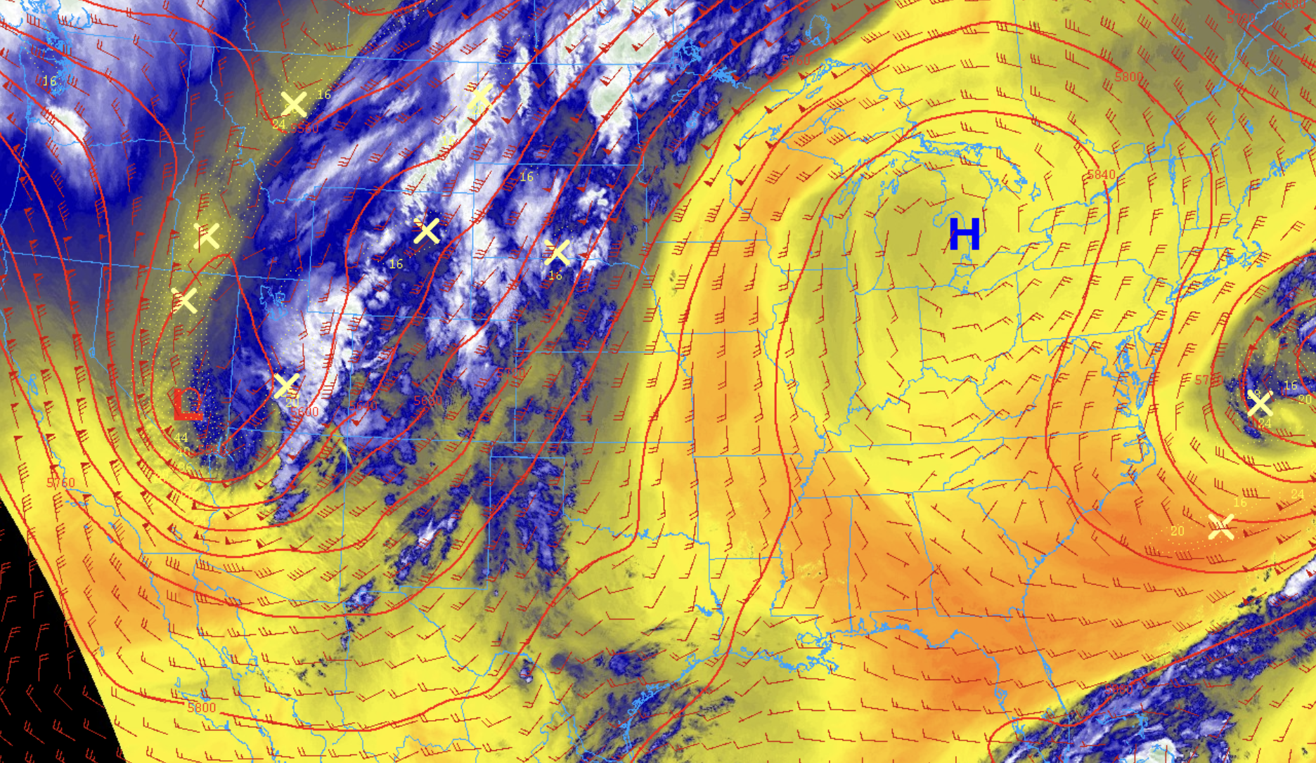
Its not forecast to make much eastward progress over the next 48 hours as it drops into Arizona tonight and stalls. Eventually it will move northeast as we head toward the latter half of the weekend/early next week, but much weaker.
The position of this trough through Saturday looks just a bit too far southwest for Northeast Colorado to really capitalize on moisture. For Southern Colorado, a much different story, with some really good beneficial moisture on the way it appears.
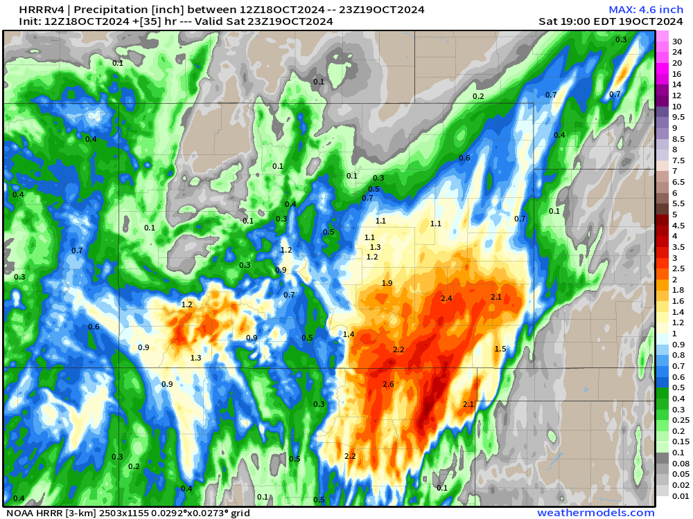
The blend of models (below) shows from 0.5 to upwards of 2.0" of liquid for parts of southern Colorado through early next week! Some of that will make it into the Denver area, but unless things change, totals will be much lower north of I-76 or so.
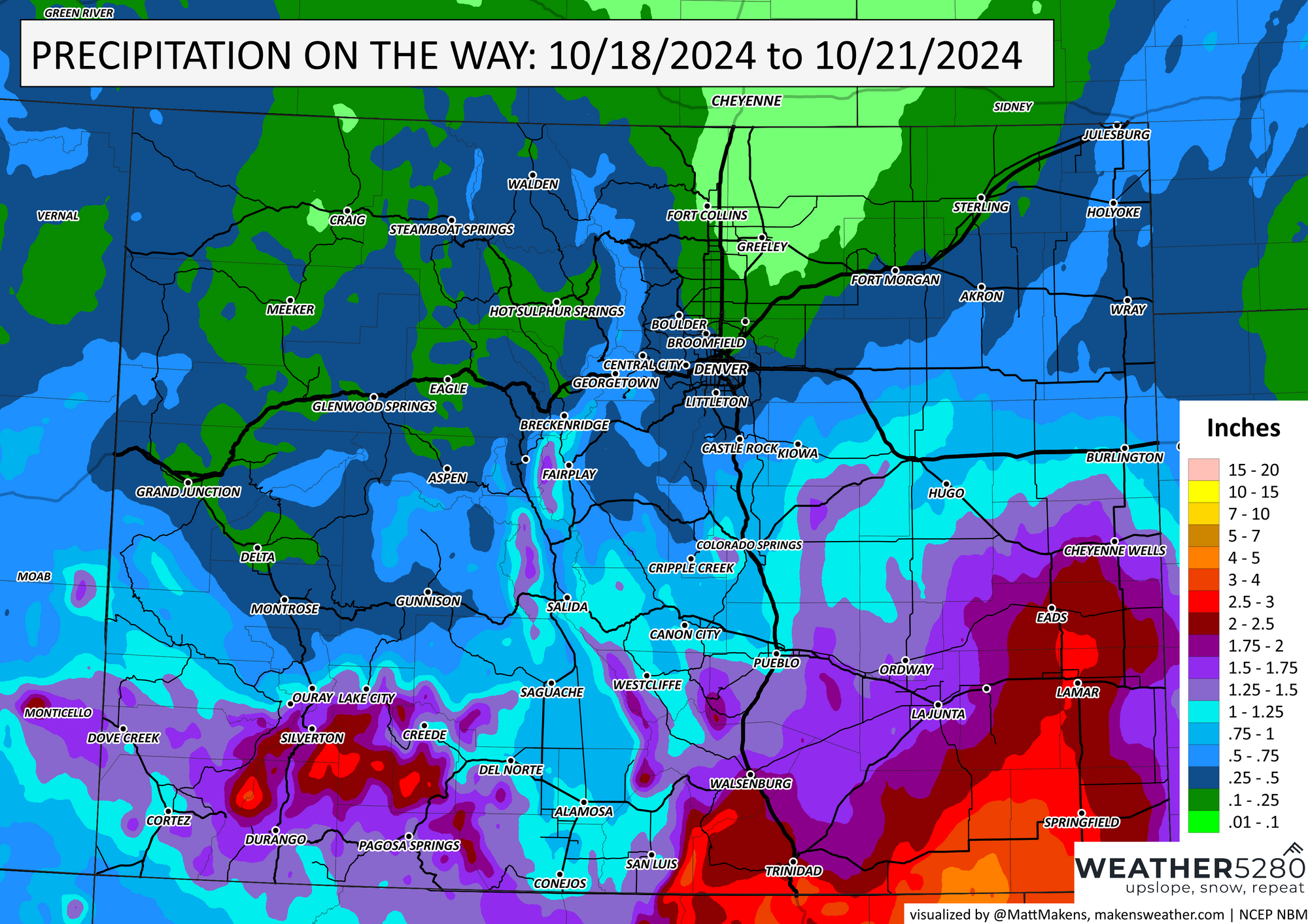
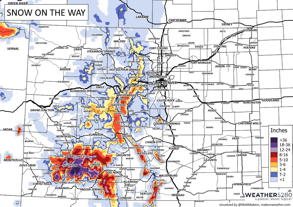
Of course some of that's going to fall in the form of snow. And in some cases, a lot of it! For the mountains of southwest Colorado a Winter Storm Warning is in effect already, and extends through noon Sunday. Places like Wolf Creek Pass could see 1 to 2 feet of early season snow over the next couple of days.
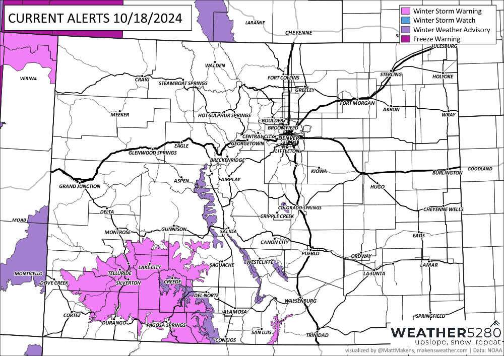
...WINTER STORM WARNING REMAINS IN EFFECT FROM 6 AM THIS MORNING TO NOON MDT SUNDAY...
WHAT...Heavy snow expected. Total snow accumulations between 1 and 2 Feet. Winds gusting as high as 45 mph.
WHERE...La Garita Mountains Above 10000 Feet and Eastern San Juan Mountains Above 10000 Feet.
WHEN...From 6 AM this morning to noon MDT Sunday. *
IMPACTS...Travel could be very difficult to impossible, especially over Wolf Creek Pass.
And here's a look at our snowfall forecast:

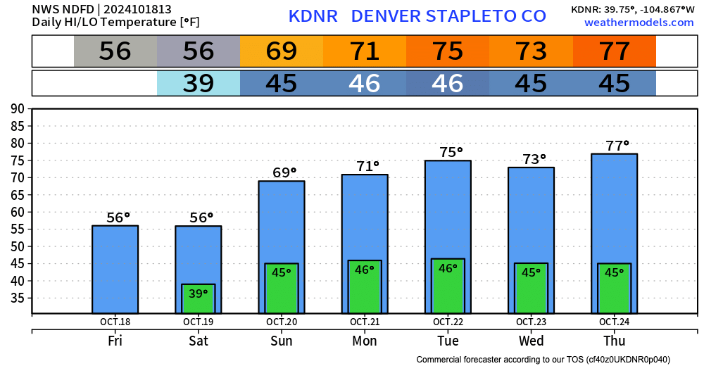
For the northern urban corridor... the biggest impact may be the temperatures. Highs in the 50s today and tomorrow with overnight lows in the 30s, before we begin a warming trend into next week.
As for precipitation, not a horrible look if you live along the Palmer and south. Places like Colorado Springs could eke out some good moisture before things are said and done later this weekend. The blend of models shown above has 0.5 to 1.1" of precipitation along and south of the Palmer Divide, with totals generally less than 0.3" north and in some cases, no appreciable moisture.
It's worth noting that some high-resolution data is a bit more bullish on snow potential for the foothills southwest of Denver and the higher terrain of the Palmer Divide.
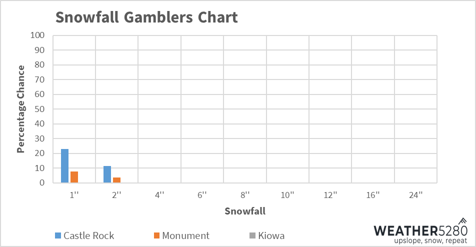
The snowfall gamblers are not picking up on much of a chance for the metro areas, but we did filter down to Castle Rock and Monument, two spots that have at least low-end snowfall chances.
The latest HRRR shows good snow for the Pikes Peak region, with perhaps some sneaky totals as you get southwest of Denver and up in elevation.
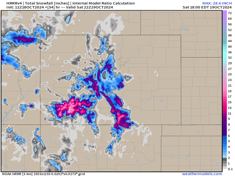
Similar to nearly all guidance, however, it shows the bulk of the precipitation for Eastern Colorado falling along and south of I-76, with not much for Denver, but upwards of 1.0" as you move southeast of the Mile High City, through the Colorado Springs area, and the – always dry? – southeast plains of Colorado. We'll take it!
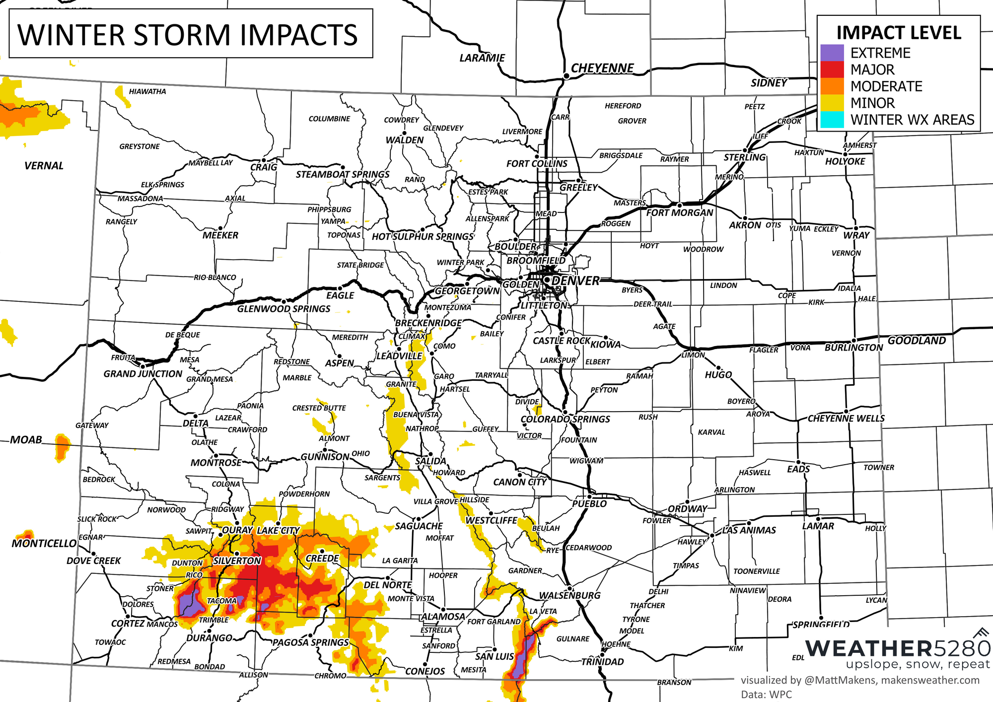
Keep an eye on the sky this weekend. If your travel plans take you south, consider delaying or plan for rain and snow over the next couple of days. Here's the travel impact for this storm.
While it's not looking like a widespread hard freeze for lower elevations at this point, certainly some of the coldest air of the season over the next couple of days, and perhaps some frosty mornings from select locations Saturday and/or Sunday. Let us know how cold (or lack of cold) you manage to get this weekend!
Subscribe today and we will email you when we post new updates!