Wednesday AM update: Rain and snow showers today, hard freeze tonight

The FAQ we put out yesterday holds up pretty well this morning, and worth a reference if you didn't catch it. Only update this morning is to give an update on today's precipitation potential and timing. The forecast for Halloween Day remains on track.
We are seeing rain and snow across the western half of the state early this morning. This will eventually move east over the urban corridor and plains as we head toward the latter half of the morning and early afternoon hours.
Precipitation may start as drizzle, even freezing drizzle for some, before transitioning to rain and snow. Worth mentioning, that while we don't see a whole lot of potential for accumulating snow below about ~6,000 due to temperatures, it could be some of us see our first real flakes of the season here later this morning, if even briefly.
The hourly precipitation forecast for the urban corridor shows the best chance of showers coming around midday, with the system scooting east of us this evening.

For lower elevations, temperatures will be marginal. So rain, or mixed precipitation is possible. And, if we do transition to snow, it's not likely to stack up... we don't think, though some of the snow showers peeling off the hills today could at least briefly bring moderate snowfall with them, that's from Fort Collins south through Elbert County.
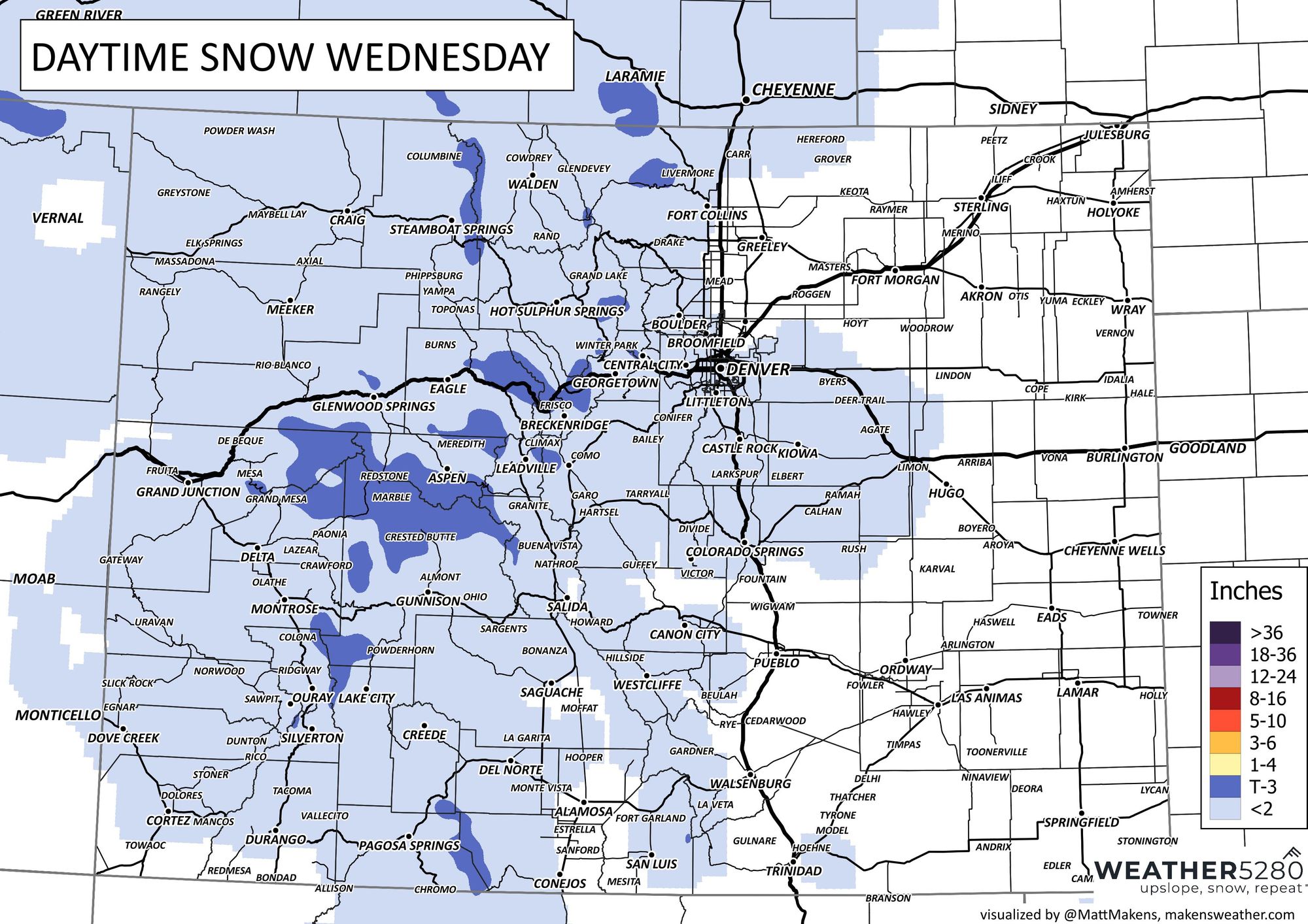
For higher elevations west of Denver, and along the Palmer Divide south and southeast of Denver, perhaps a bit more upside potential with the passing snow showers today, with some models bringing a quick dusting to 4" of snow under the heaviest showers. We'll see.
Here's our latest snowfall forecast through tonight:

Cold tonight!
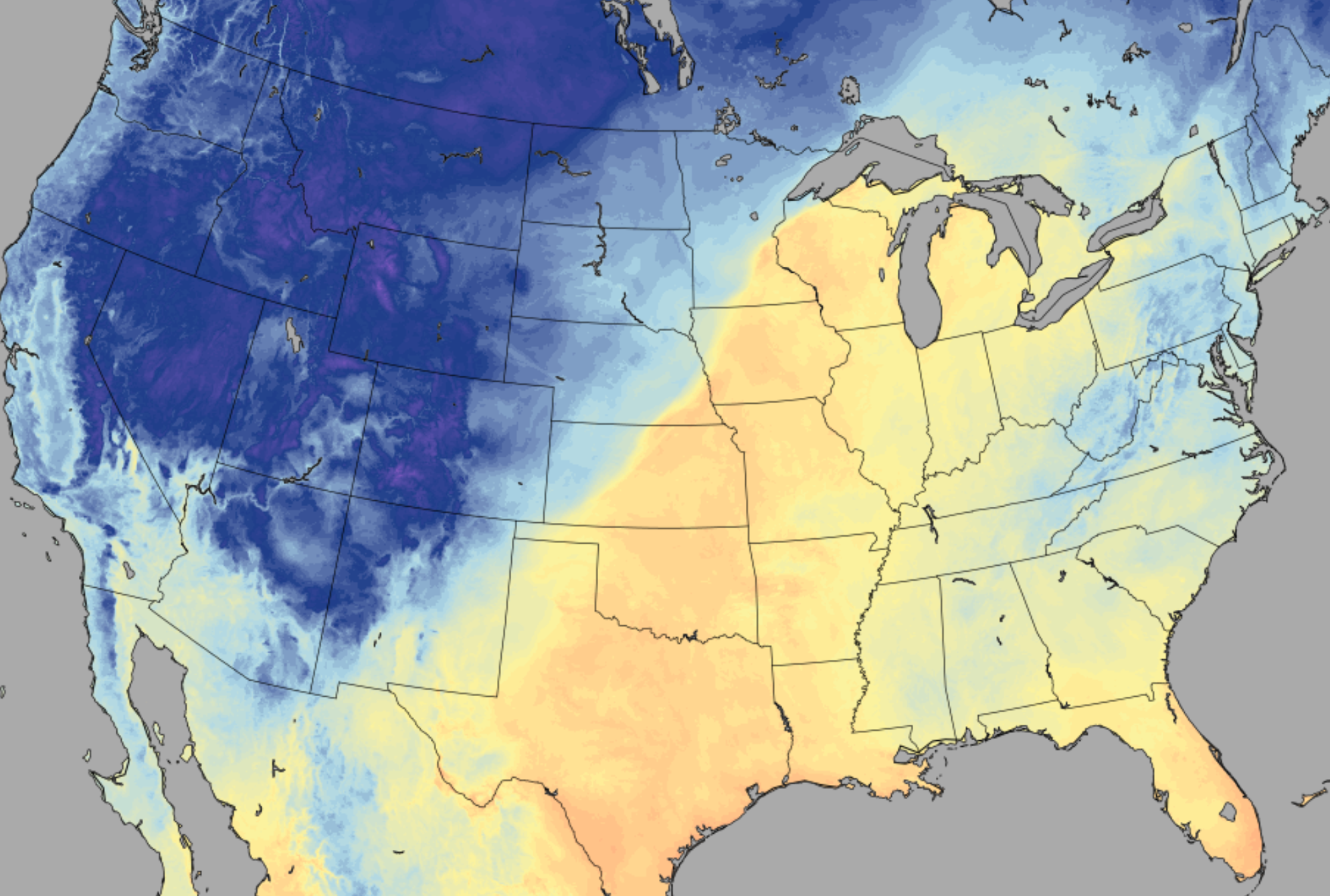
A reminder that it'll be cold tonight! The first hard freeze for many locations.
From the NWS:
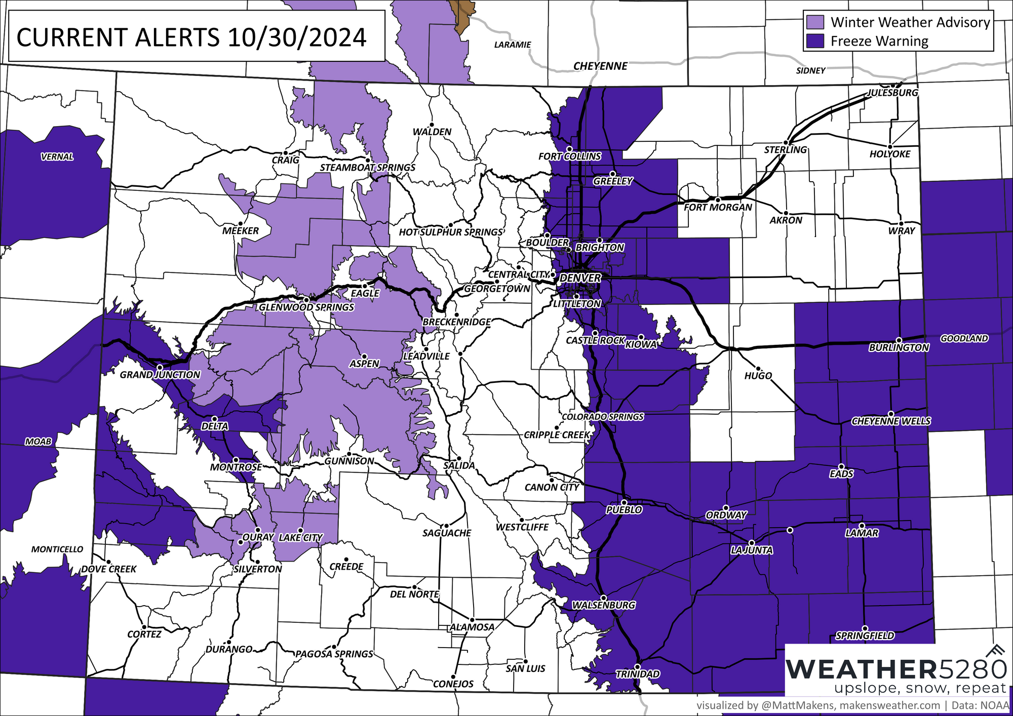
...FREEZE WARNING IN EFFECT FROM 10 PM WEDNESDAY TO 9 AM MDT THURSDAY...
* WHAT...Sub-freezing temperatures as low as 22 expected.
* WHERE...Fort Collins, Boulder and the western suburbs of Denver, Denver, Castle Rock, Greeley, and Byers.
* WHEN...From 10 PM Wednesday to 9 AM MDT Thursday.
* IMPACTS...Frost and freeze conditions are expected kill unprotected sensitive vegetation and possibly damage unprotected outdoor plumbing.
And our latest hazard map:

Enjoy this chilly day, and hopefully it gets you in the mood for a spooky Halloween! We hope everyone stays safe out there with the kiddos tomorrow evening, and as always – let us know if you see any ... snow(!) today!
You won't be scared by the changing weather if you're a Weather5280 subscriber! Sign up today... it's free! 👻 🎃
