
Colorado weather: Next system on the way... more rain, snow, and chilly temps in the forecast!

I hope everyone is settling in nicely to our rather active weather pattern that has established itself across much of the CONUS as we kick off November.
While we haven't seen a storm quite get its act together yet for those of us along the urban corridor and Front Range, it's hard to look at this pattern and not at least like our chances for our first measurable snow during the next week.
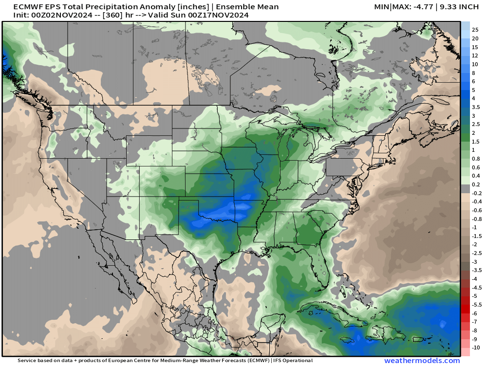
In fact, the entire region and really the central third of the U.S. is expected to receive above average precipitation over the next two weeks – Colorado included. This big blob of green and blue represents a much wetter than average couple of weeks:
The animation below is from the latest GFS model, showing a series of troughs (blues) digging into the western U.S. and through Colorado over the next 15 days. One of this will have to hit, right?
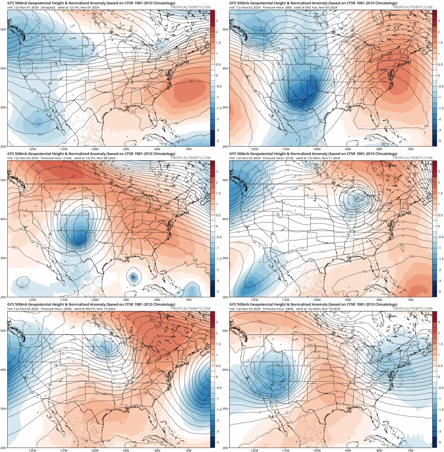
We'll see. There certainly is a social media buzz about the second system to come through our area this week (Wednesday-ish).
For now, we focus on the next weather-maker that is set to bring rain, snow, and another shot of cold air to the state later this weekend.
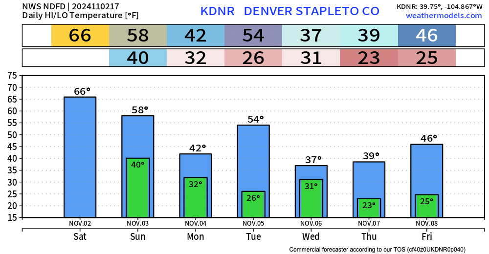
Temperatures will be quite nice this afternoon, cooling to seasonal or just below seasonal average highs Sunday, ahead of a cold front that knocks us into the low 40s for highs on Monday. We get a quick break on Election Day Tuesday, before more chilly air will push into the state for the middle and latter half of the week.
Snowfall forecast
No winter weather highlights in effect for Colorado at this time, but that could change as we head into this evening. Some close-to advisory level snowfall for the higher terrain looks possible from Sunday morning through lunch time Monday, with perhaps some nice 5"+ totals for the Front Range mountains west of Denver!
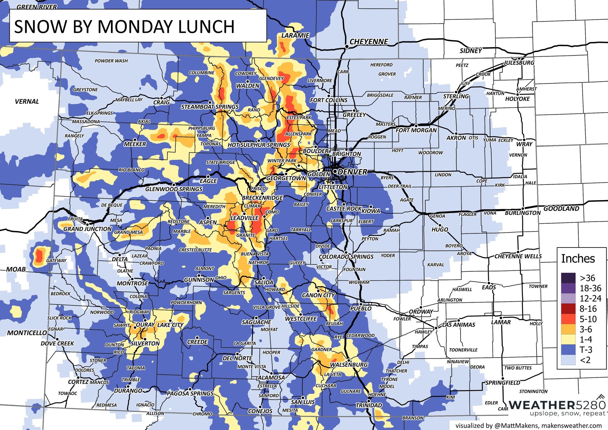
At lower elevations... This still might not be the one, though a bit better chance than the last round, especially for communities at higher elevations south, west, and southwest of Denver. We've got about a Trace to 3" in the forecast for those areas, with perhaps some upside potential we'll need to watch for. If you live in western Lakewood, Golden, Black Hawk, Estes Park... well, several inches are possible Sunday into Monday.
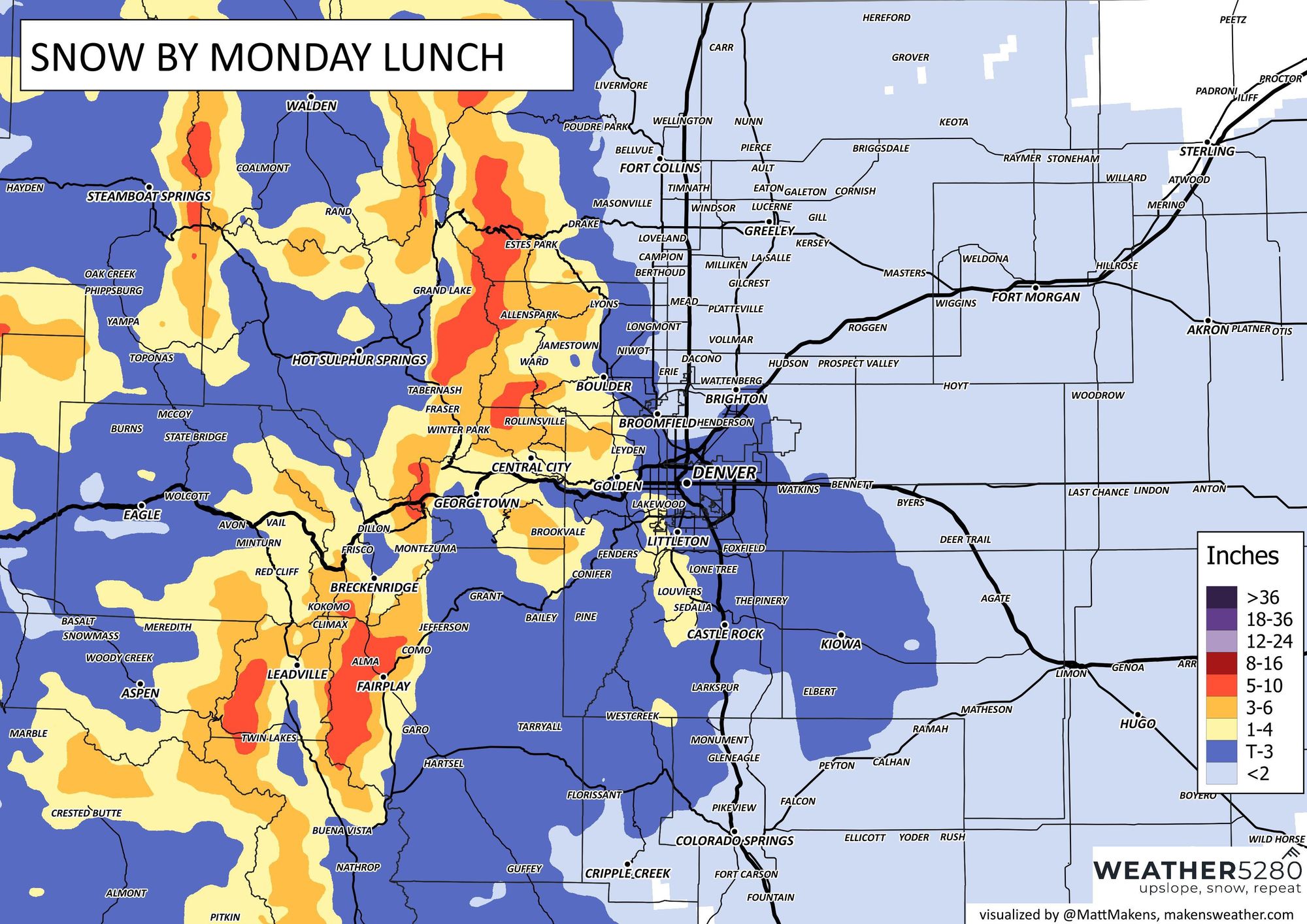
Will this system deliver Denver's first official snowfall of the season? We'll see. Not a super convincing look for areas further east of the hills and lower in elevation, but not out of the realm of possibility either. We'll see if anything looks more convincing in the data as we had into Sunday and update accordingly as well. Remember, technically Denver has to receive at least 0.10" at DIA for it to be the city's first official snowfall.
For Monday morning drivers, this could be an impactor depending on your commute. Folks from the western and southern burbs may have their first wintry drive of the season. Around here, you know how the first couple of snows seemingly shock drivers into an inability to get around smoothly, so here goes...
Even if this Sunday night/Monday storm doesn't deliver snow to you, there's another chance quickly on its heels.
Midweek
Once we get Sunday/Monday's system out of the way, our focus turns toward the middle part of the week. Guidance is a bit more excited around this system's potential for lower elevations, with some models keeping us under an active pattern of on-again-off-again snow through the end of the week without much forward progression of the trough.
There lacks consistency here in the data, so hard to get super excited just yet, but definitely something to watch as we head into the latter half of the weekend and early next week. And, this system is the one that is inflated on social media.
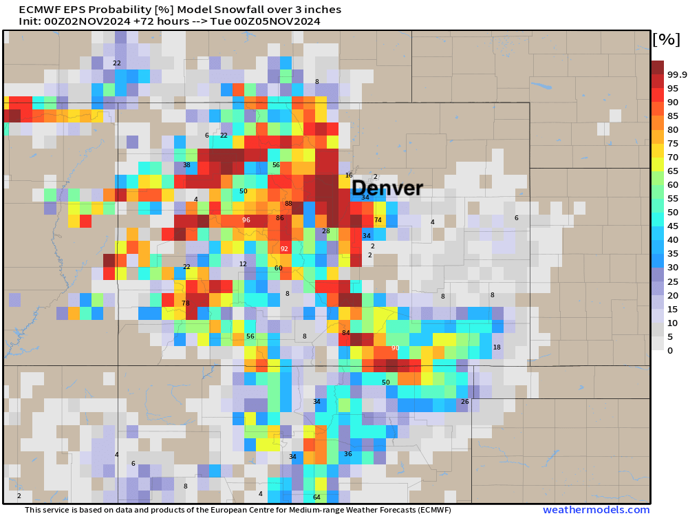
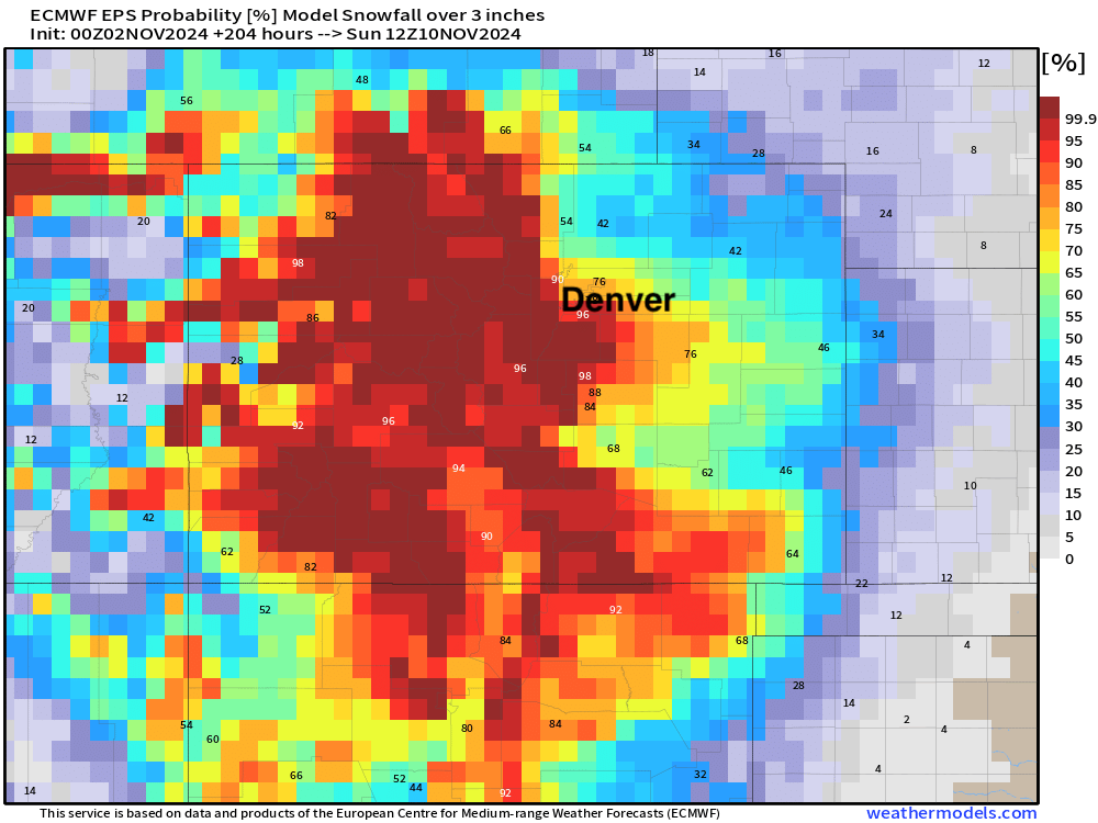
While the European deterministic model has been maybe the most bullish on snow with this event, its ensemble model doesn't look too bad either. If we look at probabilities for 3" of snow or more, hard not to like our odds for Denver to see its first measurable snow of the season by the time we get through the next week.
Here are odds through Monday, with good odds west and south of Denver, but not really registering for the city:
If we pull that through next Saturday we see upwards of about 70% odds for the city:
No doubt an active time ahead!
Get out and enjoy the day today and look for those changes to arrive Sunday afternoon to our area. We'll keep an eye on the sky and pass along updates as needed – stay tuned!
