Winter Weather Advisory in place west of Denver, some snow possible for the Mile High City

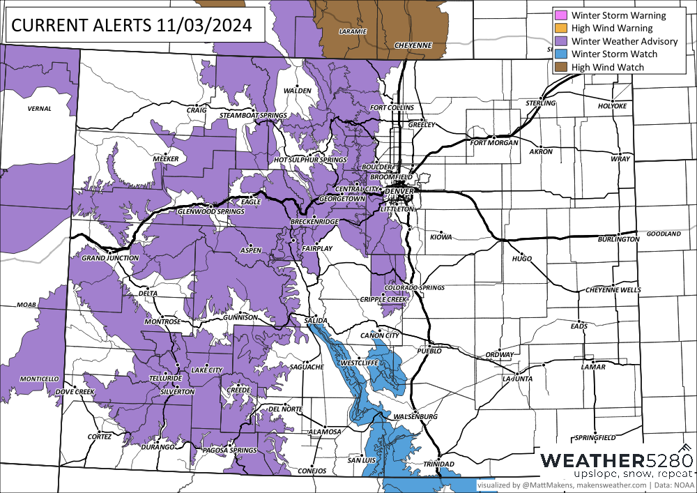
As we opined in yesterday's update, the National Weather Service has issued a Winter Winter Advisory for the higher terrain west of Denver. It goes into effect at 8pm this evening, and runs through mid morning Monday.

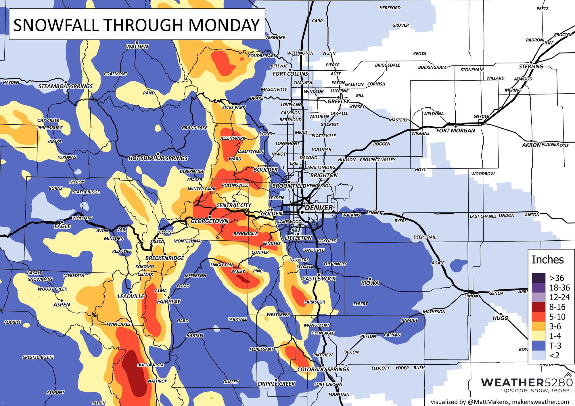
The Advisory closest to the metro areas calls for 3 - 8" of snow, which fits pretty well with our forecast. This includes western Douglas County, western Jefferson County, and western Boulder county, mainly above 6,000 feet.
For lower elevations this continues to not look like a huge deal (theoretically, but a wet road in the metro area can throw the whole city into a tizzy). Chilly? Yes. Some rain, snow, and everything in between? Probably. Accumulating snow? Maybe not so much. Most guidance suggests only a Trace to 1/2" for Denver (if that) with perhaps 1 - 4" for the western Palmer Divide and southern/southeast metro area suburbs at the high-end.
With that, our snowfall forecast hasn't moved much since yesterday's update either.

Timing and impacts
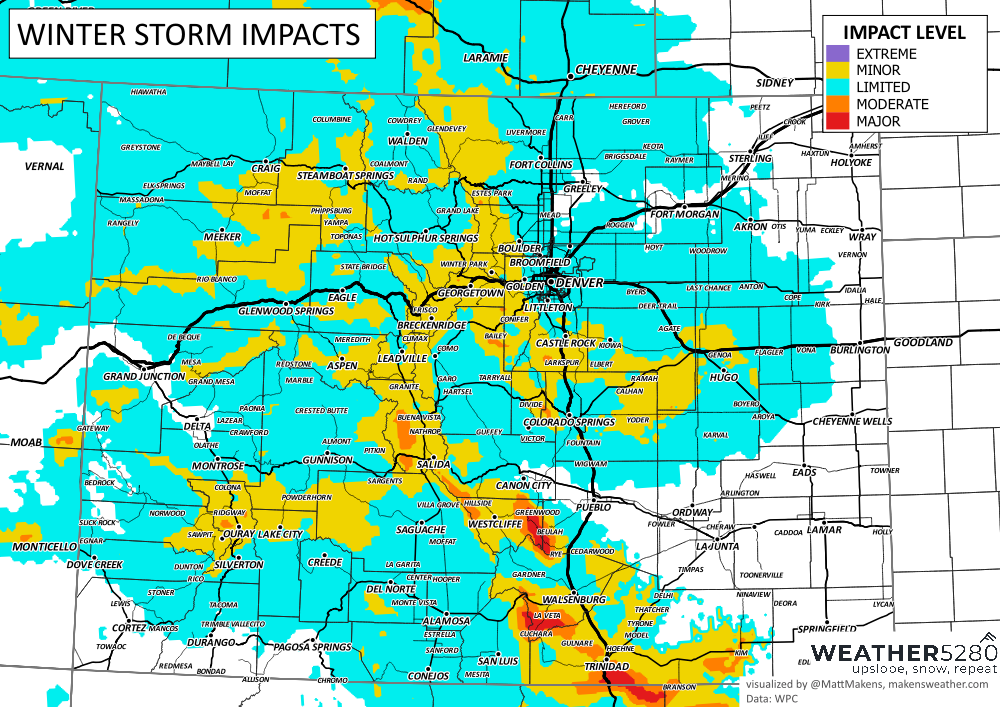
As for timing and impacts... look for precipitation to be on the increase later this afternoon, with the best chance of those rain/snow showers moving through the Denver area overnight into early Monday morning.

In the cities, not a huge impact expected, though under the colder/snowier scenarios even a 1/2" in spots could lead to some icing on the roadways – so maybe give yourself some extra time for your Monday morning commute just in case.
West of Denver, and south between Denver and Colorado Springs a bit more of a concern, especially given water on the roadways and freeze potential.

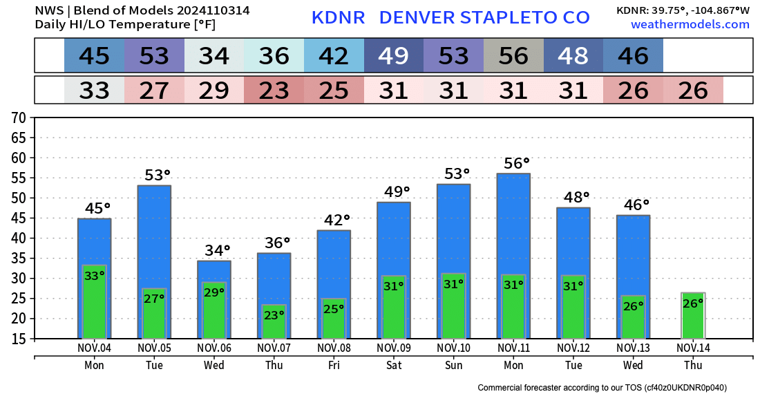
As for temperatures, the blend of models shows highs in the mid 40s in Denver on Monday, with overnight lows tonight near freezing. Briefly warmer on Tuesday, before another shot of cold air arrives Tuesday night into Wednesday.

Looking at the timelines above you'll note two additional important things.
- Election Day weather looks like a non-factor, so no excuse not to get those ballots in!
- There's another storm lurking Tuesday night into Wednesday that may want to linger through Thursday, Friday, and the weekend, so keep an eye on the forecast – and subscribe to Weather5280!
If you manage some snow tonight, let us know!
