Colorado Front Range snowstorm(s?) this week? Here's what we know now...
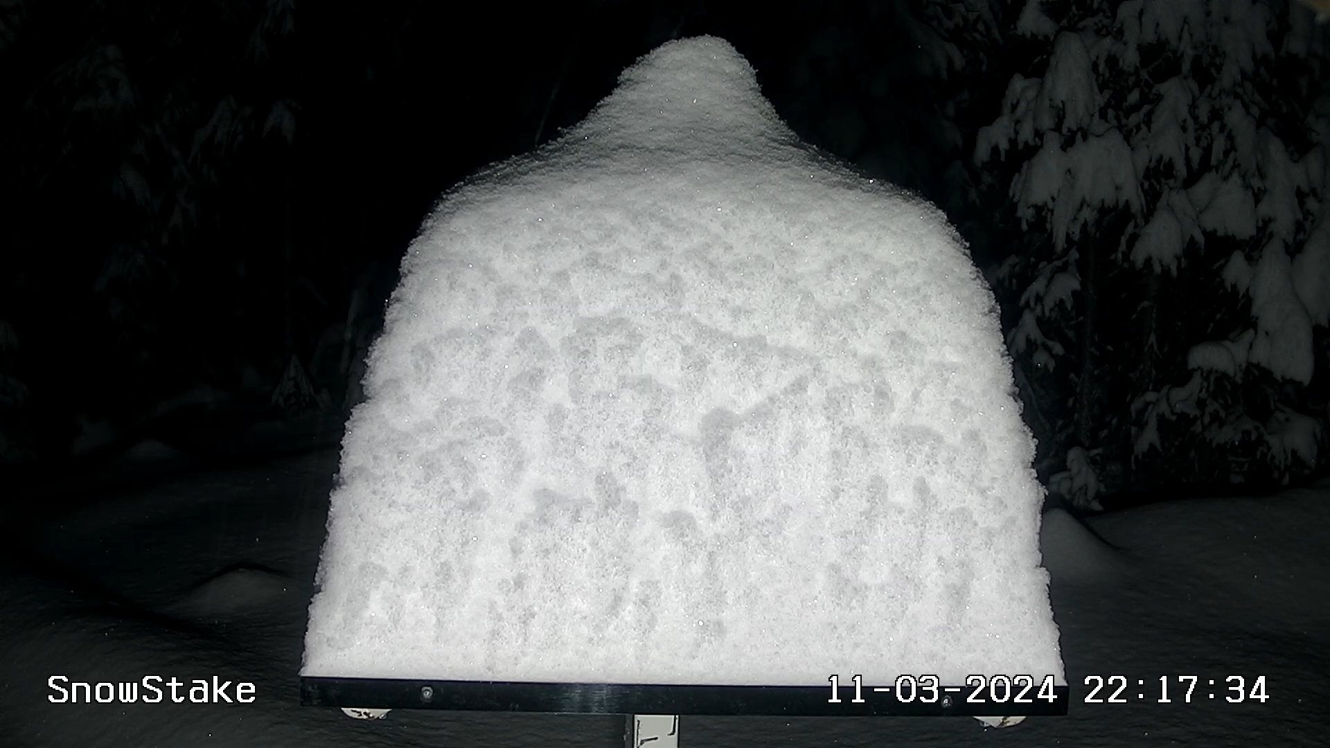
Our first "organized" winter system of the season is slowly moving away from Colorado today. It brought quite a bit of snow to the high country! Check out the snow stake at Copper Mountain below Sunday night!
And, there's another waiting in the wings...
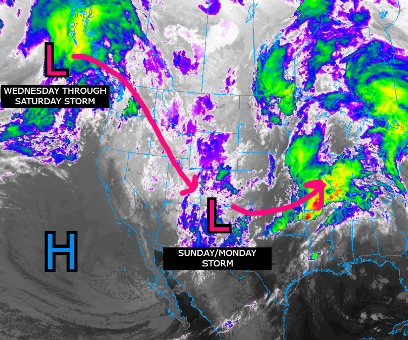
Our current system gets on out by Monday night, but it may end up merging with a storm already beginning to impact the Pacific Northwest. Check out the 500mb anomalies stepping you through the weather pattern the rest of the week (remember, blues = cold and stormy, orange = warm and drier)
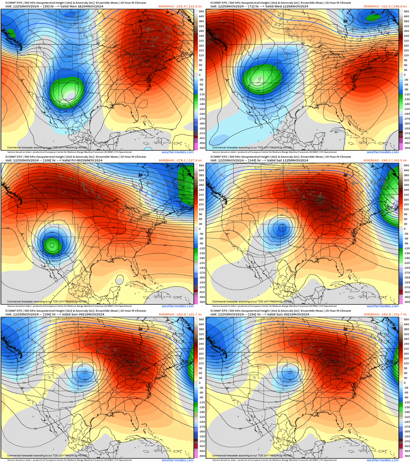
A few key things to note:
- As always, positioning of that low is KEY to what happens for us along the front range. A further south track, which has been a trend so far this Fall, means potential for any significant snow is further south too...
- It seems like there will be a "first wave" Tuesday into Wednesday that will feature a brief merge of the two storms discussed above.
- It looks like storm #2 will have momentum and slide south Wednesday into Thursday, likely leading to a break in precipitation
- The greatest snow boom potential (but also bust! potential) comes from a potentially more impactful wave that would hit Thursday into Friday, and possibly into Saturday where snow and even wind could become a problem across Eastern Colorado.
- With these slower systems, more moisture is always possible, and SOME modeling has indicated HEAVY snowfall potential across much of the state between Tuesday night and the end of the week.
Southerly track to burn us?
Lots of excitement around this incoming system, and you'll see in the snowfall map below why... but take it with caution. There's a lot at play here, and getting multiple waves of snow to line up right is hard to do!
Perhaps the biggest risk to the heaviest snowfall potential we see out there right now is the secondary wave late in the week ending up too far south, then east for that heavier snow to wrap up west along the Front Range. If it stays a bit further north and west... well, we should be in good shape to get some good snow.
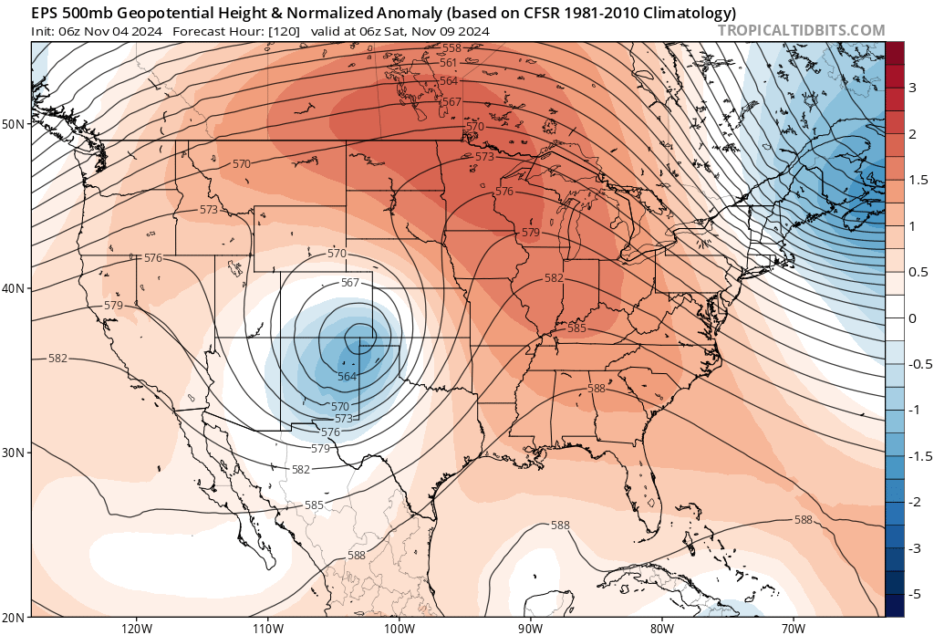
At 500mb – the Euro ensemble takes a pretty good track for us on Friday, moving it into the panhandles then ejecting northeast:
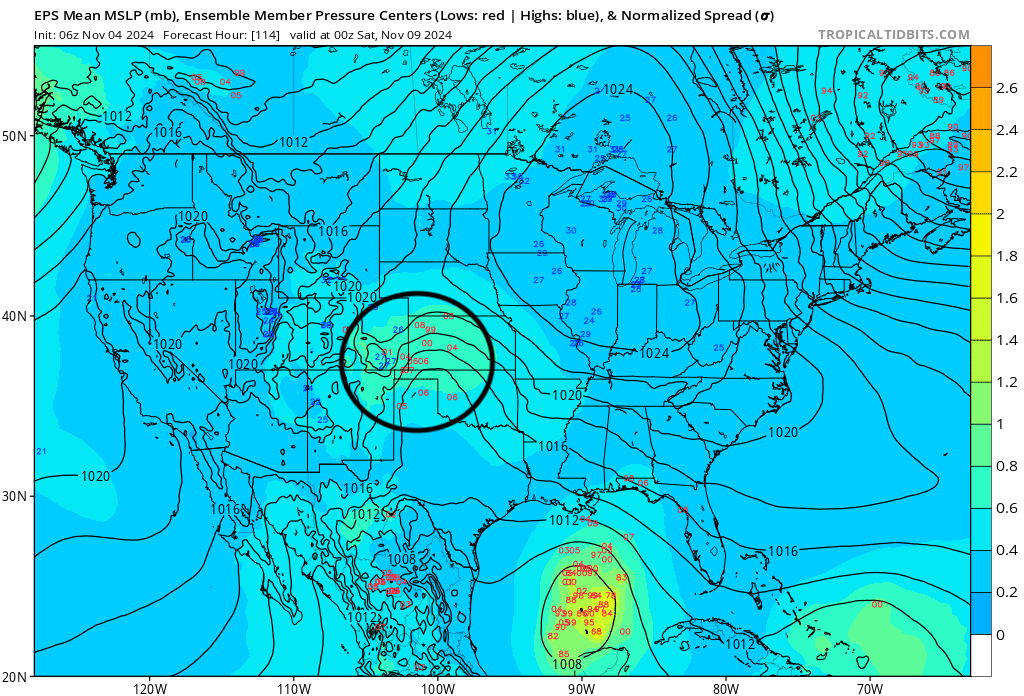
At the surface, some disagreement between the members is evident though... with quite a spread for the placement of the low (indicated by the red numbers over southeast Colorado into Kansas).
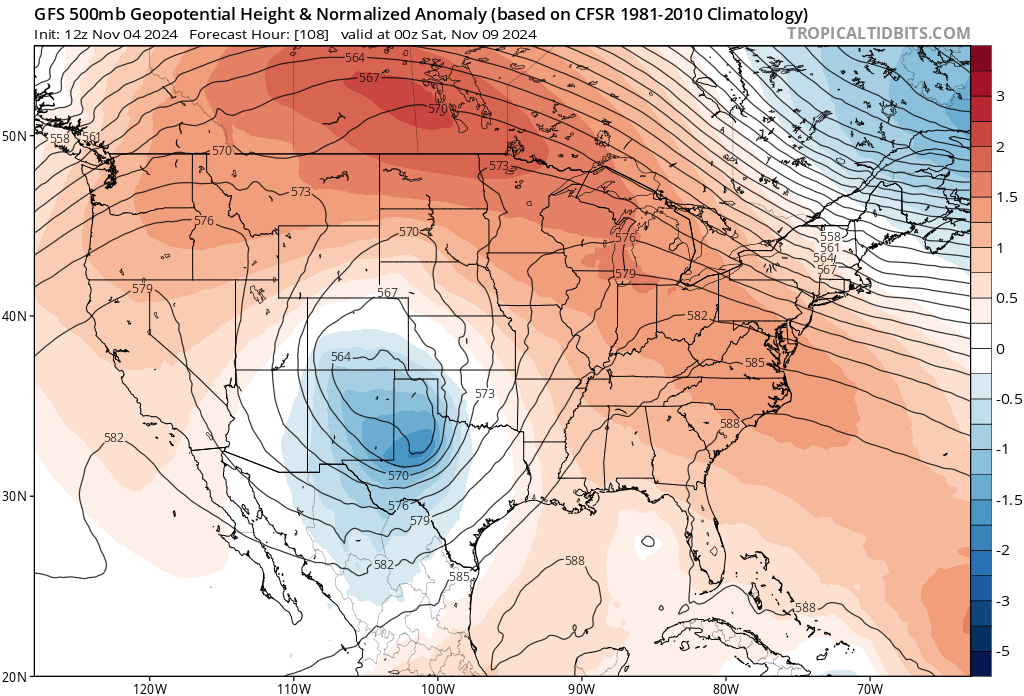
And then the deterministic models have a spread too... The GFS is largely a MISS for snow in Denver, and you can see what, lots of energy really digging too far southeast of us Friday night:
And it's that southerly bias in the GFS we will be watching closely today. The operational (above) is scary if you want snow in Denver later this week, but the ensemble had a pretty big shift southeast from yesterday too. Below (left) is yesterday's run (with upwards of 1" of liquid for Denver), and blow (right) is todays – a big time shift southeast.
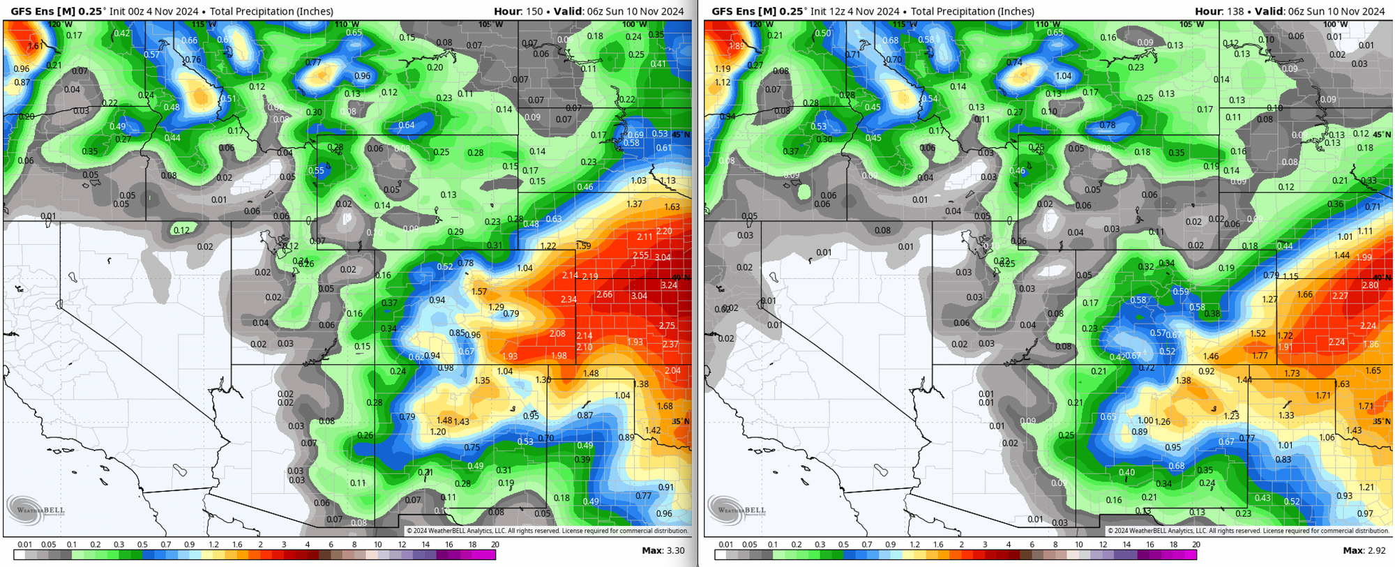
Does the trend show in other modeling today? We'll see.
How we're handling snowfall totals right now:
The trend: some have a chance for higher end snowfall, especially with the second wave mid to late week. That "higher end" of the snowfall is a bit up in the air at this point. Like, maybe way up in the air.
We've seen guidance produce everything from a several inches, to a foot, to two feet and in some cases over 2 feet for some along the Front Range.
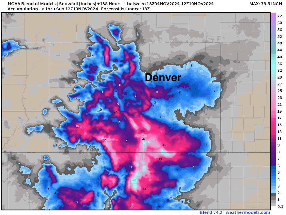
The blend of models shows lackluster snow potential for Denver (remember this is a combo of both waves) with the heaviest snow south of the city. But still, some snow.
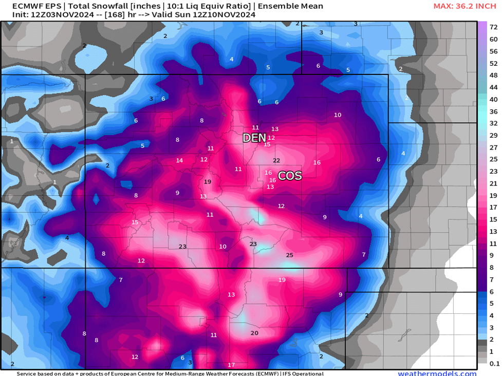
Here's what the (trusty?) EURO ensemble is printing (a combination of all the various waves through Saturday)... a solid potential this far out!
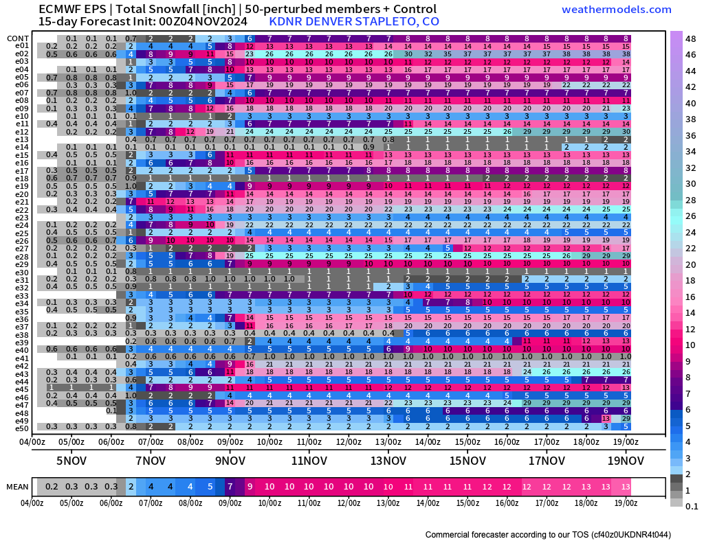
If we break down by 24 hour totals... There's a couple of things to note. We see maybe 2 - 4" for Denver from round one in the ensemble mean, and 4 - 5" in the means for round two. But if you look at the individual members (along the y axis) you see some produce as little as 0.1" of snow through the period, and some upwards of 20"! That's HUGE spread, and therein lies the uncertainty.
GFS and Canadian ensembles have similar snowfall potentials across the state... however some have different flavors of track/strength, leading to variable totals for the front range.
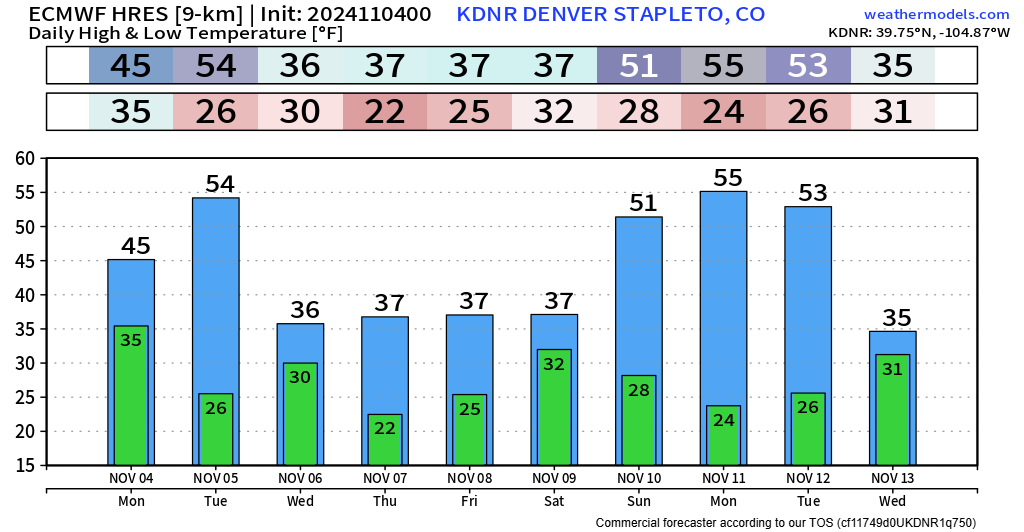
To pair, we should get pretty cold during this stretch of potential snowfall, with highs in the 20s and 30s.
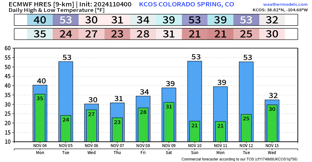
Clearly a lot to track... we'll have all the latest on Weather5280 through the week. The big question today will be, does the GFS remain alone in its southerly shift? Or do other models follow?
Stay tuned! https://www.weather5280.com/subscribe
