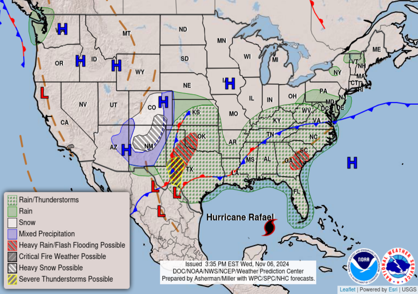
Colorado Weather: More heavy snow is expected on Thursday and Friday

What has been on the top-end of many of the winter storms we've seen over the last several years, we STILL have to contend with the core of the storm system as it pivots northeast out of the four corners. Below is an infographic from the National Weather Service in Pueblo where snow is expected to be the heaviest for the I-25 corridor.
Here are the anticipated snowfall amounts through Saturday morning along I-25 from the Palmer Divide southward across Colorado Springs, Pueblo, Walsenburg, and to the Raton Mesa. Please make sure to follow the latest on road restrictions and closures from @ColoradoDOT. #COwx pic.twitter.com/ung2REV31I
— NWS Pueblo (@NWSPueblo) November 6, 2024
What we've seen so far
For many along and south of I-70, this has been a high-impact snow event, with closures of major roadways including HWY 24 east of Colorado Springs and HWY 287 in far southeast Colorado. For the immediate Denver metro area, this storm has produced mostly moderate impacts, with heavier snowfall totals on the south side of town near the Palmer Divide.
Here were the totals through this morning, and we added to this today:
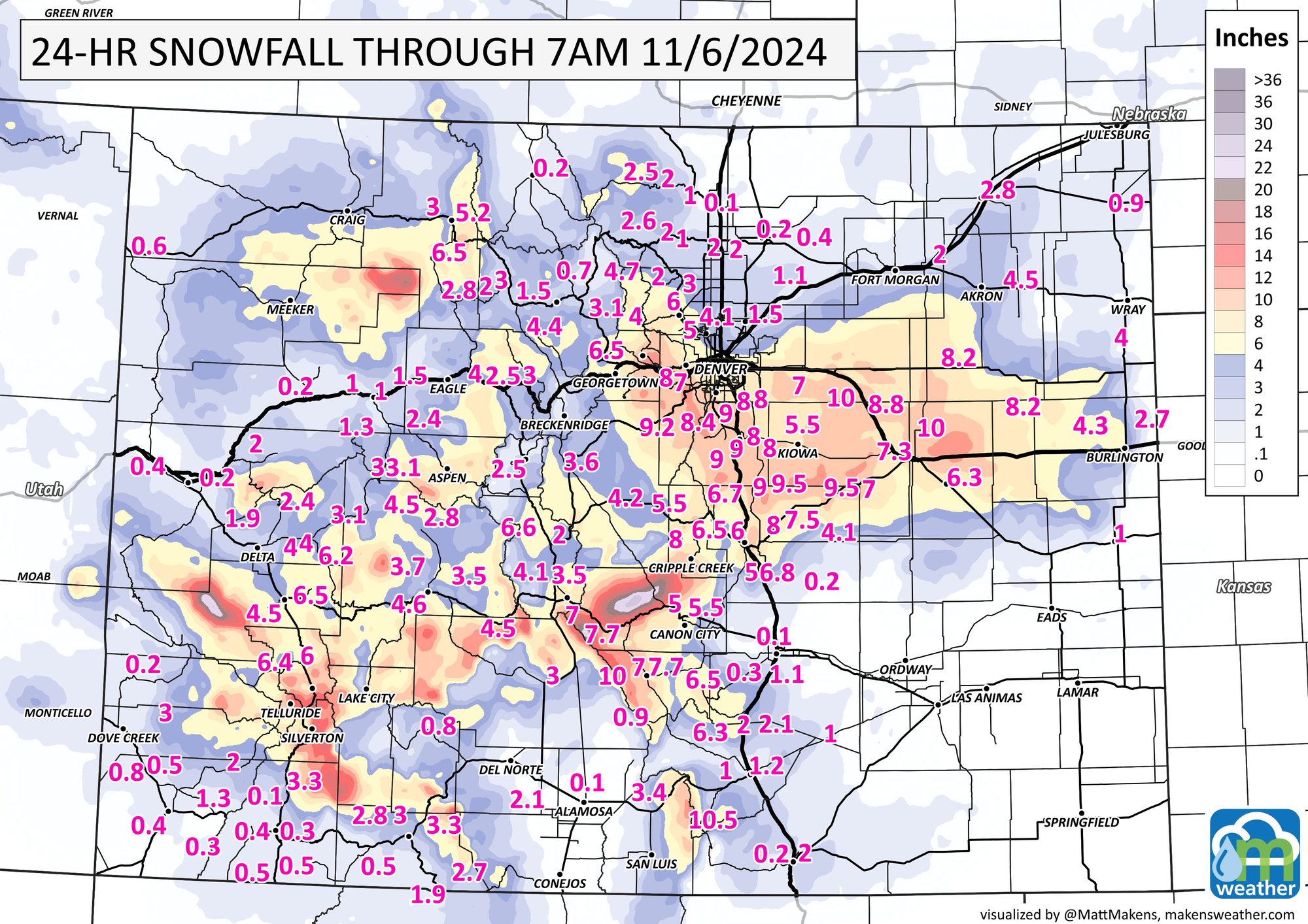
Reports from 7AM: areas around Colorado Springs overachieved the most with the first wave of this system as a powerful mesoscale band dumped 6-12" between Tuesday night and Wednesday morning.
Meanwhile most of the Denver metro area saw totals between 4-9".
Light snow has been on and off for much of Wednesday, with most locations seeing minor additional accumulations.
That will change tonight into Thursday morning. Below is a look at simulated radar from Wednesday evening through Thursday evening. Snow will increase over far southern Colorado overnight, spreading north into the morning commute and throughout the day on Thursday.
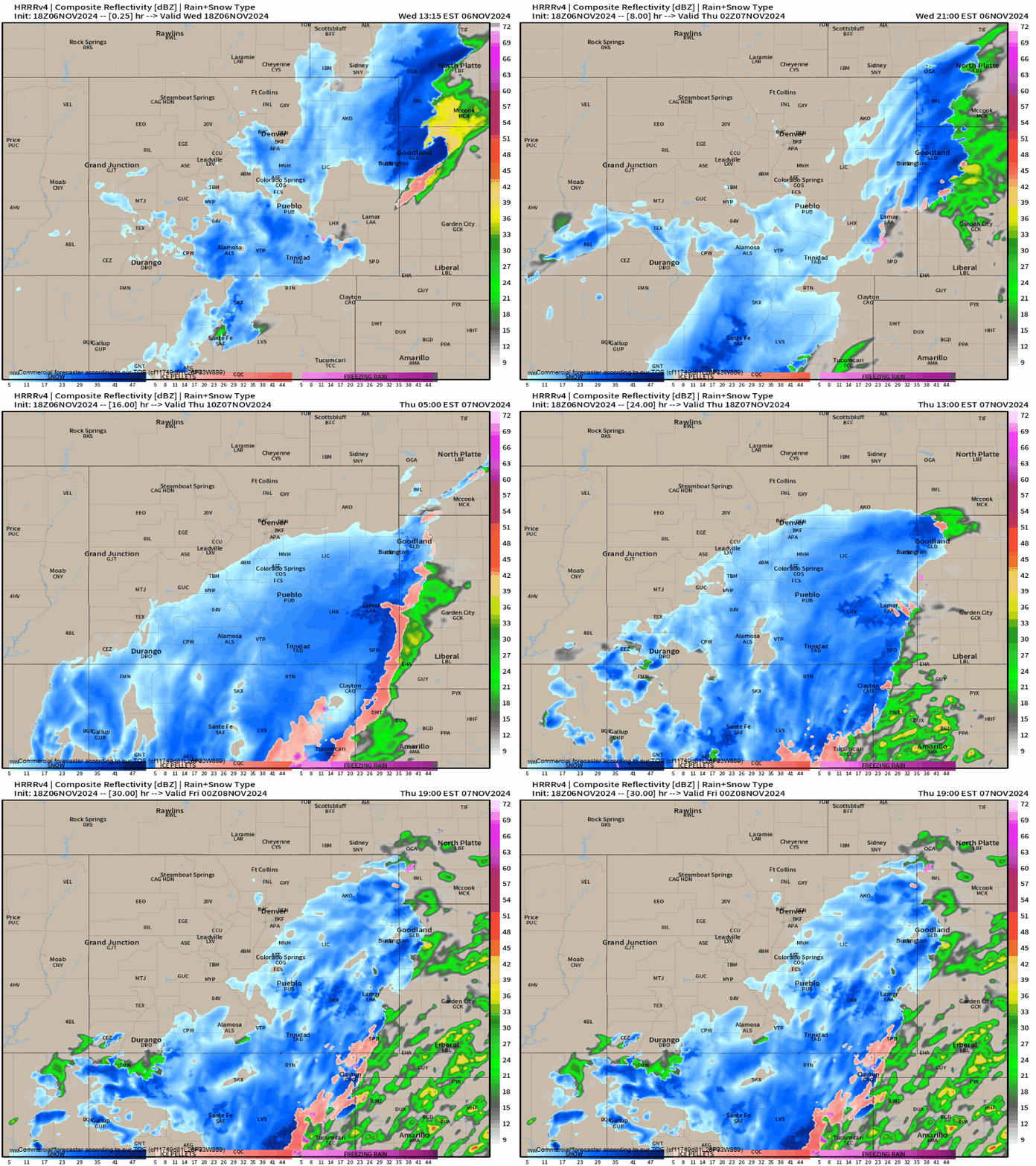
We'll likely see that shield of snow slowly break apart by Thursday night before another wave of energy spins up and takes a similar path into Friday morning. That following wave looks to last all of Friday and linger into Saturday morning before the system as a whole finally begins to taper in strength and move east.
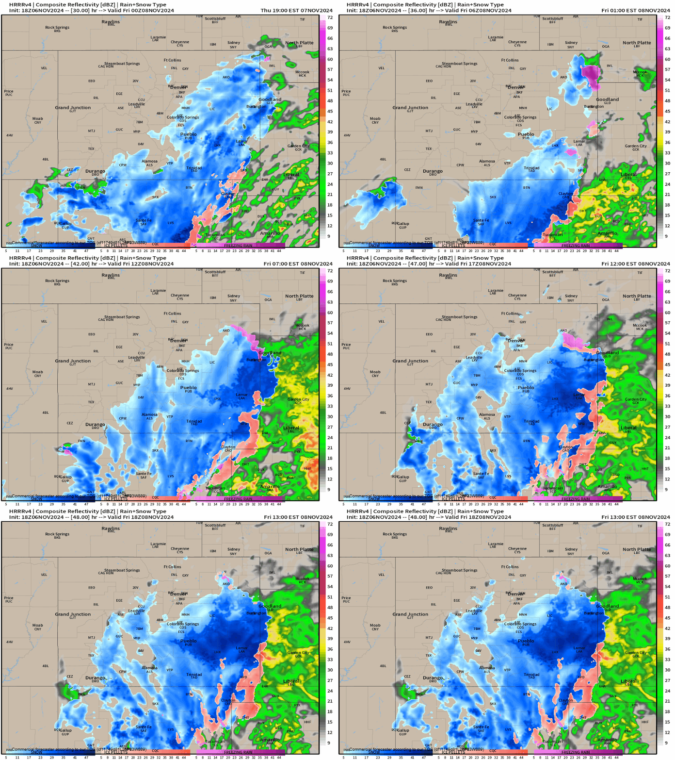
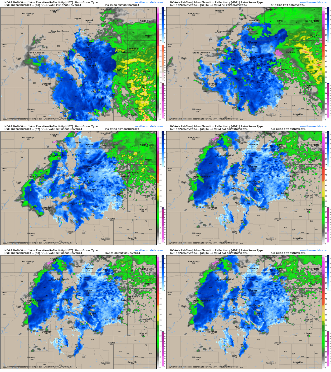
You can see the light at the end of the tunnel after we get past midnight into early Saturday morning. But the damage will be done... especially for folks over southern Colorado.
How much more snow can we expect?
For southern Colorado quite a bit of more snow on the way, and that's not to say some of that won't make its way north. For places like Trinidad, however, several feet between now and Saturday will be possible.
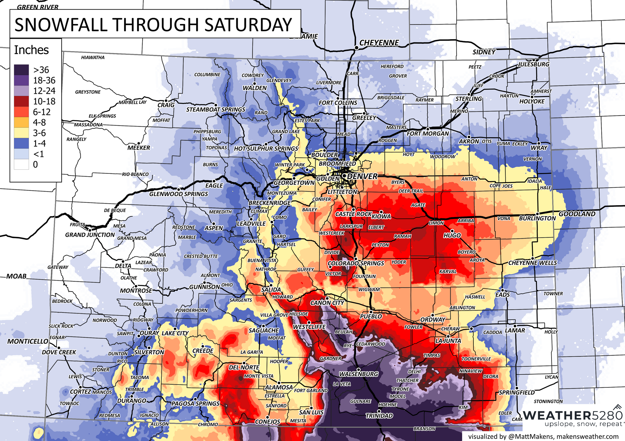
As you get closer to Denver, the heavier snowfall is again expected along and south of I-76, with the greatest totals between now and Saturday over the Palmer Divide.
Still, several more inches of snow for the Mile High City looks doable, on top of what's already fallen. Good stuff.
Look for snow showers on Thursday, a brief lull, and then increase snow coverage again Friday into Saturday before this system finally kicks east. Timeline below.

We'll keep an eye on the trends, and pass along updates as needed!
