Wednesday AM update: Snow continues off and on all day, Advisory for Denver through 11pm

Denver logged its first official snowfall of the season yesterday with 2.3 inches of snow recorded at Denver International Airport through midnight last night.
We've obviously added to that total since then, and will continue to put a bit more snow on top of current totals today, with on and off snow expected to continue most of the day – especially for communities along and south of I-76.
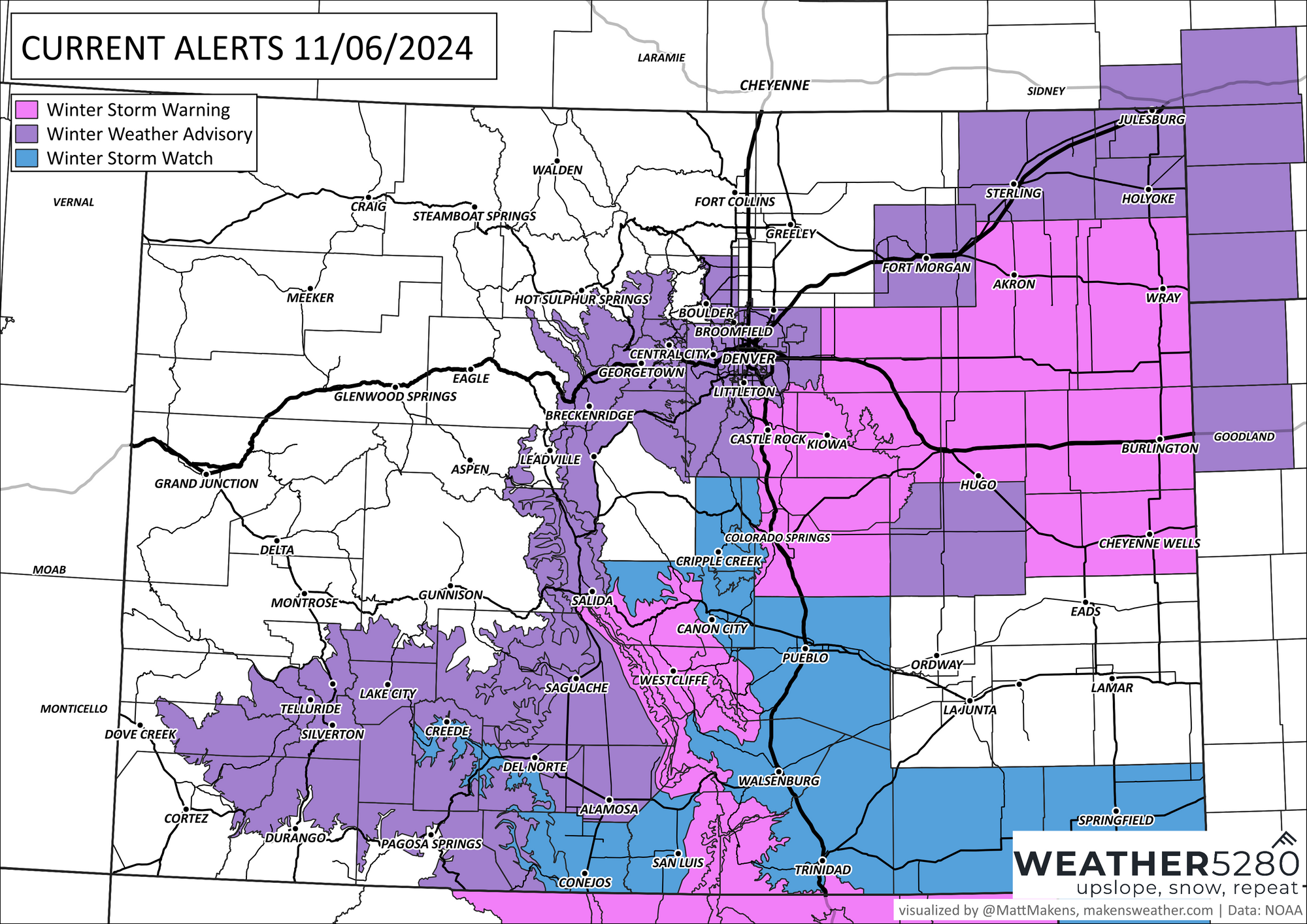
Here are the latest winter weather alerts from the NWS in Boulder. The heaviest snow will be from Denver's southern and southeast suburbs through east-central Colorado, where a Winter Storm Warning remains in effect through 5am Thursday.

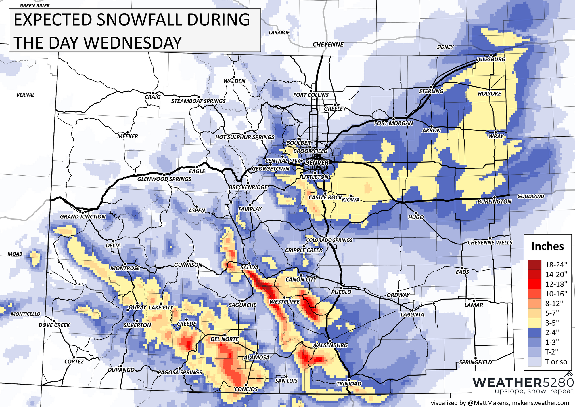
Below is what to expect for additional snowfall through tonight. Look for an additional 1 - 4" or so for Denver, with upwards of an additional 4" possible further south and southeast as you head out of the city.

Thursday forecast
Thursday we'll be a bit between the two waves we've been talking about for some time now. Still, we'll be under the influence of the trough to our south, which means a rather chilly and possibly unsettled – rain and snow showers are possible – day is on tap Thursday.
This is evident in the hourly planner. Look for snow chances upwards of 60% all day today, and about 30% chance for those rain/snow showers on Thursday across the metro areas.

Friday into Saturday
The big question here remains how far west the trough tracks as it finally begins to eject northeast. The trend recently has been a bit further west again, which would increase snow chances for the Denver metro area. A wobble southeast, however, and those chances go back down again. A bit of a wait and see.
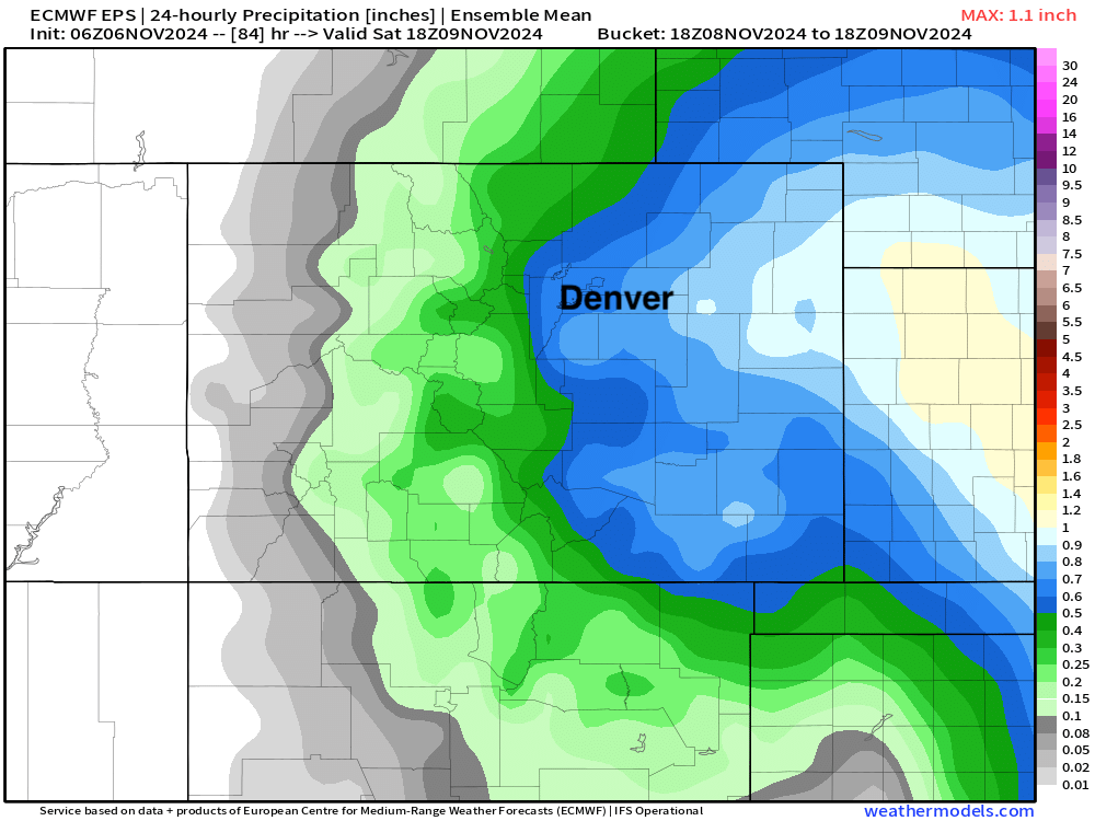
The latest European ensemble mean 24 hour precipitation forecast ending Saturday morning shows another 0.5" of liquid across the the area, with more to the east. If this pans out, we'd see another accumulating snowfall event for the metro area to kick off the weekend.

For now, plan on the chance of snow ramping up again later in the day Friday, particularly across the eastern plains, with the best chance of snow for Denver looking to come Friday night into Saturday morning.
Temperatures
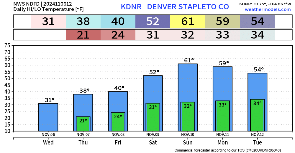
No surprise here, but we'll remain chilly until the trough finally moves out for the latter half of the weekend.
The blend of models shows gradual warming through Saturday, but that warming will be overdone if some of the models are correct with the western track of the low.
In any event, highs in the 30s today and tomorrow, near 40F on Friday, and perhaps a bit cooler-than-advertised here Friday night into Saturday, but we'll see.

We'll continue to watch things for you, stay warm, stay safe, and post those snow reports and photos!
