
Colorado weather: One last push of snow today; Winter Storm Warning for Denver through Sat AM

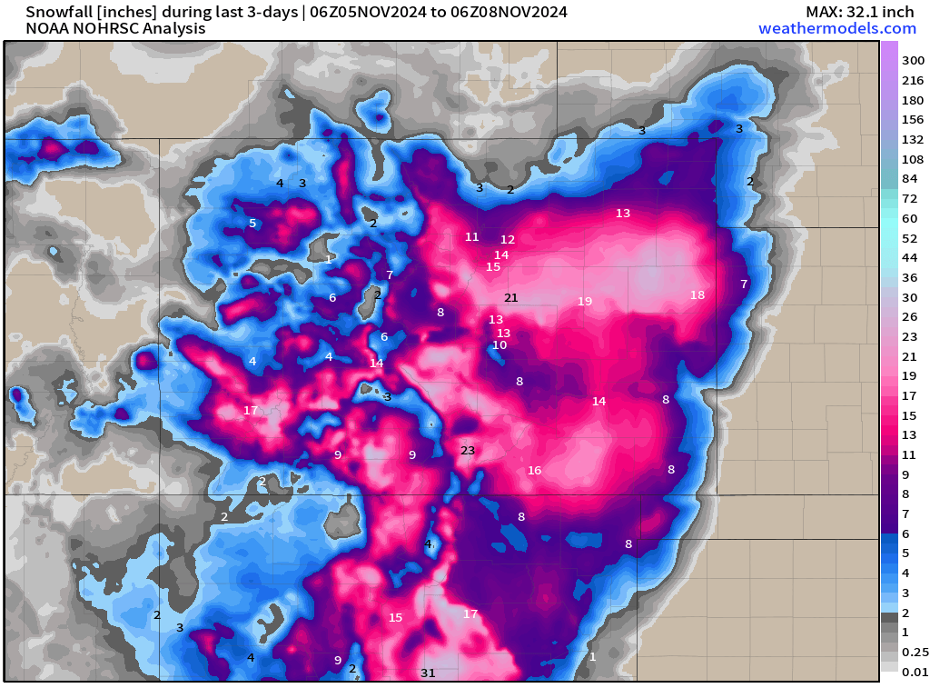
It's been an impressive week of snowfall for many in Colorado, especially south of I-70. Snowfall totals so far this system have brought a bunch of much-needed water to many of us... Unfortunately, there are places that are still begging for moisture north of the Platte River basin. Here's a look at snowfall totals so far this week ⬇️
As of 10:00am Friday, the radar is lit up across most of eastern Colorado. You can see the moisture pinwheeling around the upper-level low... fantastic upslope setup for pretty much everyone.
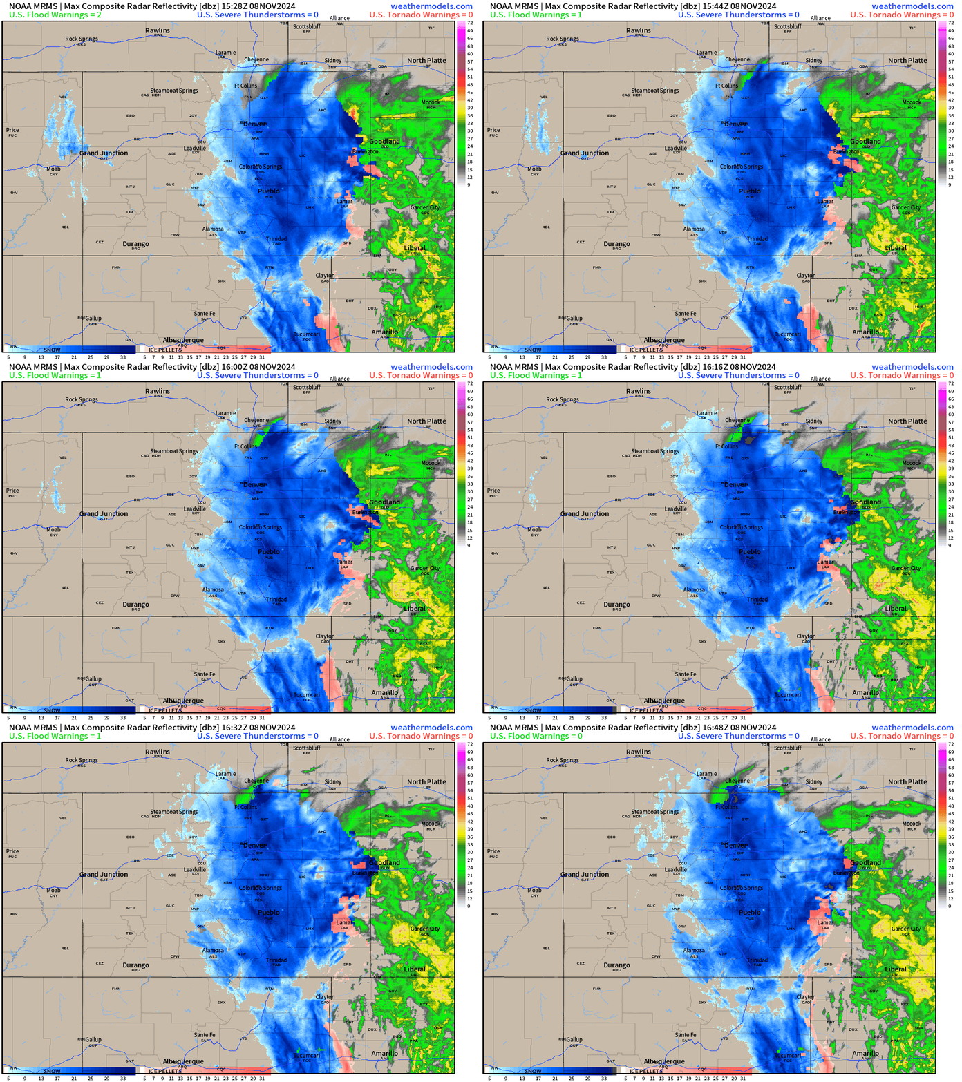
And it looks like Weld and Larimer counties are finally starting to get their share!
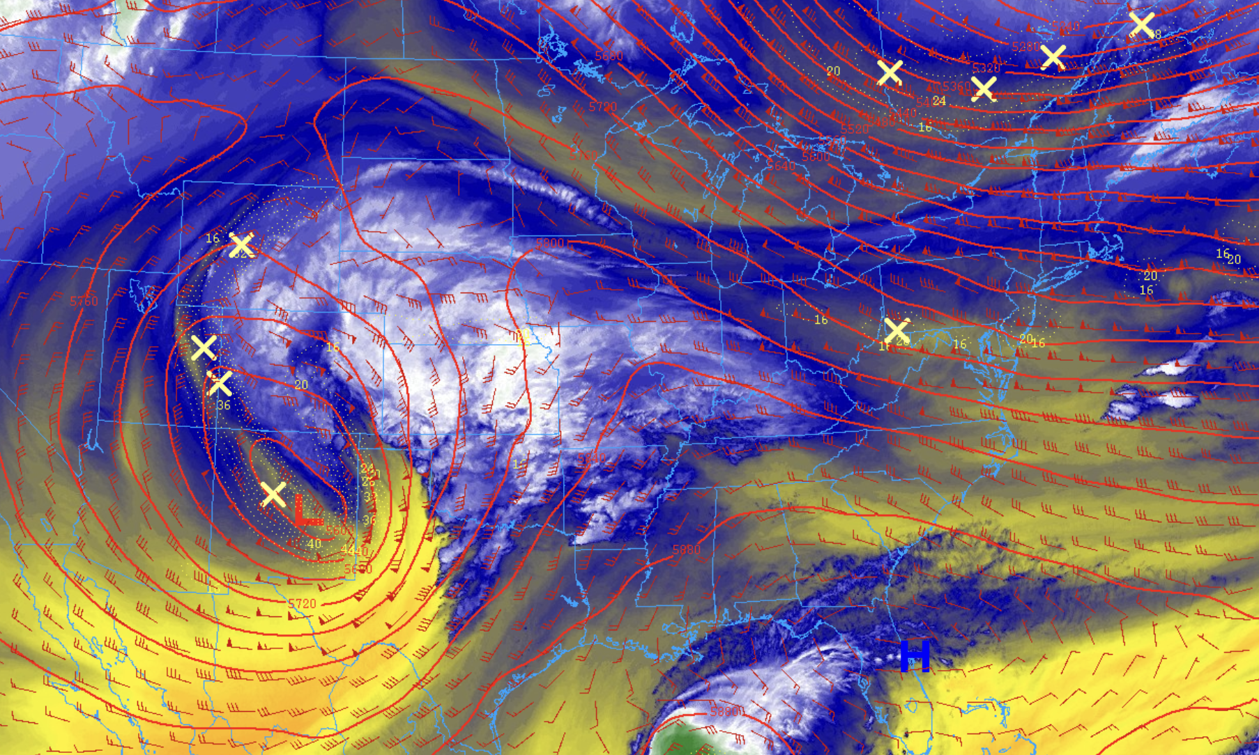
At look at mid level water vapor imagery shows our low continuing its gradual track east this morning, soon to begin its turn north/northeast through tonight. The blues and whites are indicative of lots of water being thrown up against the hills with great upslope in place at this hour:
We'll see snow most of the day. A bit of dry slow may work through the area through early afternoon, but if it does – it'll be relatively short-lived, with most guidance promising some heavy snowfall across the urban corridor for that evening commute.
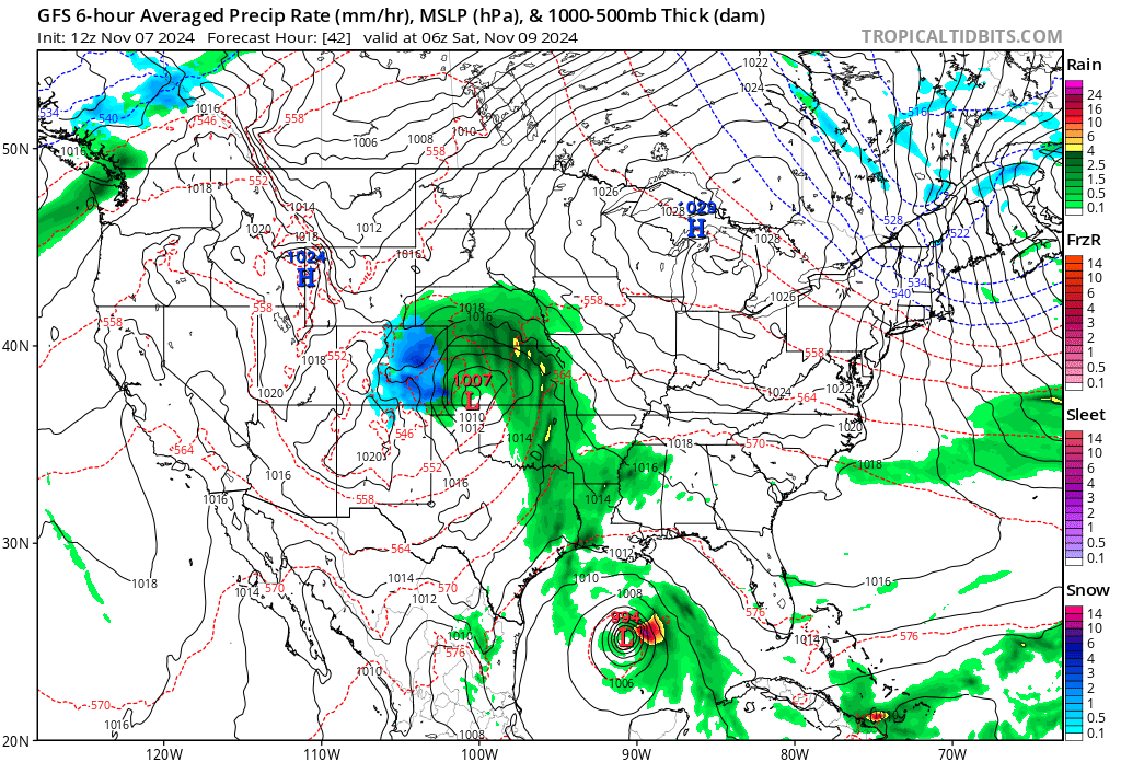
HRRR depiction for snowfall looks like it's being handled well. Snow will continue to progress northward as the low scoots north along the Kansas/Colorado border. As it does so, the storm will likely puff up in intensity through mid-afternoon, before slowly relaxing and weakening as we progress into early Saturday morning. As the low wraps up more today, we're likely to see winds increase to 25-35 mph, especially over the plains leading to blizzard-like conditions at times.
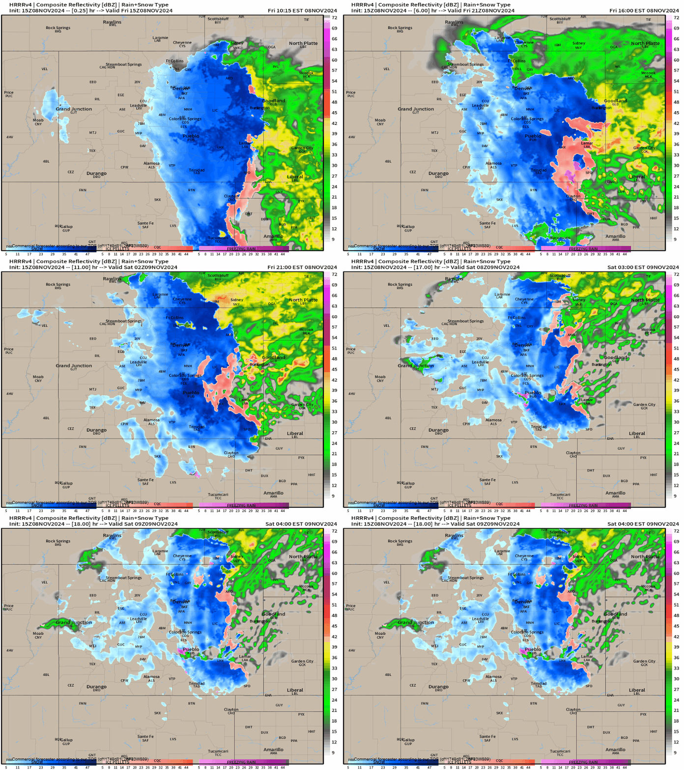
It's likely the accumulating snowfall will taper off once we get to sunrise Saturday if not before for some, but lingering snow showers and wind are likely to continue through lunchtime. Blowing snow could be an issue trying to get out the door tomorrow, especially if you live further east.
WSSI impacts show worst conditions expected along and south of I-76, but if we can keep rates up this evening, look for trouble along the northern urban corridor as well for that evening commute. While yellow, let's not sleep on it!
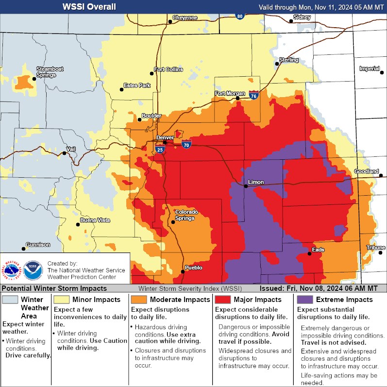
As for snowfall totals... we aren't going to adjust from what we put out yesterday. Most areas should have no problem hitting low-end projections (if you haven't already) with good bet on some boom snowfall totals.
Here's our quick list from yesterday:
- Fort Collins: 3-8"
- Boulder: 6-12"
- Denver (downtown): 6-12"
- Southeast Denver: 7 - 14"+
- Conifer: 6-12"
- Castle Rock: 6 - 12"+
- Elizabeth: 10-16"
- Colorado Springs: 6 - 12"
- Limon: 10-16"
And the post:
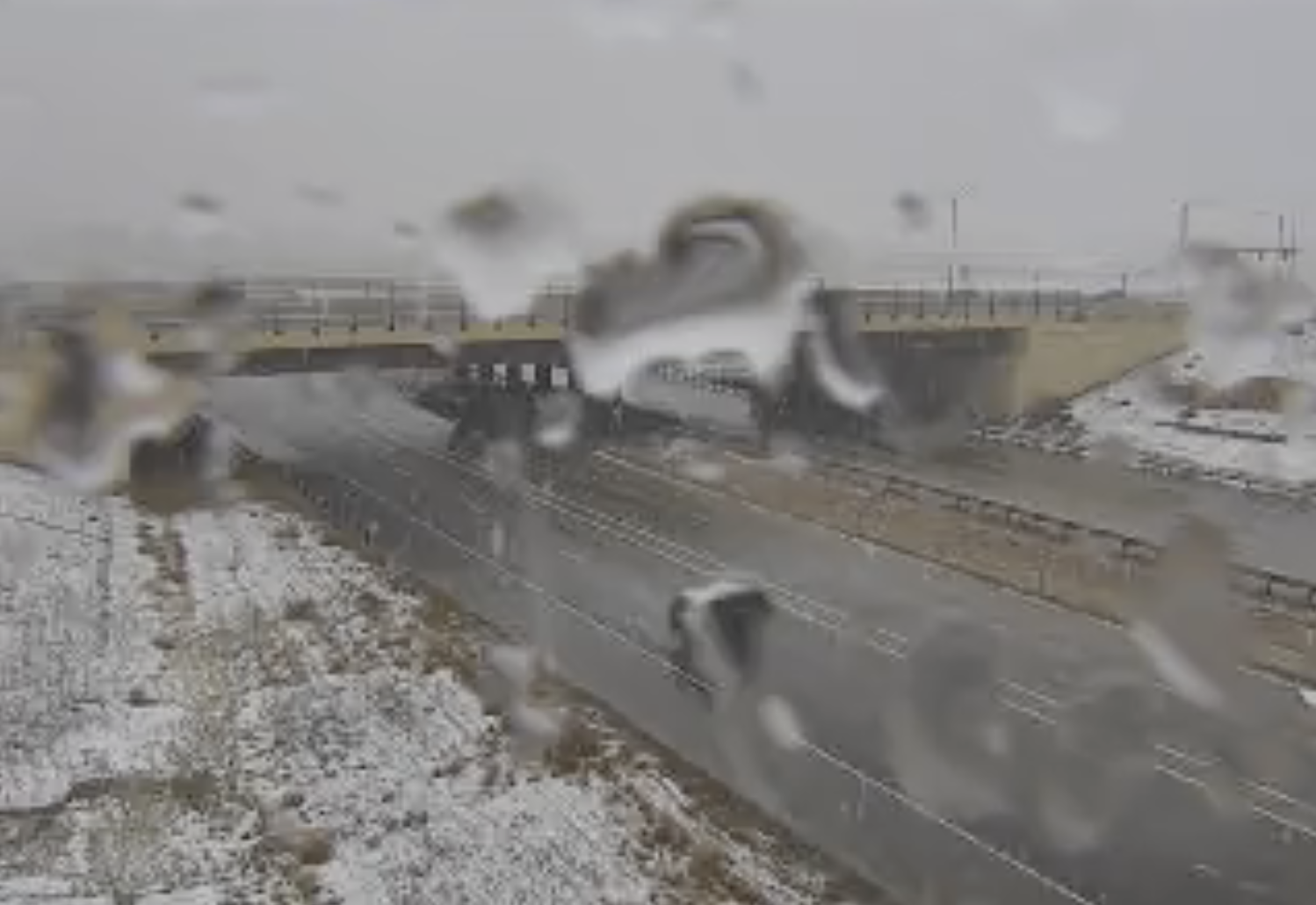
A quick check on our friends up north near Fort Collins shows that rates have been heavy enough so far today to overcome and temperature issues, and we've got snow on the ground up there! Could be we see some precipitation mixing for northern communities today if and rates decrease in any given area.
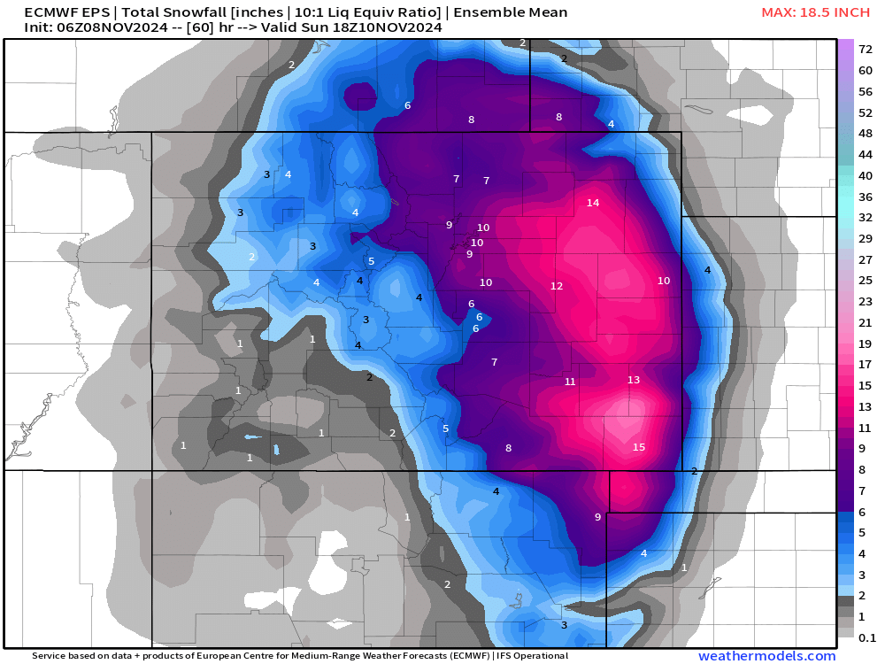
The European ensemble showed this for totals in its early morning run, and looks pretty on target, even even a bit low in spots. Overall, a snow-filled finish to a snow-filled week across Eastern Colorado.
And FWIW, here's the latest HRRR snowfall forecast through early Saturday morning hot off the press. It shows about 8" more for Denver, a bit more for higher terrain south and west, and 3 - 5" up north:
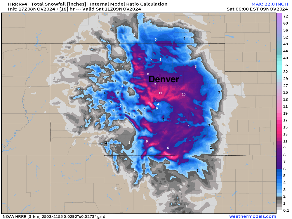
It seems likely most are in line for at LEAST 6". This would put many locations above 20" for the weekly totals. Great stuff all around.
Please keep us posted in the comments below! Feel free to share pics as well, we love the ❄️ ☃️!
