One for the history books: Storm delivers 20 inches of snow *officially* to Denver, setting records across parts of the state

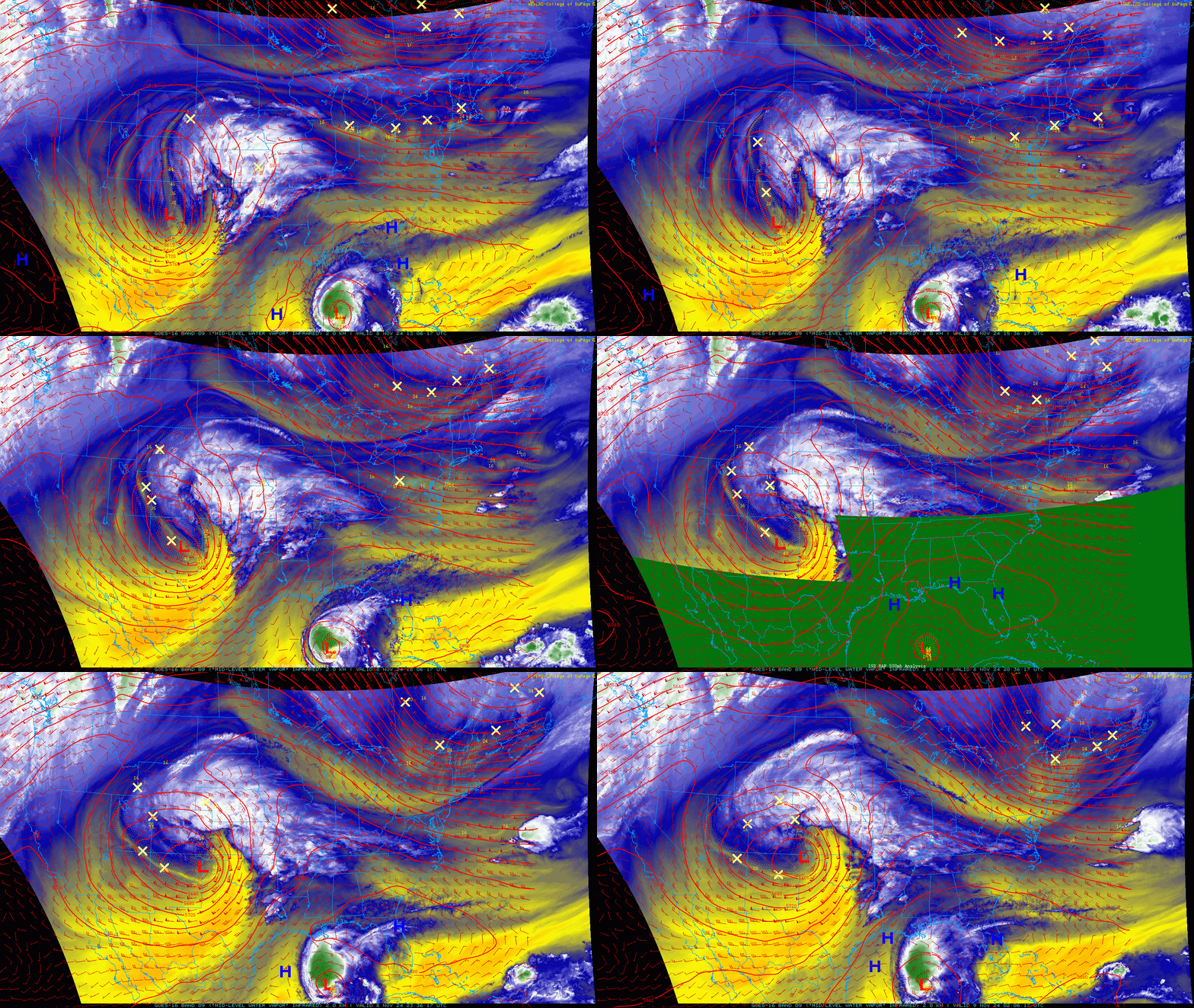
The system that impacted our state over the course of really about 5 days over the last week has finally moved on, but in its wake many Front Range communities and especially those living across the Eastern Plains of Colorado are digging out of the biggest November snowfall since 1983, and for some it the snowiest 5 days on record for the month of November!
Snowfall totals
For Denver, the official total for the duration of the storm: 20.0" at Denver International Airport. The last 20"+ storm in November came when 22.4" of snow fell near the end of the month in 1983. If we see no more snow for the duration of the month, this will go down as Denver's 10th snowiest November on record, toppling 1972 when the city picked up 19.4" during the month.
❄️✨96-Hours snowfall totals are in! Areas such as Lincoln and Elbert counties received historical snowfall over the time period between November 5-9th. To view more totals, check out our list on the URL: https://t.co/E4mXlwHjMF pic.twitter.com/mrkNAzFDqR
— NWS Boulder (@NWSBoulder) November 9, 2024
While hard to measure given melting, compaction, and multi-day event, the overall picture is nothing short of impressive. NOAA's NOHRSC analysis shows just how much of Eastern Colorado was absolutely buried in heavy, wet snow last week:
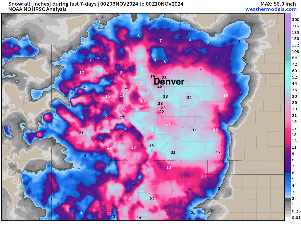
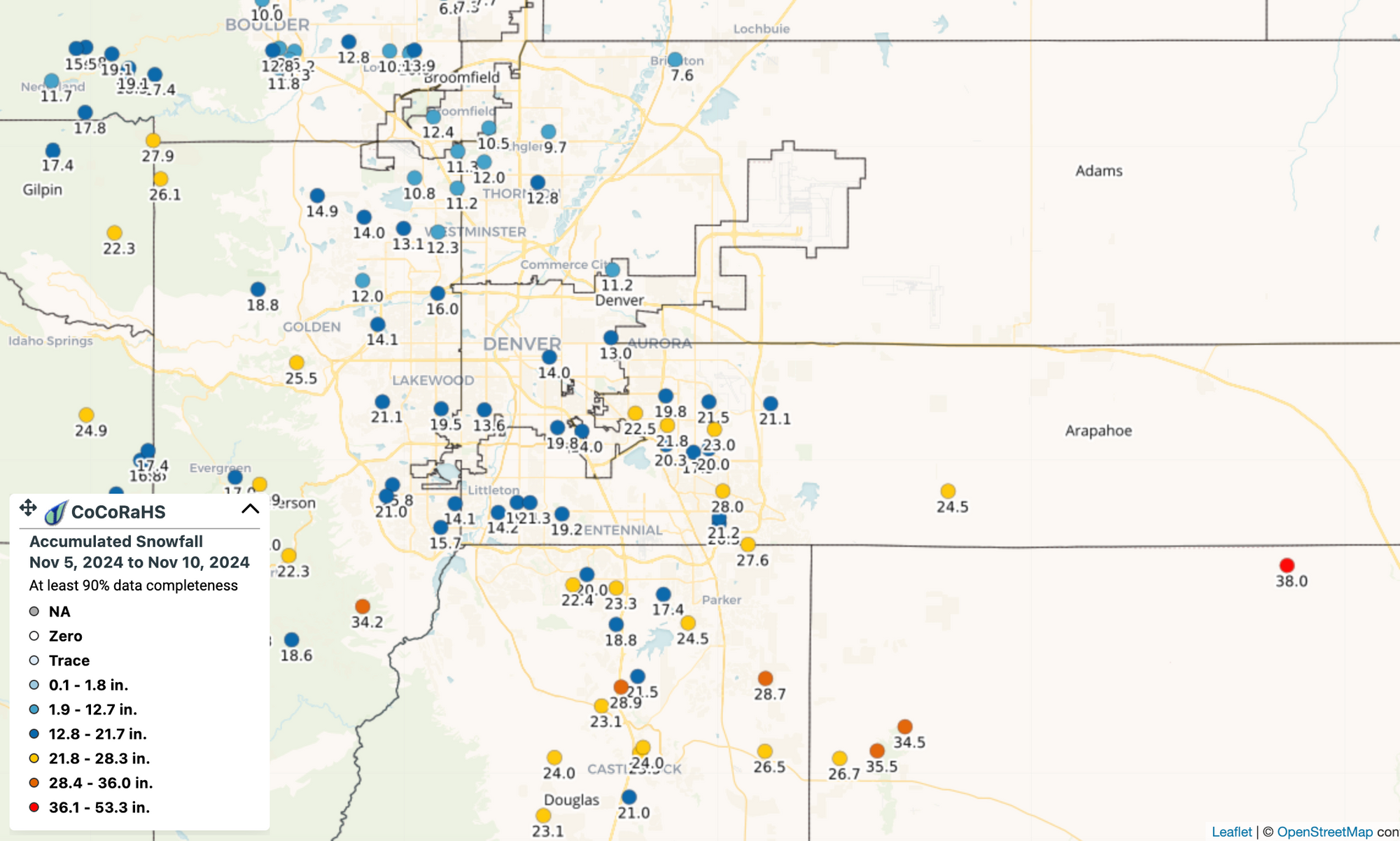
CoCoRaHS observations mostly confirm these totals, with yes some 30"+ totals south and east of Denver. In the city proper, the 5-day totals were more in the 1o - 15" range, with slightly lesser amounts north, and plentiful 2o"+ totals to Denver's south and west.
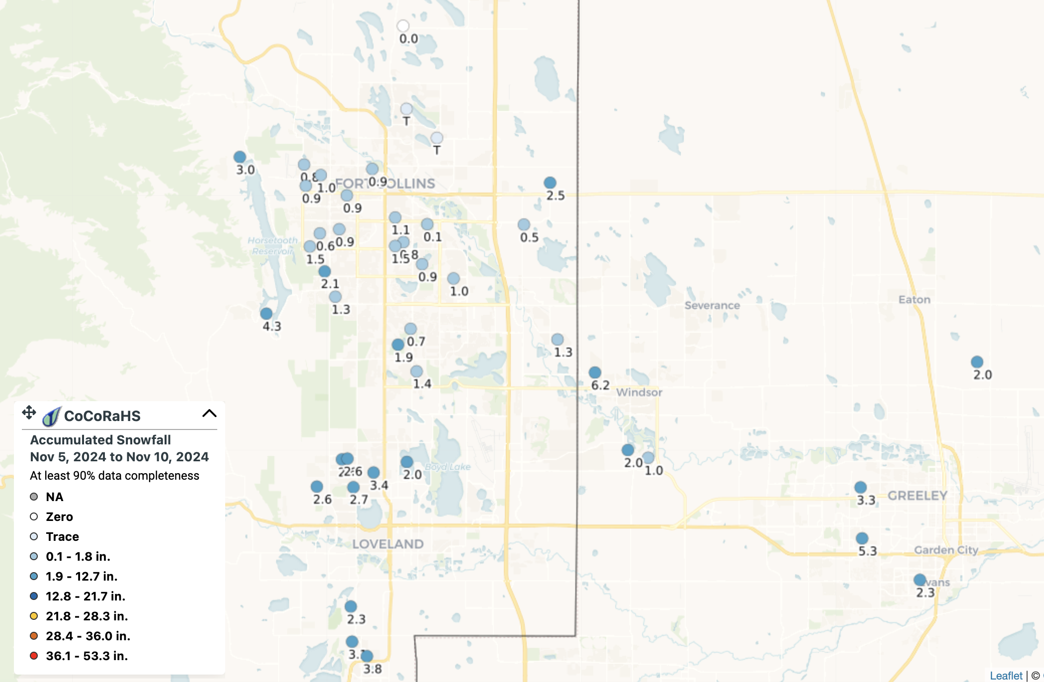
Up north we never quite got off the struggle bus for cashing in on the snow. Five day totals show just a Trace to 3" for areas up around Loveland and Fort Collins, with placement of the low and ultimately temperature issues really limited snowfall potential for these areas.
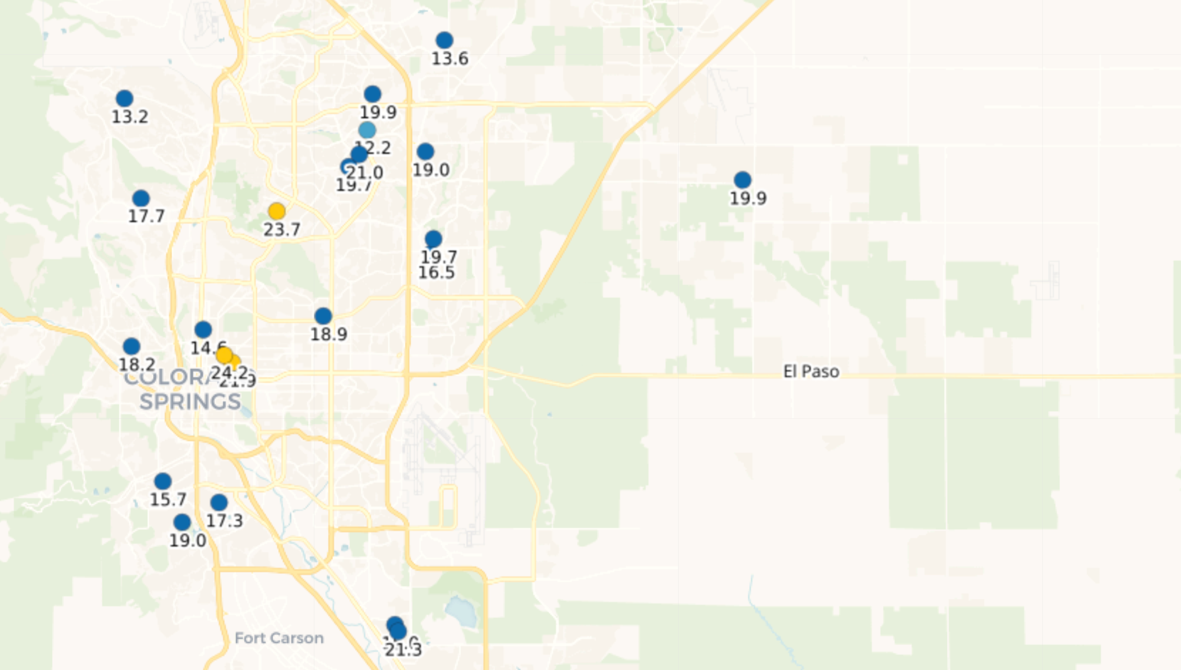
In Colorado Springs, however, also a pretty epic snow event. Totals here from 15 to 24", with 19.3" at the airport landing it in the top spot for largest November snowfall on record for the city! Checkout this list of records from COS and Pueblo:
This past weeks snow storm brought abundant moisture to the area, with two of our main climate sites setting new daily snowfall and precipitation records.
— NWS Pueblo (@NWSPueblo) November 9, 2024
Check out the graphic below for the records, and how this storms totals compare to Nov. monthly averages and records. #cowx pic.twitter.com/F5BGxmeysr
Not just snow, but lots of water too!
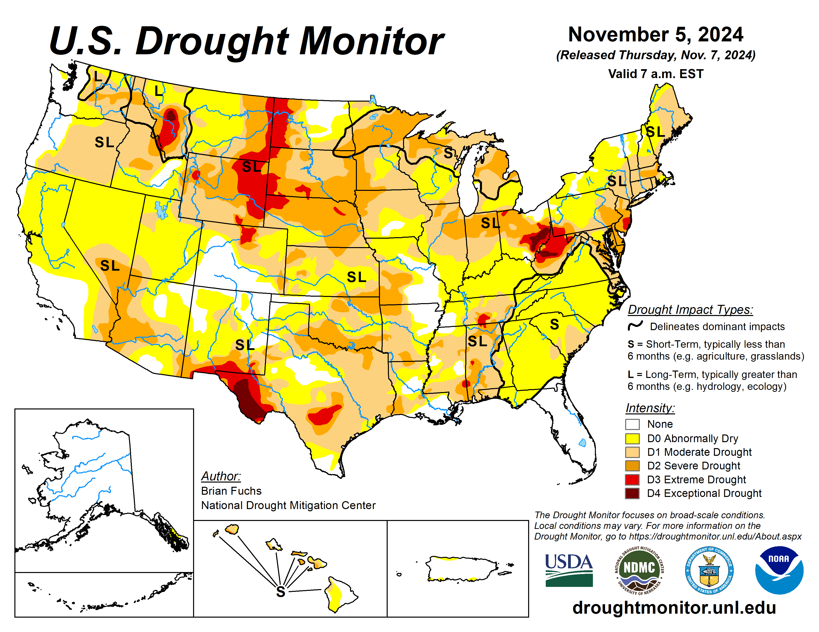
The drought picture through November 5th (right before the storm started) shows really much of the CONUS experiencing drier than average or drought conditions, including much of Eastern Colorado:
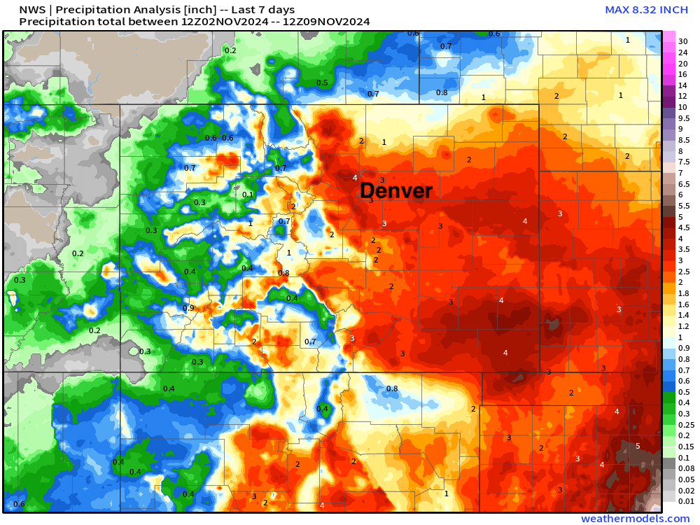
This system will be HUGE in combating that trend, with copius amounts of moisture received in the last week:
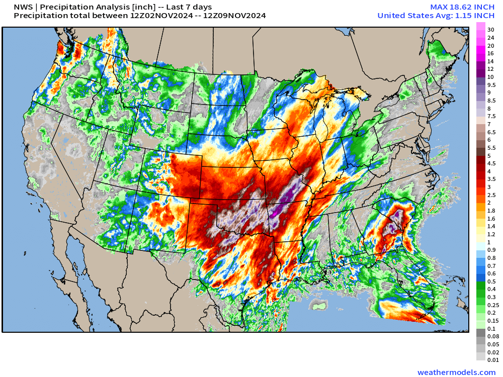
Zoomed in to Colorado we see most of Eastern Colorado picked up 2 or more inches of precipitation over the last 7 days, with upwards of 4" of liquid for some locals. Can't stress enough how big that is, especially for November!
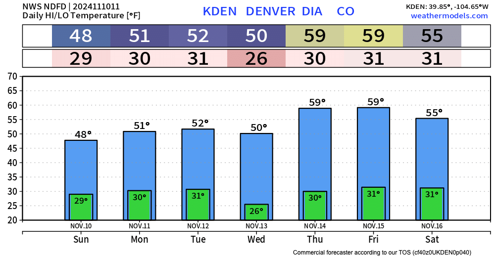
The week ahead looks much quieter across eastern Colorado, with highes mostly in the 50s along the urban corridor. The next system to impact that state arrives mid week, but at this point looks like it'll keep most of the rain and snow in the high country – let's keep an eye on things just in case!
