Beautiful Saturday, Wintry Mix Sunday Night, Thanksgiving Snow?

Quite an up and down November so far – this weekend will trend on the side of warm and dry, but you can see it clear as day on the extended forecast... big-time winter cold likely awaits as we turn the page into the Thanksgiving holiday.
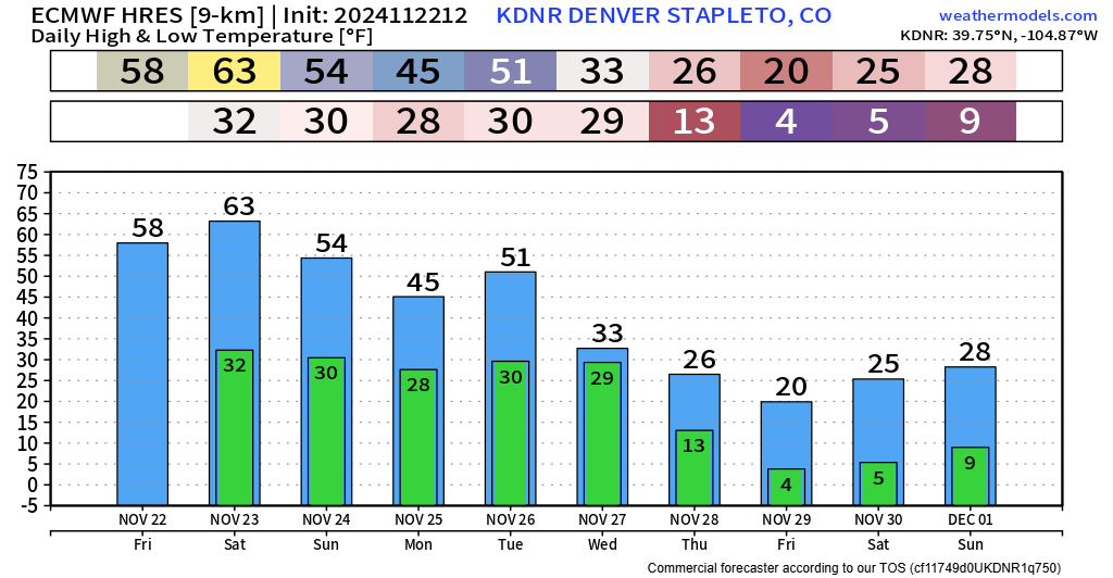
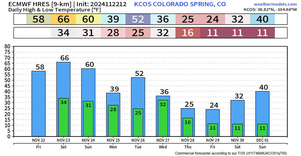
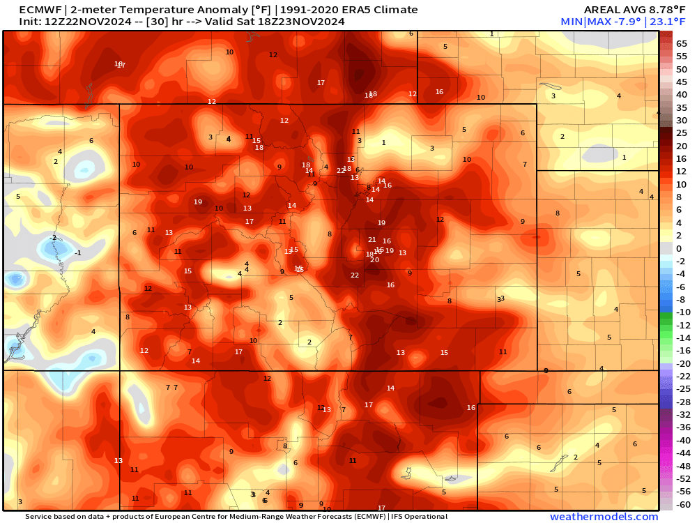
For your Saturday, don't expect any curveballs! Get out and enjoy it while you can because it's almost certainly our nicest day of the next 10 out there. Get out there if you can! It looks like almost every single part of the state will be running above average, and in some cases, especially for the Pikes Peak Region temperatures will be up to 20 degrees above normal! We'll see breezy winds in the afternoon, up to about 25 mph.
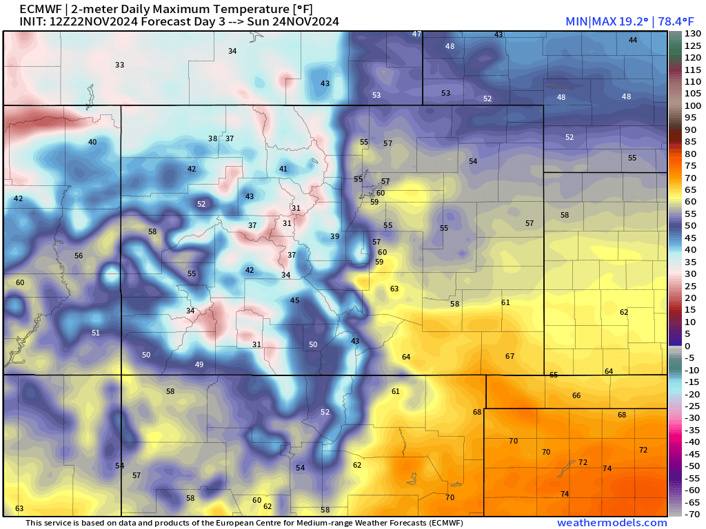
We'll see some slight moderation down towards normal on Sunday, but I don't think it's anything crazy. Below are Sunday's projected high temperatures from the Euro. Biggest changes are up in the hills where temperatures will start to fold back below freezing. Most of the plains and urban corridor will run between 55 to 60.
COLD FRONT SUNDAY NIGHT... WINTRY MIX POSSIBLE?
The big changes can be seen to the north though! Southwest Wyoming will see the first of a fast-moving cold front set to sweep our way Sunday night into Monday morning.
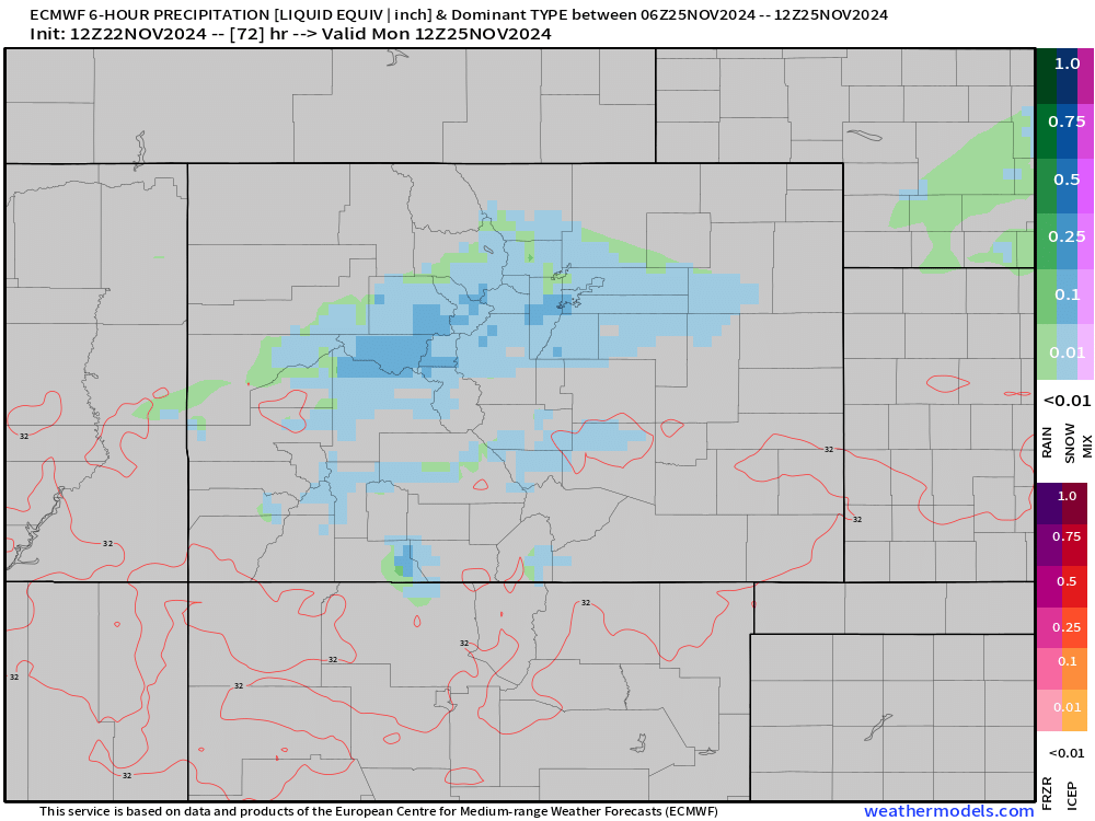
That cold front can be seen with a band of precipitation that is expected to develop late Sunday night into Monday morning.
These kinds of systems can be tricky because:
1) The precip, especially east of the mountains, can end up pretty light which sometimes leaves our p-types somewhere between a light freezing drizzle, mist, and sometimes snow under a heavier band.
2) Temps will likely be well below freezing Monday morning (between 25-28°) meaning if we DO see drizzle instead of snow, freezing drizzle could be an issue... that stuff is never fun.
3) The good news is that if we DO see any problems Monday morning, they should pretty quickly resolve with temperatures back above freezing after 10am.
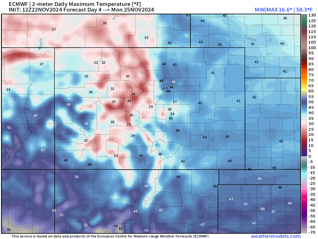
You can see a complete flop in temperatures by Monday afternoon compared to the weekend. The mountains will see highs in the 20s and 30s with 30s and 40s expected in the lower elevations.
After that, we can expect a bump in temperatures on Tuesday before a stronger storm system begins to take shape on Wednesday of next week.
This system has been a bit "hot & cold" in the mid-to-long range weather data over the past week or so, but it seems like the last 36 hours of weather data has keyed on some decent winter-weather potential for the Thanksgiving timeframe.
Overall, the "look" of the system isn't terrible impressive when you look at the 500mb charts. A fairly fast moving wave ripples across the state Wednesday into Thursday, dragging in a cold front south as well...
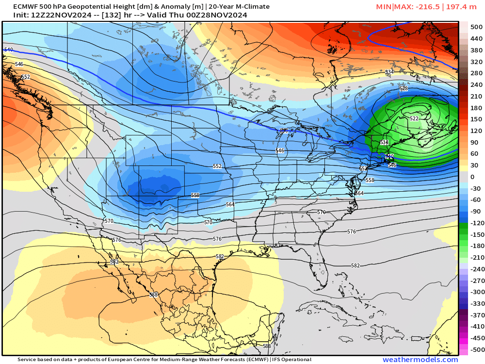
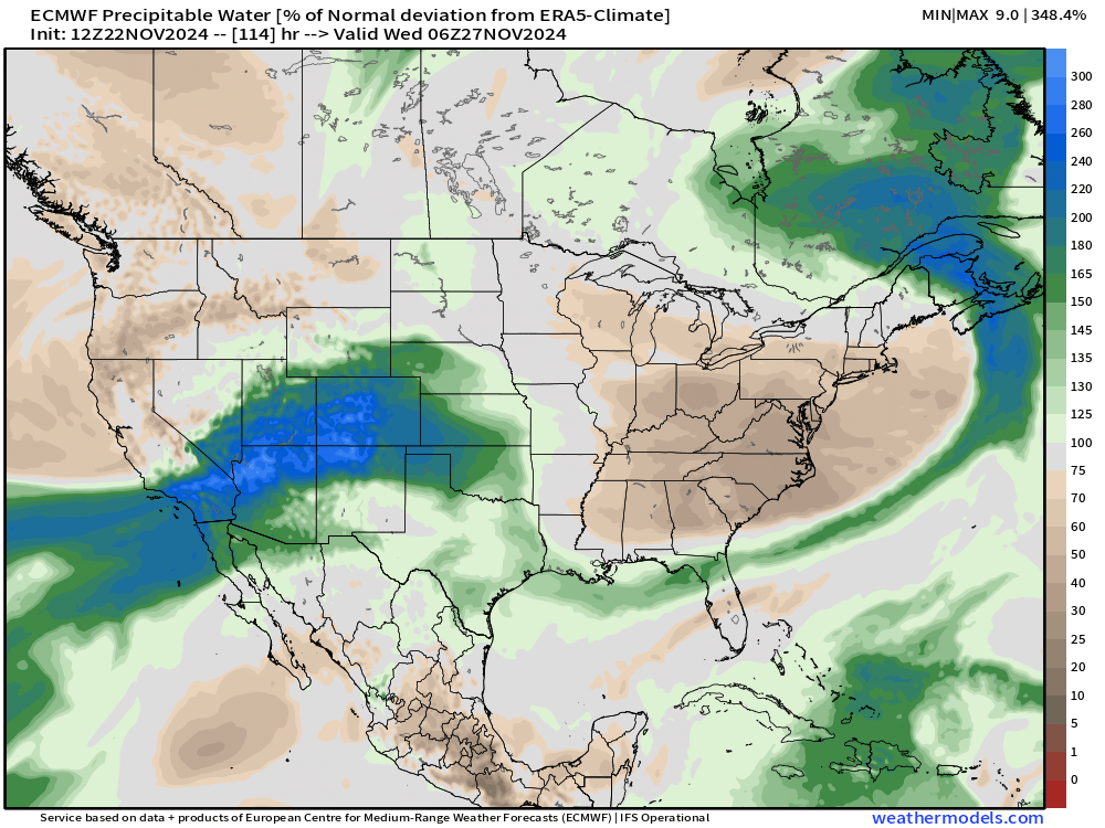
The likely "wildcard" with this system looks to be the moisture source... If you have been following weather across the western US, you might have heard about the bomb cyclone that impacted the PACNW this past week. Remnants of that atmospheric river look to swing towards Colorado – in tandem with the approaching wave could bring a fast, but potentially impactful round of snow.

I'd say there's still plenty of uncertainty with the front range snow potential at this stage of the game... BUT with a strong jet stream push and all that water, the mountains will score BIG time. Mountain travel will likely be a problem starting next Tuesday night, so plan accordingly with the holiday ahead!
As you can see, we'll likely be busy providing you updates in the days ahead... stick with us and sign up for those e-mail updates!
