
Denver Weather: A chill today, snow on way for the weekend

Strong wind gusts hit the Front Range Tuesday evening as another push of cooler temperatures arrived. This will be just a chill this time along with a hint of snow here and there today, but we could see accumulating snowfall return this weekend.
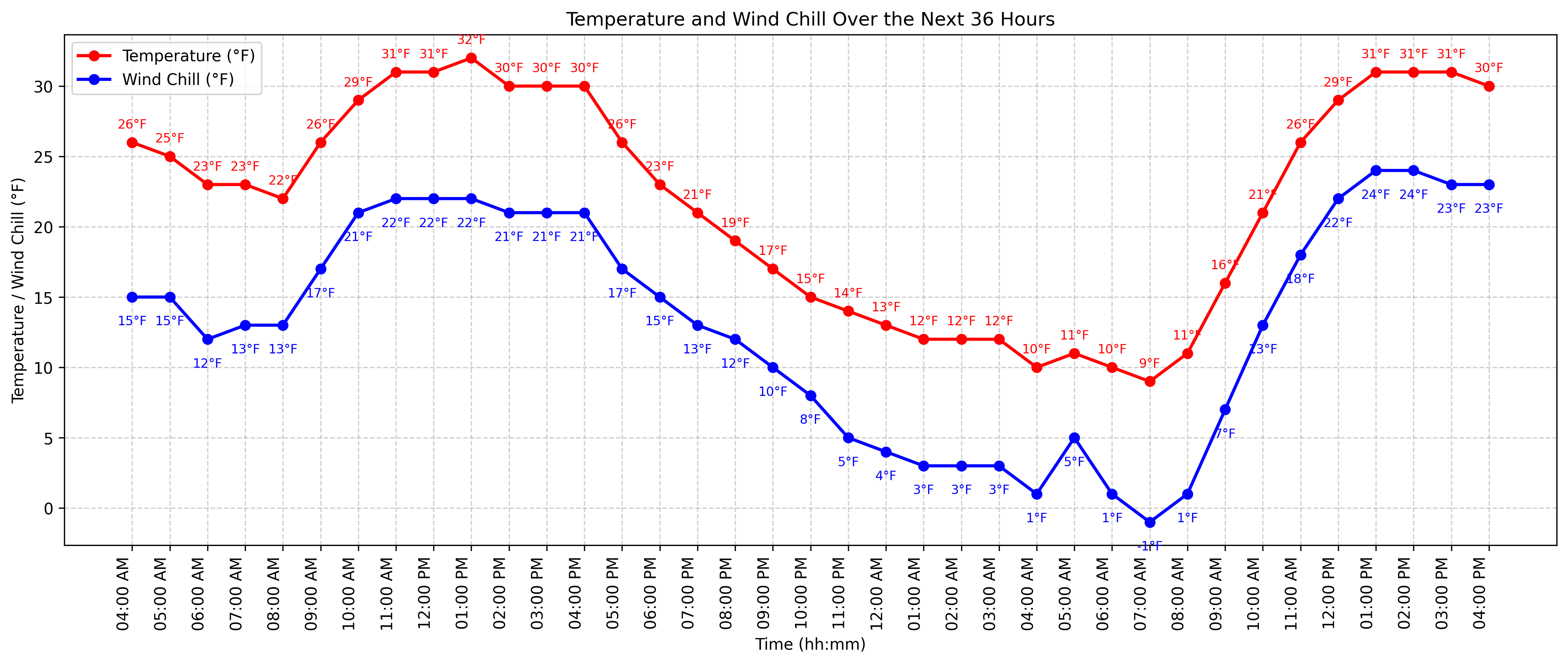
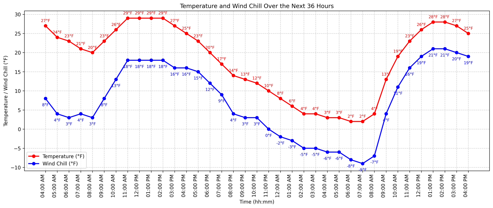
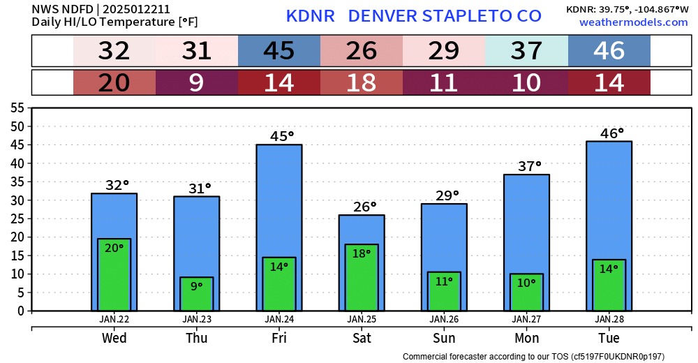
First, today. Here are hourly temperature timelines for Denver and Colorado Springs. For Denver, which hit 42° Tuesday, we'll be about ten degrees cooler today staying at and below freezing throughout.
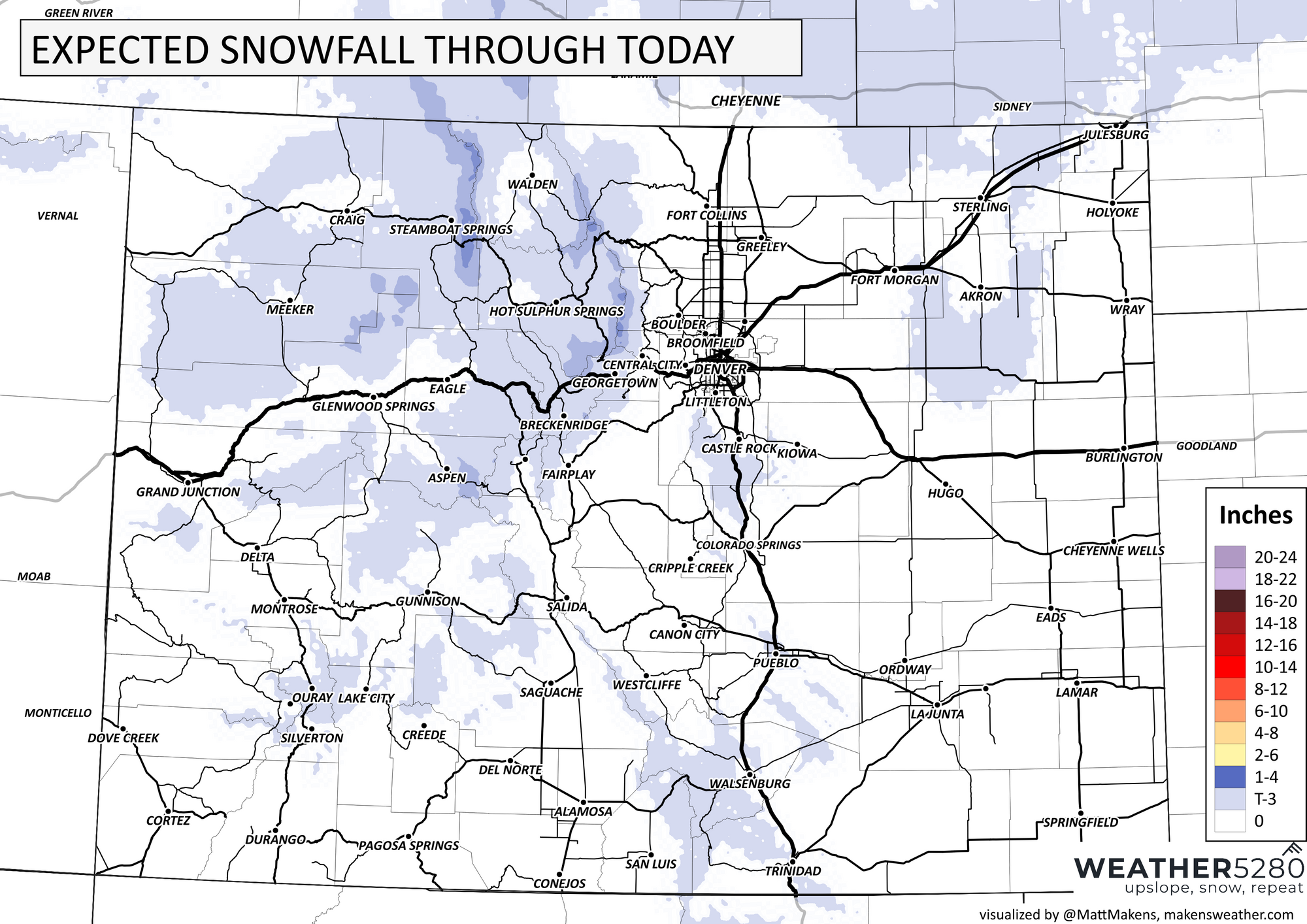
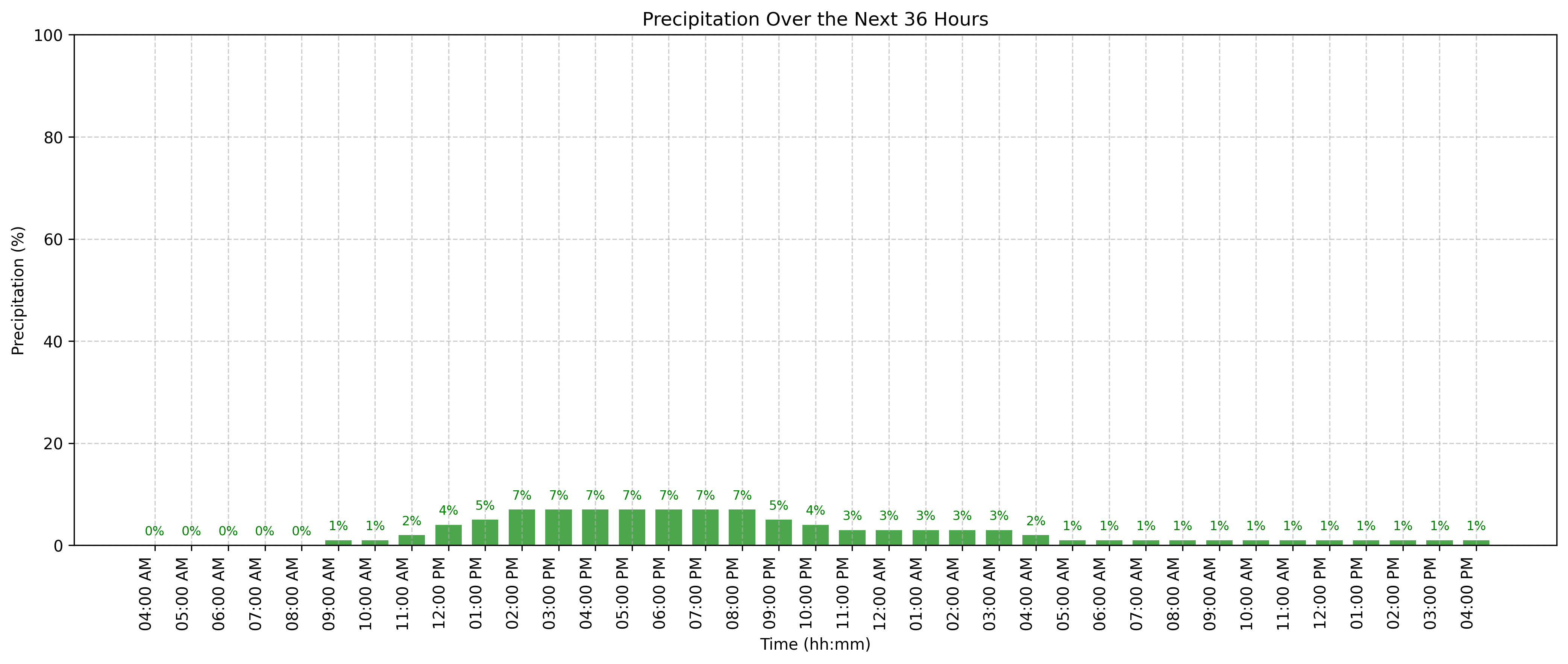
Although there will be some light snow in the mountains today and tonight, it'll be hard for showers to reach the metro area. Perhaps a bit more likely near Castle Rock and Monument, but only slightly. Total snowfall looks something like this through late tonight.
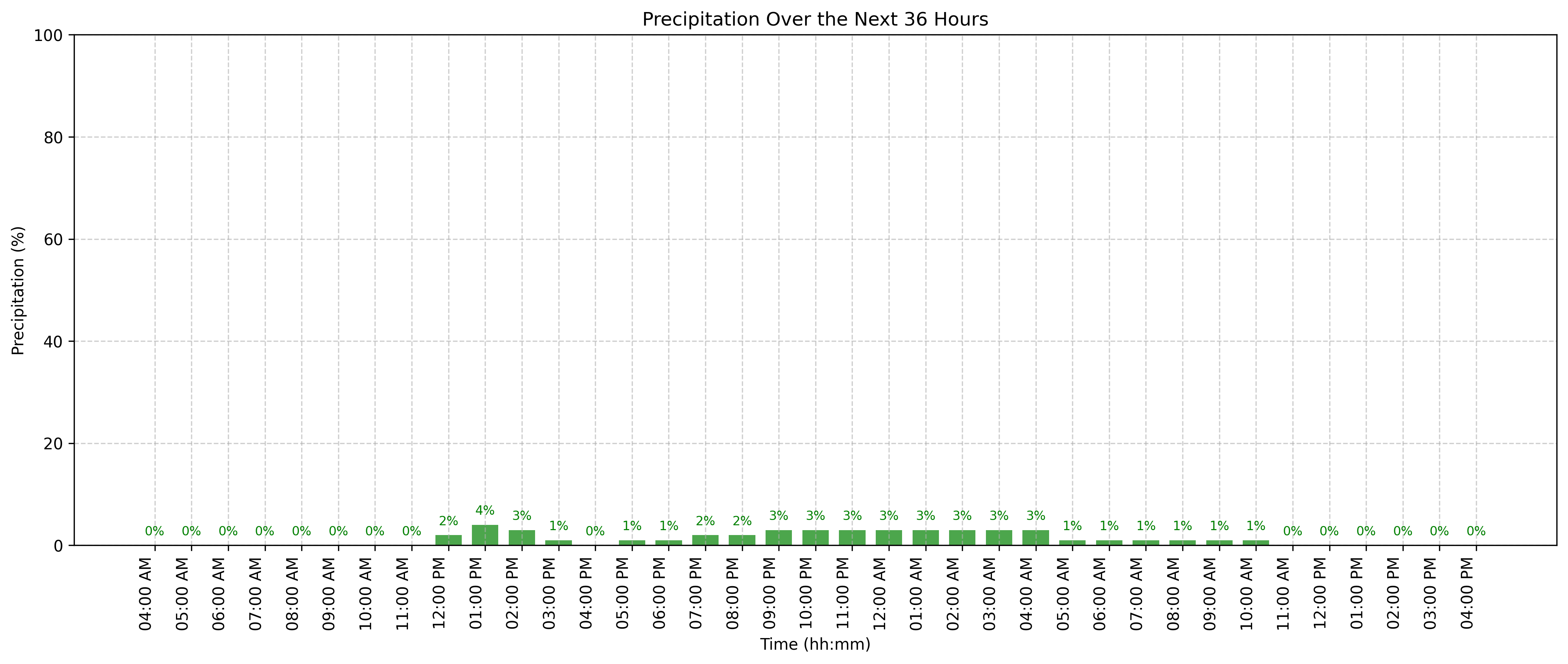
Hourly precipitation chances for today in Denver and the Springs.
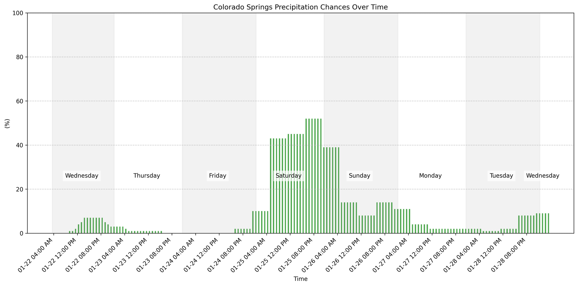
Not much to write home about for the next 36 hours regarding snowfall, but I want to expand those hourly planners to the week now. Note the increase in chances this weekend.

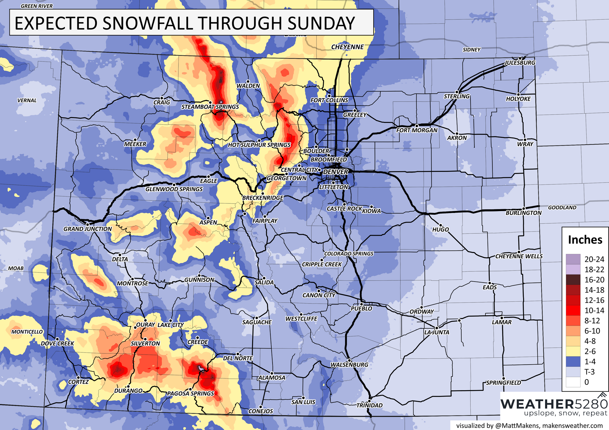
Arriving later Friday will be another system with potential for moderate snowfall in the mountains and parts of the metro areas. We will dig through those details in another post just focusing on weekend snowfall and travel impact, but for now here is a rough idea as to totals by Sunday.
Now, there is a notable increase in snowfall potential for this weekend, mostly Saturday but we could have some travel slowdowns into Sunday also. Anyone frozen and worried about another deep temperature plunge, here is how the week shapes up in terms of temperatures.
Again, we will have more on the weekend snow in a dedicated post. Subscribe today, these updates are here for you.