
Colorado Weather: Winter cold and snow Tuesday and Wednesday

Not so bad for our Monday. Most folks along the front range are in the 30s and 40s. We'll see a mix of clouds and sunshine throughout the day, with a bit more clouds for Denver by Monday evening.
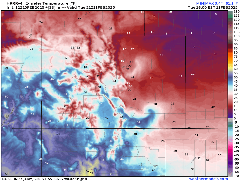
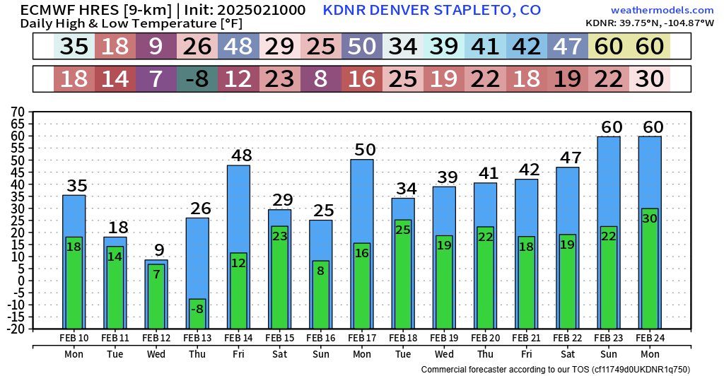
Big changes arrive tonight into Tuesday. A cold front will sweep across the state after sunset, with temps falling into the 10s and 20s... and likely not making much of a recovery Tuesday afternoon. Below are projected high temperatures from the HRRR model for Tuesday:
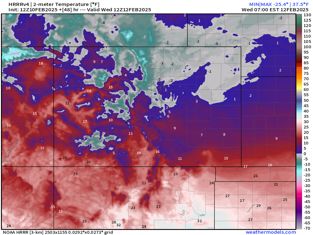
Even colder when you push the model forward into early Wednesday morning! A few spots will attempt to go below zero.
We will likely see an even colder temps Wednesday night into Thursday morning following the expected snowfall... so make sure you have those heavy coats ready!
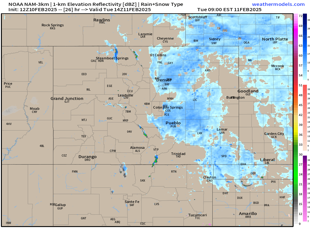
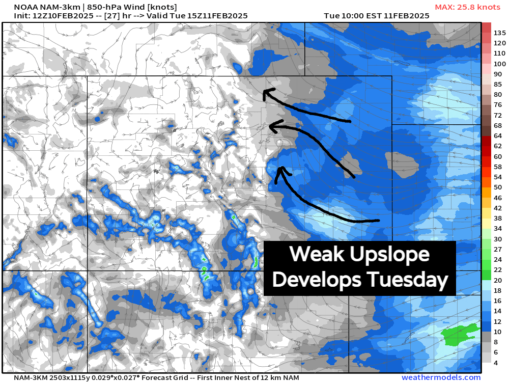
Now, let's talk some of that snowfall. Following the cold front Monday night, we should see some weak upslope winds develop into Tuesday morning and for most of the day. This should keep areas like Denver and Colorado Springs cloudy, with chances for flurries and light snow showers much of the day Tuesday.
We shouldn't see much accumulation, but temps will be in the 10s and 20s... it will be cloudy... and any snow you get under will enhance that winter feel.
A secondary cold front will push through Tuesday night and into Wednesday. This one should have a bit more to work with.
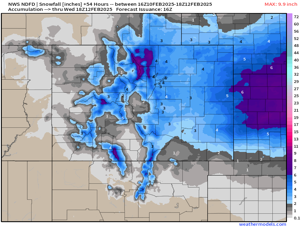
Below is a precip projection for Tuesday night -> Wednesday morning. Generally snowfall looks to pick up in intensity by sunset Tuesday, and will be heaviest through the morning commute, before tapering off by lunchtime Wednesday.
It also looks like this set up could yield localized snow banding, meaning not everyone sees uniform snow totals. Wherever those bands set up, heavier amounts are more likely.
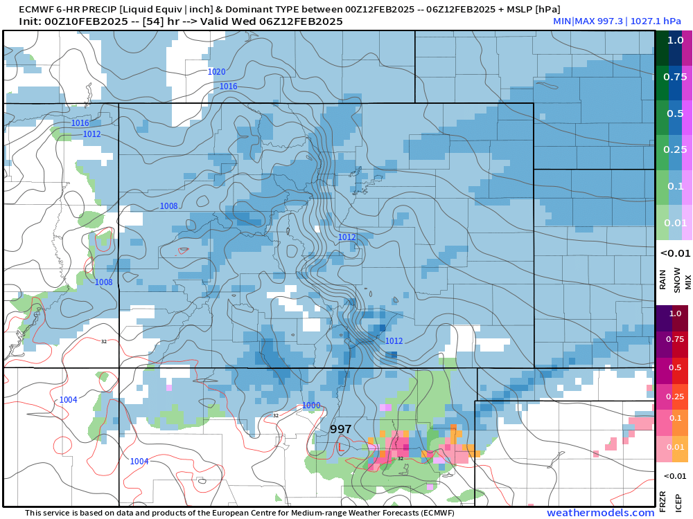
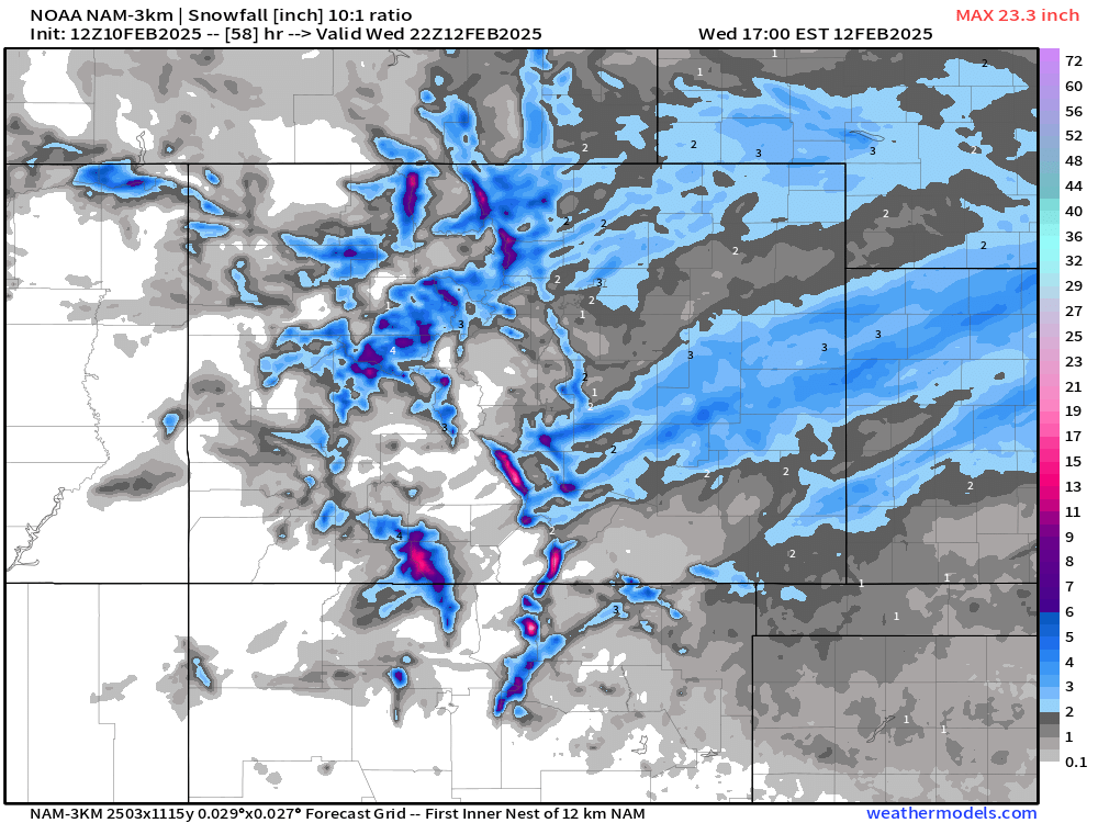
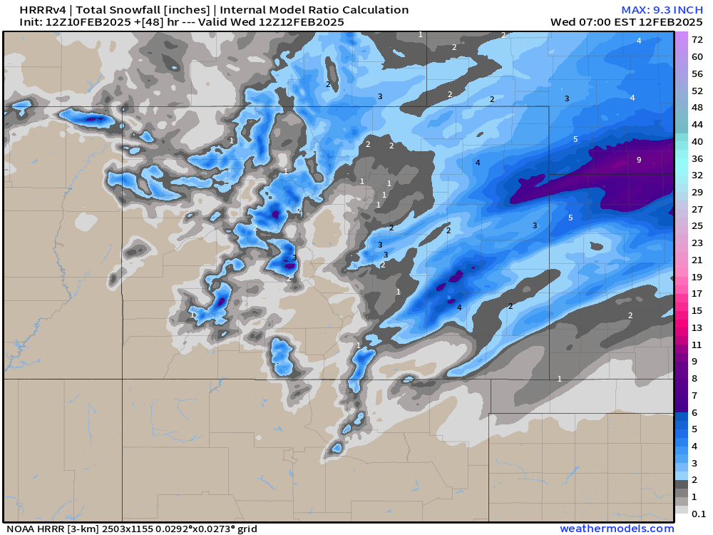
It's a little more clear to see this banded snowfall when we break down snow potentials on the charts. NAM and HRRR maps below some focused banding along the S Platte River, with another healthy band along and south of HWY 24 and I-70.
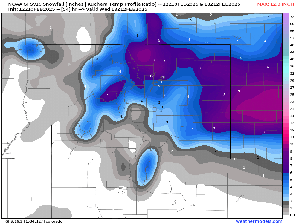
And the EURO/GFS combo don't spark off a bunch of confidence in this thing...
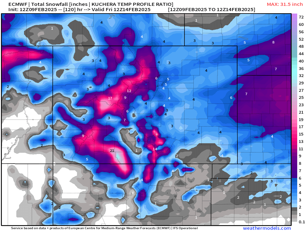
So, how can we make a forecast with data varying so much? At this point, we'd say a blend of them all is a good start... and this seems to line up with the NWS charts below:
It seems like the EURO probably has the best handle on this system (per usual), so to throw some numbers out there --
- Denver/Aurora/Arvada: 2-5"
- COS: 1-4"
- Boulder/Golden: 3-7"
- FoCo: 2-5"
- Castle Rock: 2-5"
- Monument: 2-5"
- Pueblo: 1-4"
Overall this won't be a major snow storm, but the timing of it is our biggest issue... prepare for a slower than normal commute Wednesday morning and make sure to stay bundled up the next few days! EURO is pretty aggressive with out cold set up, but it makes an attempts to get us back on track later in the forecast period! For now... it's all about the cold and snow...
Luke