Colorado weather: Snow and bitter cold through Wednesday, another round by the weekend

Bitter cold air has filtered into Eastern Colorado today and it's not in a hurry to go anywhere either. The arctic chill sticks with us through Wednesday night before moderating a bit on Thursday.
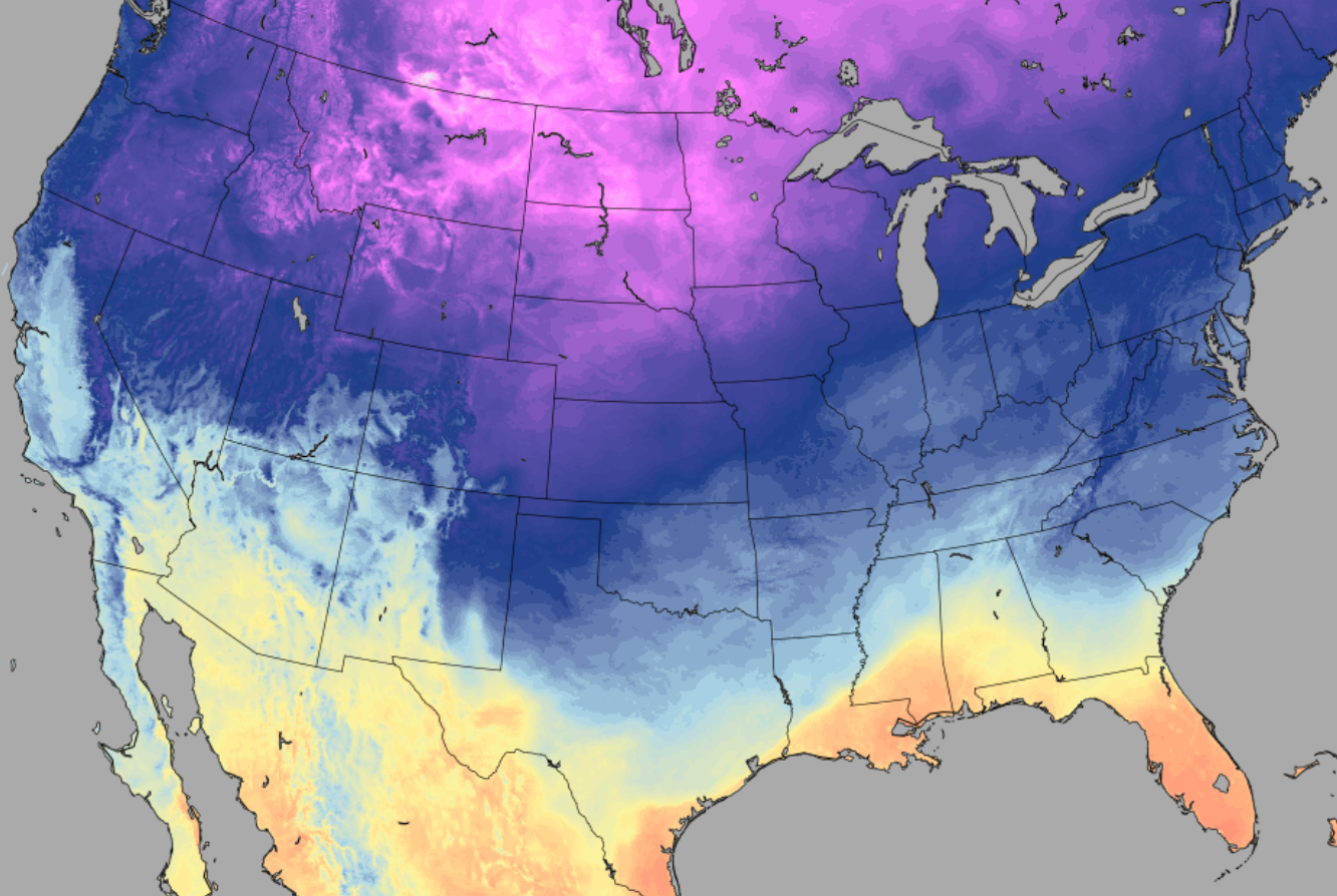
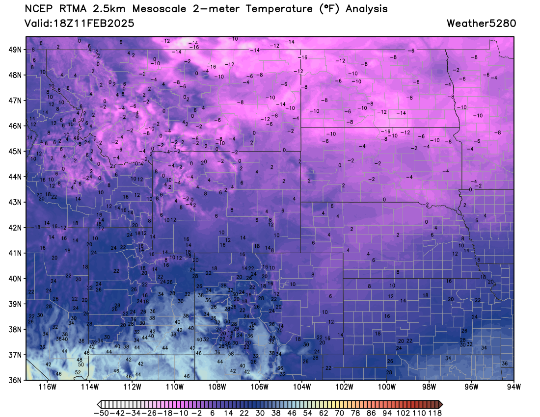
Current temperatures from across the region show we aren't alone, with single digit to sub-zero temperatures all across the High Plains as of midday Tuesday:
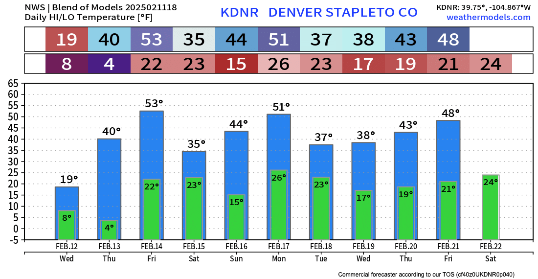
The temperature outlook from the NWS in Boulder shows highs in the teens again on Wednesday (most of us aren't even that "warm" right now) then climbing to near 40°F Thursday. Friday is even warmer ahead of another system that will bring rain and snow to the mountains for sure, and possible a bit more action to the plains east of the hills as well – we'll see.
Not just cold, but snow
It's been a raw, cloudy, and at times snow kind of day across the region. While many of us have managed a coating of snow thus far, we should see an uptick in snowfall coverage an intensity this afternoon, continuing overnight into Wednesday morning.
As we discussed yesterday, snowfall will generally be light, but some embedded bands of heavier snow, coupled with the bitter cold temperatures already in place, and travel impacts as well as simply just feeling wintry are a good bet for the next 24 to 36 hours around here.
We are going to stick with roughly what we put our yesterday for totals. Generally speaking a bit higher snowfall totals along and west of I-25 for the urban corridor, with lighter totals east of I-25 – the exception being the far eastern counties of Colorado where heavier snowfall is anticipated.
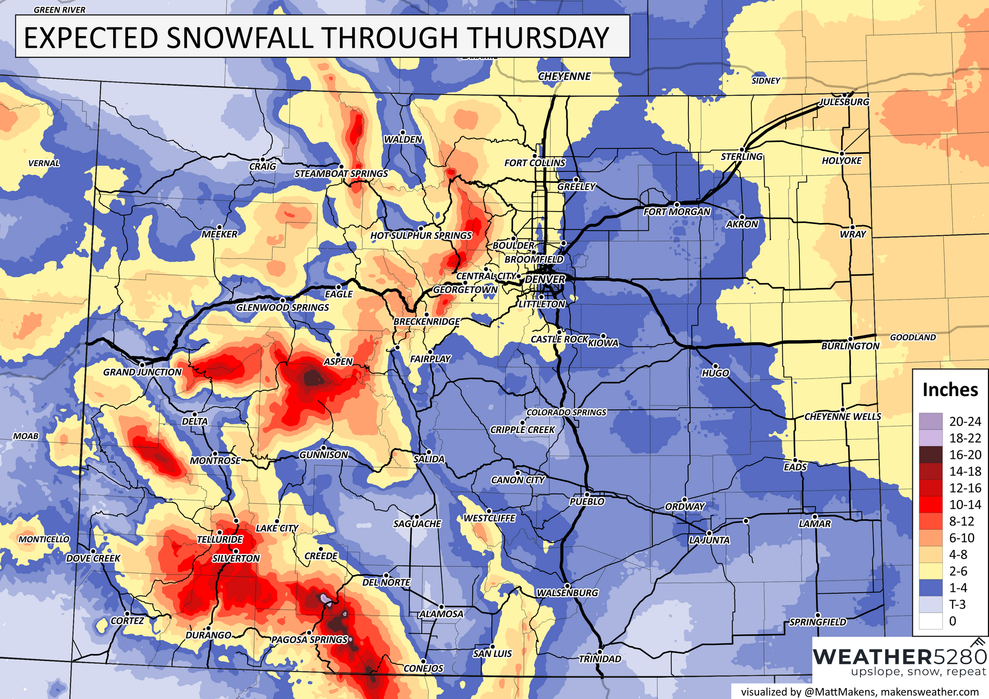
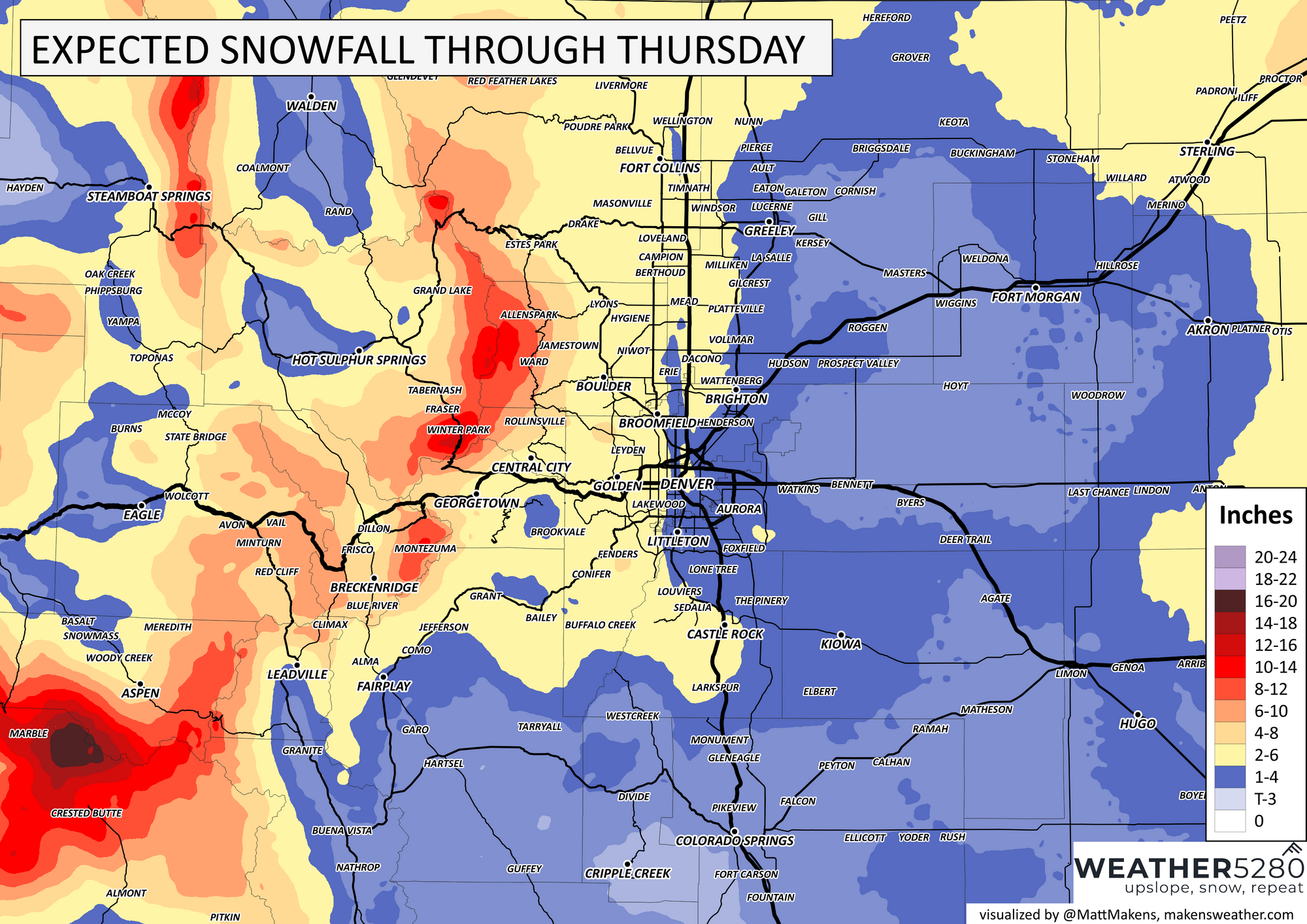
On the low end we think most folks end up in the 1 - 3" range. Should things come together right, and should we see snowfall ratios (snow:liquid) pay off and we could see some spots with some healthy 5"+ totals from this event. Despite some occasional bullish model runs, this feels like the exception, not the rule, and that you'll need to end up under one of these snow bands for that to occur.
Given the cold and anticipated snowfall, it's not surprising at all that the NWS has issued a Winter Weather Advisory for really all of Eastern Colorado. The Advisory is in effect from 2pm today through 11am Wednesday.
This means if you can stay off the road this evening and overnight that will definitely be advised! Roadways will be quick to become snowpacked and icy as the sun sets this evening.
Looking ahead
We warm up briefly Thursday and especially Friday ahead of the next system that will impact the state.
The track of this system looks a bit more favorable for the mountains vs the plains, but there's still some time to see how it'll ultimately evolve. In any event, expect temperatures to cool a bit once more for the weekend and look for some good mountain snow at least some unsettled weather across the plains.
Keep us posted on how much snow you see!