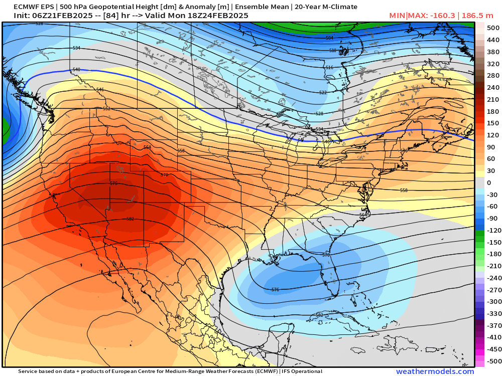
Upper low dumps snow in the foothills, sharp cutoffs along I-25

Hey all! Foothills and Palmer Divide classic last night! That slow-ish moving upper level low had no trouble getting started in the late afternoon Thursday and really picked up steam once the sunset. Look at that firehose of moisture that slammed up against the hills overnight!
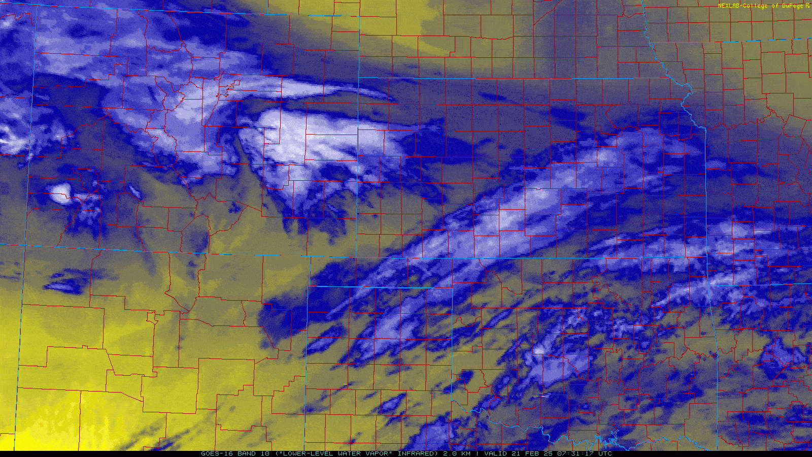
I captured this video below last night in Colorado Springs as the first wave of energy moved through the Pikes Peak Region. Kicked us around good for about an hour or two before it shut down for most of the night.
 Facebook
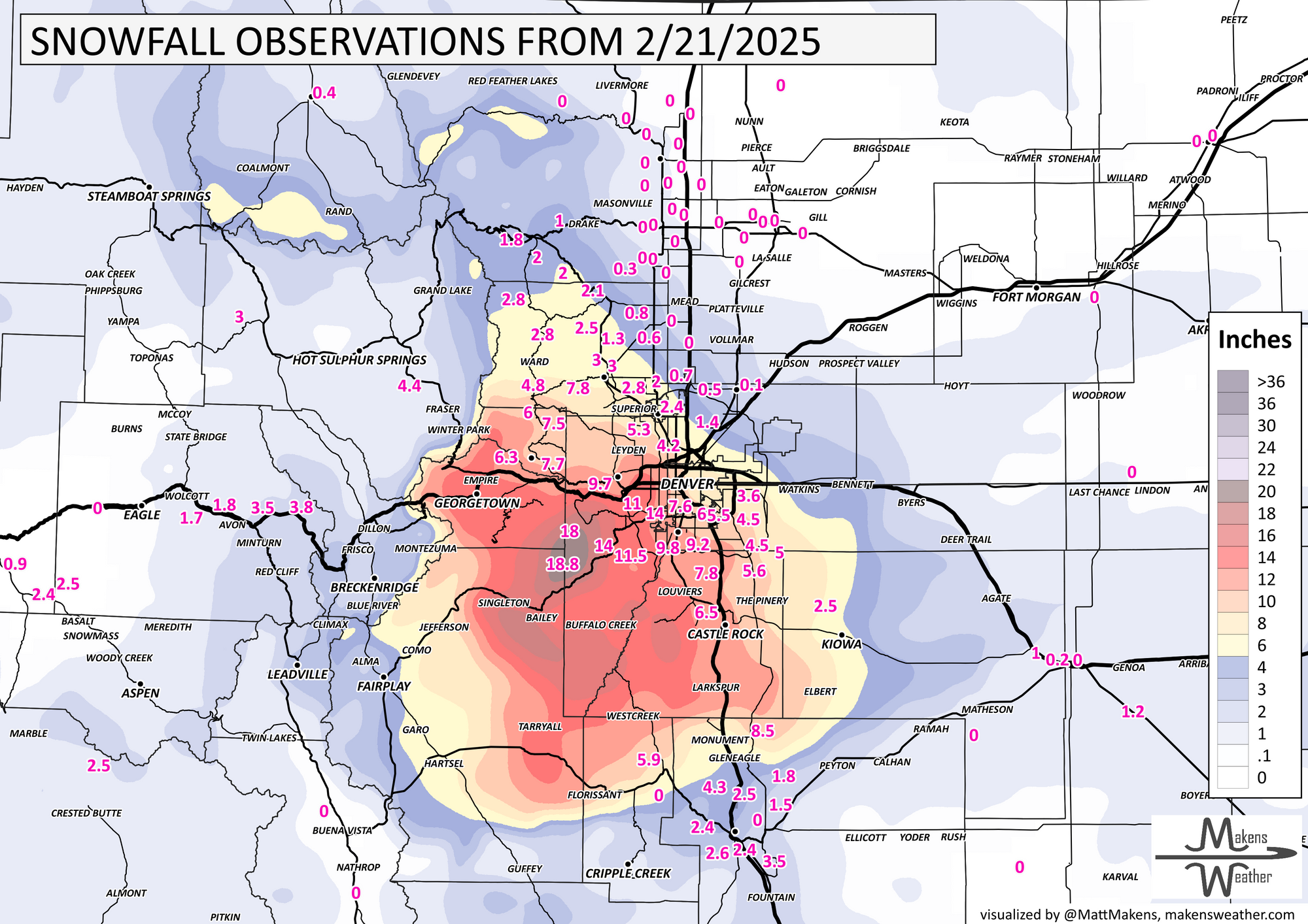
Snow was a little more persistent on the Palmer Divide and the foothills of around Jefferson County, especially along Highway 285. Below is a look at observed snowfall totals, as well as a color legend showing that bullseye of 1.5 ft totals over west central Jeffco.

Definitely outperformed expectations just a bit. We were thinking up to a foot would have been reasonable... clearly the storm had other plans. Check out SW Denver too! A couple spots near or above a foot of snow along C-470/Highlands Ranch/Ken Caryl areas. The gradient across the Denver Metro alone is impressive... basically nothing at DIA, half a foot downtown, and the totals west and southwest mentioned earlier.
Totals across the Pikes Peak Region ranged anywhere from 1-5", with some spots above 6" along Monument Hill and into Black Forest.
Unfortunately, we saw a pretty sharp cutoff to the north... Lots of goose eggs up near Fort Collins.
Big changes on the way this weekend, next week
After what has been a pretty persistent pattern of cold and snowy weather the last 6 weeks, we're likely going to get our longest stretch of warm weather so far this winter! Temperature graphs are about as good as you'll get this time of year with 50s starting Saturday, and lasting basically all of next week.
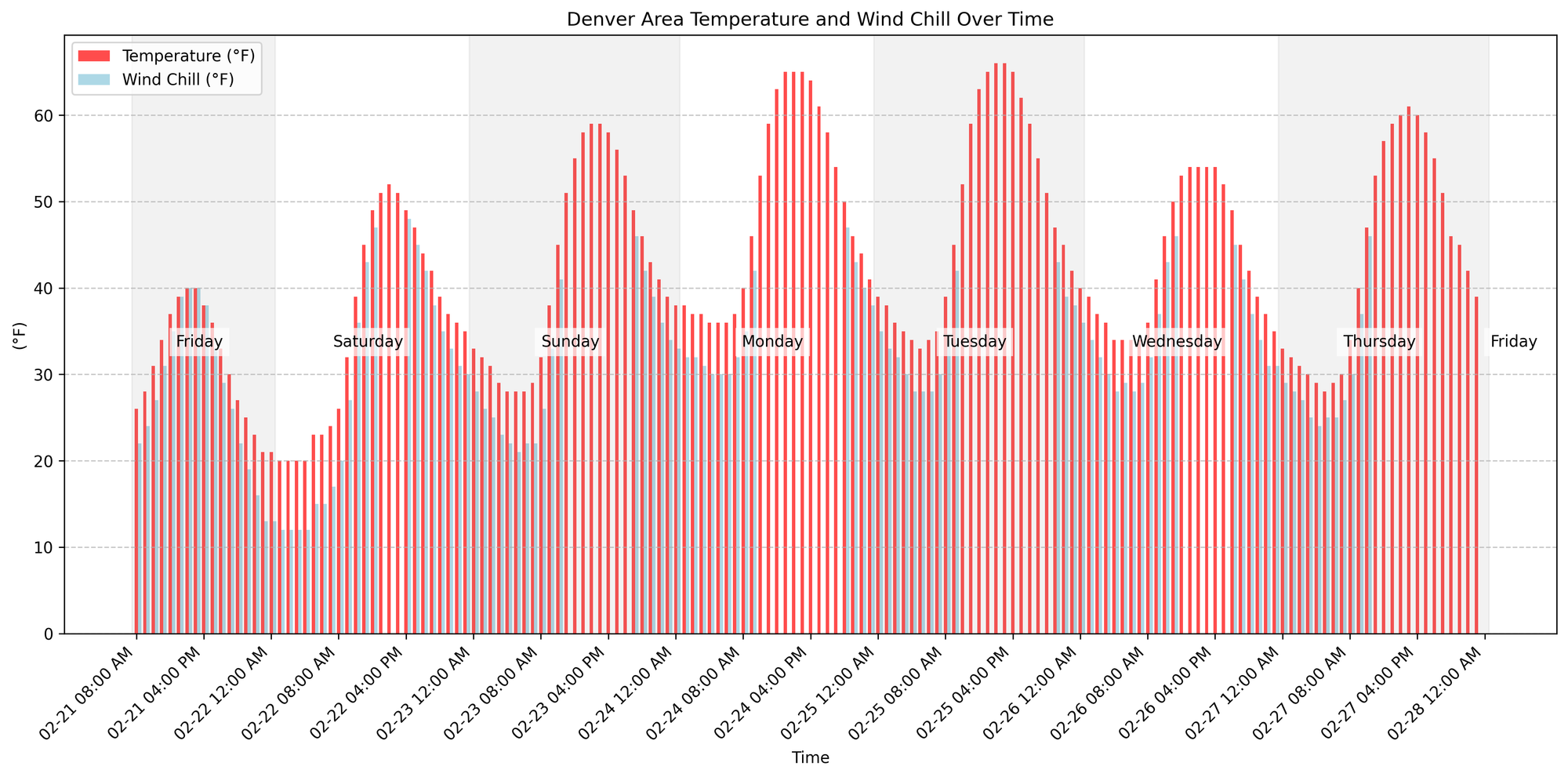
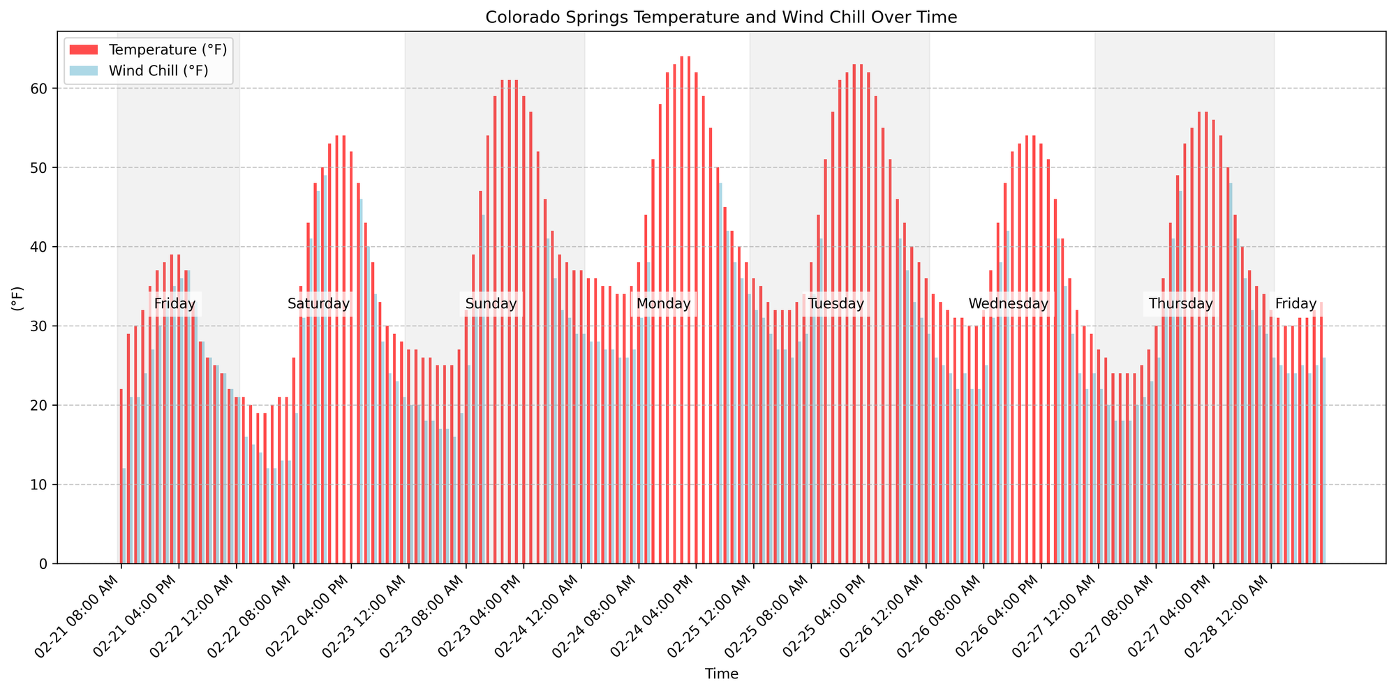
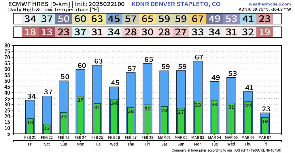
Yep... that's a good lookin' forecast. Find some time to get out and about! March can get turned up around here, until that happens, we probably won't have a whole lot of update for you. Enjoy!
Luke