Colorado weather: Snow and wind possible next week

Happy Friday and what an end of the week AND weekend that we have in store! Temps should have no problem getting well into the 50s, with plenty of low 60s around too.
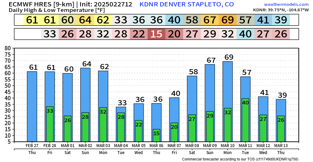
Getting out shouldn't be a problem at all, but much like the last few days, gusty winds at times are possible each afternoon. Winds will probably hover around 10-20 mph.
Now, for the elephant in the room... A pretty potent storm will crash on shore of the western United States Sunday night into Monday morning.
As we move throughout the day Monday we'll see this storm will makes its way through the four corners, eventually kicking east of the hills by Tuesday morning.
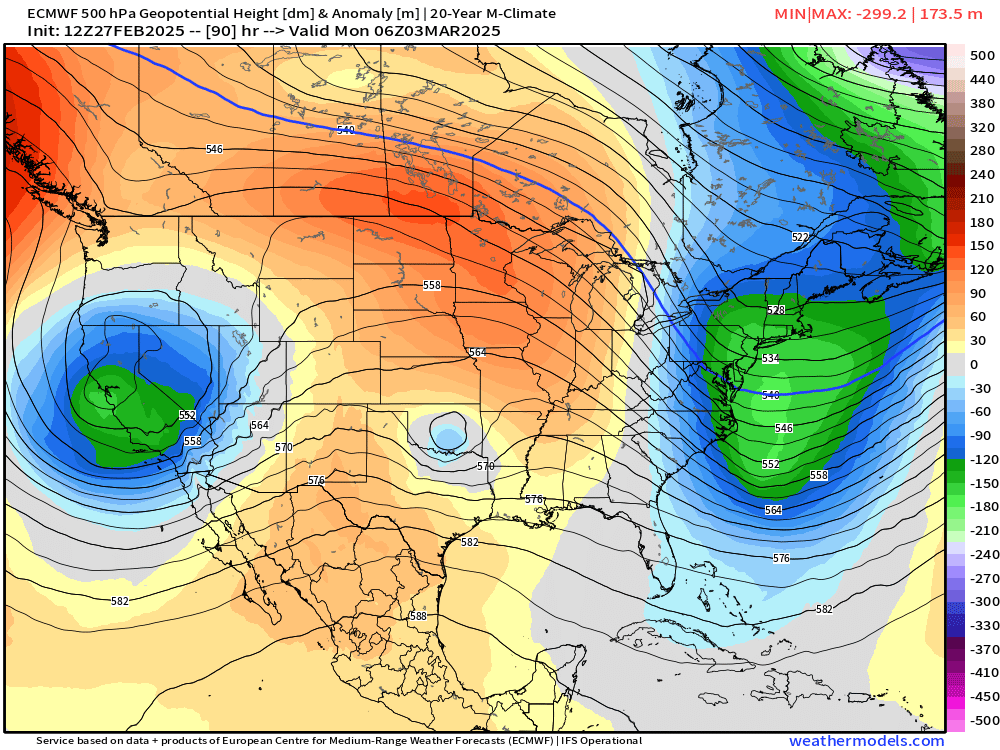
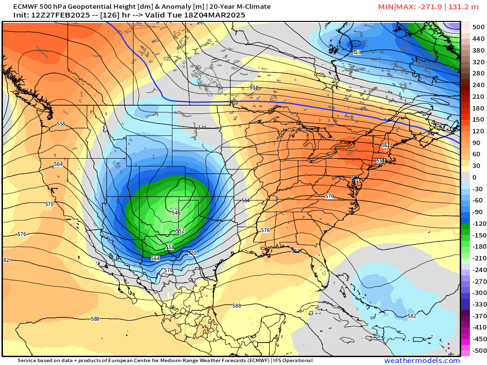
Below is the upper-level wave pattern for Tuesday morning. Notice how the storm is still "open". This can be seen as none of those black lines over Colorado make a concentric circle. It's all still "u-shaped" at that time.
The "openness" means the storm still has some room to strengthen a little bit more.
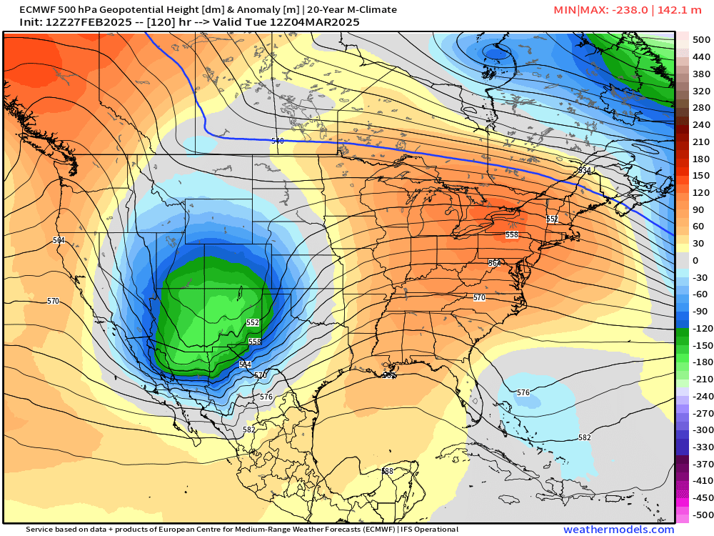
Notice the storm by Tuesday afternoon. This particular model begins to "close off" the storm over southeast Colorado and the panhandles. This means the storm could try to strengthen as it moves east. This type of setup also means we could see the wind kick up pretty good on the northwest side of the low.
Also of note: the orientation of the low could bring strong NORTHEAST (upslope) winds to Denver and the Palmer Divide... That setup can do work this time of year...
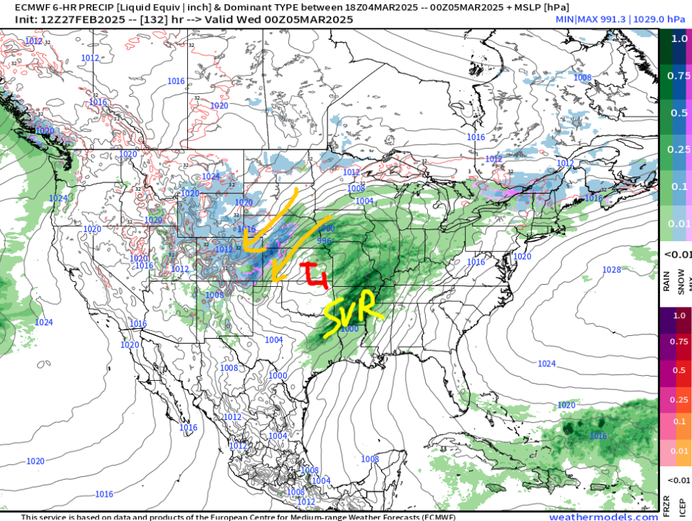
Below is a rough illustration of precip and surface pressure by Tuesday evening. Plenty of wind and snow across eastern Colorado would be possible with this. There's also the potential of severe weather over the southern-tier of the US.
So... any indication of snowfall out of this thing?... Well, it's not looking too shabby 5 days out, but it's a loonnggg ways out. You can see a focus of snowfall over the Cheyenne Ridge, around Denver and the Palmer Divide, and over the Raton Mesa. There will also be mountain snow to contend with.
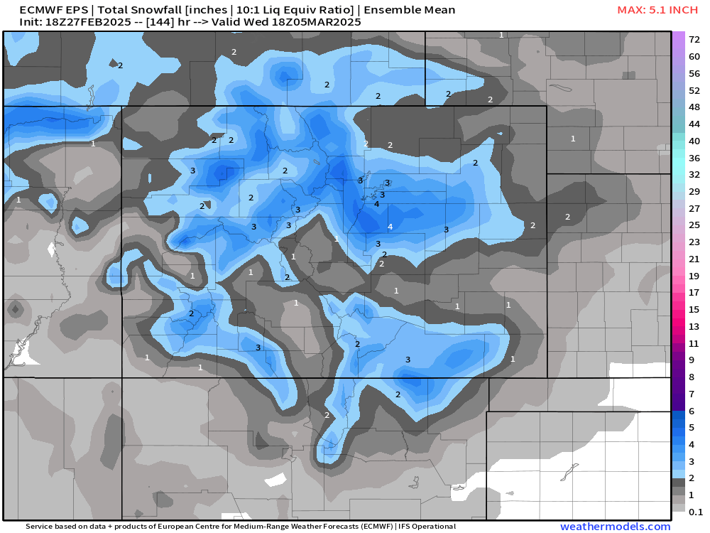
Digging precisely into snowfall totals is a fools errand this far out, but several inches is definitely not out of the question with this setup. You combine that with a strong wind potential, things could get interesting around here on Tuesday! Of course, the devil is in the details and some guidance tracks the low a bit further north than others which would hinder snowfall potential. Bottom line, keep an eye on the forecast this weekend.
We'll have some official numbers later this weekend so be on the lookout for that. For now, enjoy the awesome weather ahead for this weekend!
Luke