Colorado weather: From high winds to heavy snow, early week storm will have a bit of everything

We've flipped the calendar to March, and like clockwork we have rather classic setup for wind and snow getting set to fly through the state early this coming week. While the devil is in the details, some folks will should expect an impactful event Monday night into Tuesday, with the greatest confidence for this along the Palmer Divide between Denver and Colorado Springs and the adjacent eastern plains.
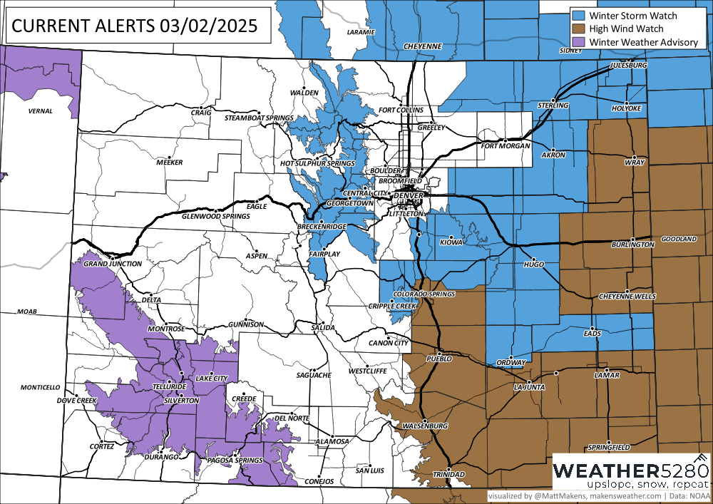
Here we already have a Winter Storm Watch in place. It goes into effect Monday evening and continues through the day Tuesday.

Under the watch upwards of 4" of snow is expected, along with winds upwards of 50 to 60 mph at times which will lead to considerable blowing and drifting snow.
For folks in the brown colors above a High Wind Watch goes into effect early Tuesday through Tuesday evening, where even if we see lesser snowfall totals winds of 60 to 70 mph could cause issues, and even lighter snowfall totals will prove travel difficult.
The setup
If you're looking for a classic March snowstorm across eastern Colorado, this is just about how you'd draw it up. But, like any system, it's got its issues, and for some those could mean a near-miss vs a substantial snowstorm is on the way.
You can see our system move inland late tonight then across the Great Basin Monday. By Monday evening we see it move through the Four Corners region and eventually east of the hills Tuesday, intensifying as it does.
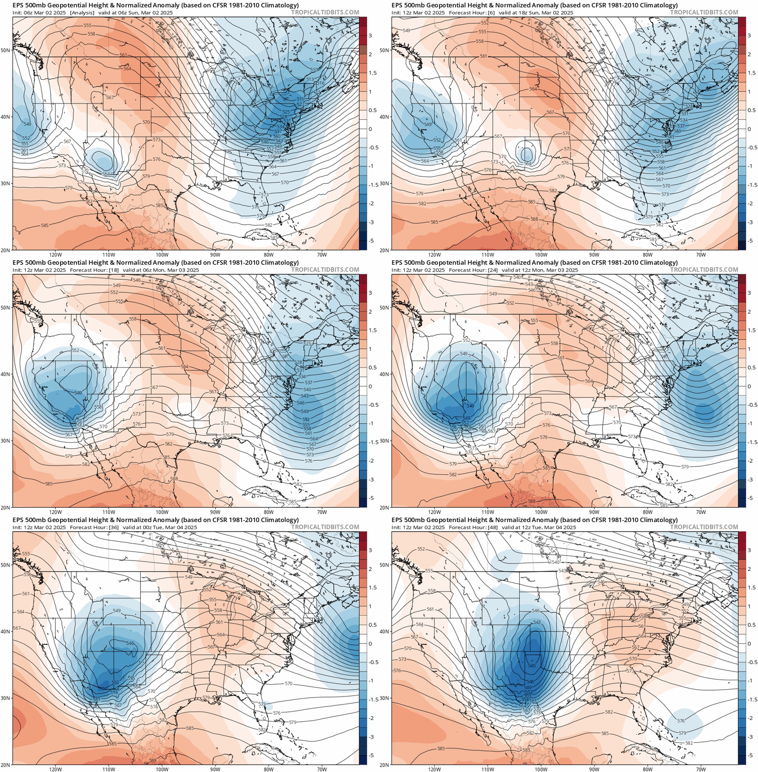
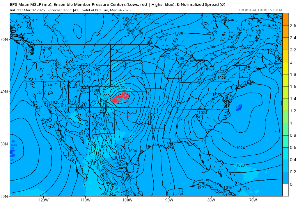
At 500mb the low is close, but the pattern is fairly progressive and the low is a bit elongated north to south as it moves east of us early Tuesday. Harder to pick out here, but the overall bias is a bit further north than the "sweet spot" for Denver too. Maybe sounds nit-picky, but if we look at the clustering of surface low forecasts for Monday night from the European ensemble, I'd like to see that entire blob about 50 miles south for better shot at snow in Denver.
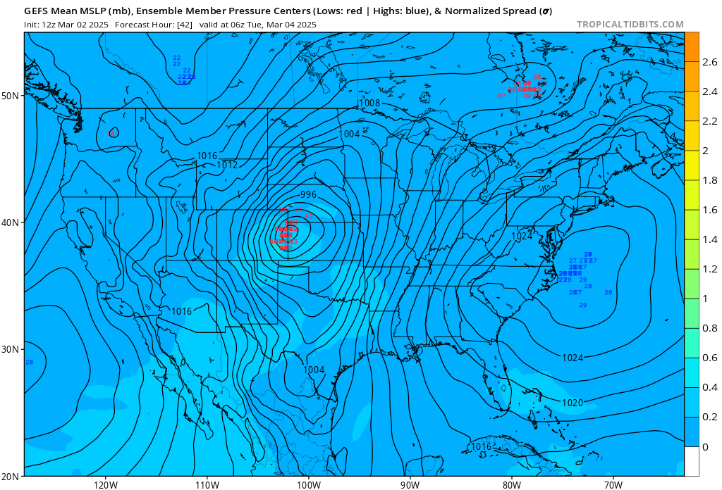
The GEFS is similarly placed for teh same time:
What this track may lead to is more wind than snow for cities like Denver. This is because models show a pretty healthy downslope off the Cheyenne Ridge. Downsloping is kind of a buzzkill for snow (hence the beer is called Upslope). You can see in the red-checked square in the graphic below wind barbs pointing nearly straight down, which is indicative of a strong northerly wind for the same time the maps above are valid. This is not a great sign for Denver, though could be OKAY for the Palmer Divide.
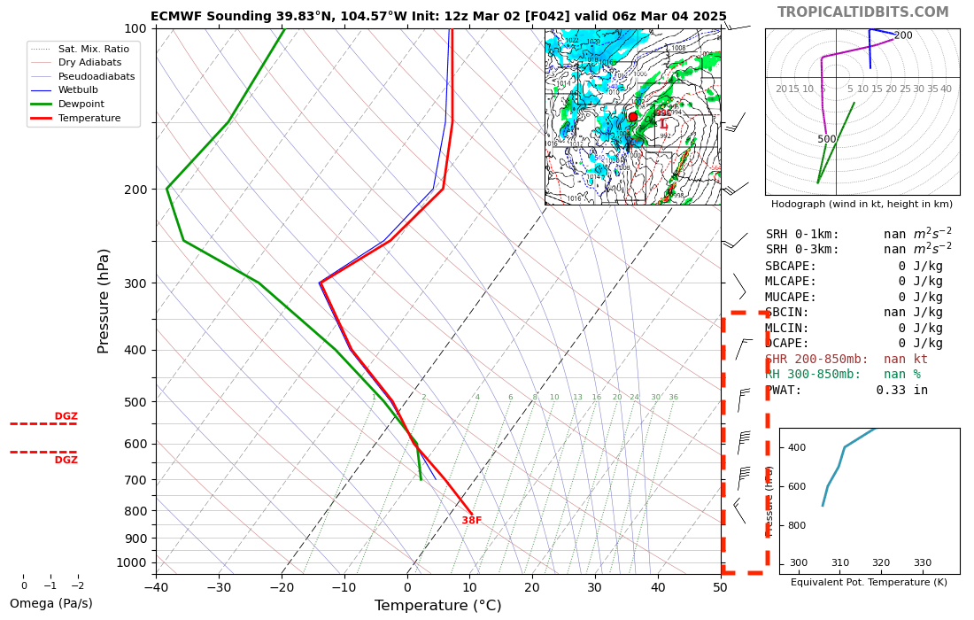
If you stare long enough at this graphic you might also note the 38F temperature at the surface... which, well, is a bit on the warm side for snow! Downsloping winds not only work to kill precipitation, but are also warming winds!
In fact, for as potent as this storm is in many ways, it sure isn't cold. Denver's 7-day outlook shows our weekend warmth coming to an end, but highs in the 40s isn't exactly frigid either, with temperatures borderline for snow Tuesday...
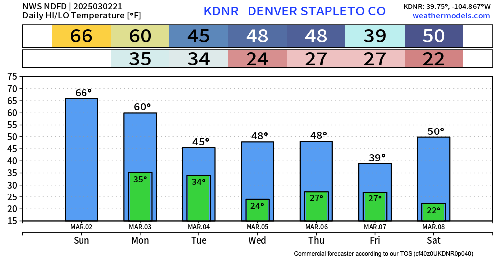
All this to say, if you live in the Winter Storm Watch there's relatively good confidence you'll see high winds and accumulating snow Monday night into Tuesday, but if you live outside that blow above... well, the forecast confidence is low.
Denver, Boulder, Loveland, Fort Collins... let's see what trends we see in the data tonight and regroup. Colorado Springs? Hard to see how you recover from the northerly winds on this one... but the north side could certainly have some issues with the snow and blowing snow expected.
Here's the latest blend of models for precipitation. Note the greatest totals are southeast of Denver and northeast of Colorado Springs. For the urban corridor it's not DRY, but... it's more spotty. Plus, some of this might fall as ...rain!
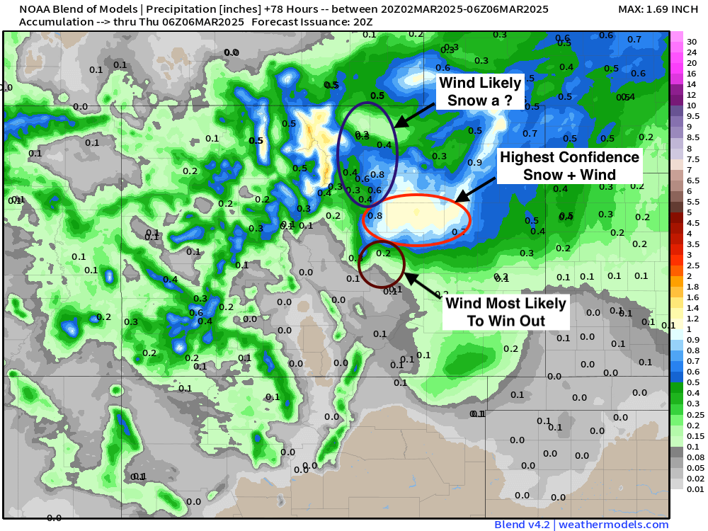
It's hard to see in the map above... but this also could be one of those systems where a crazy tight gradient sets up from no-snow to 8"+. We've seen systems like this produce almost no snow downtown Denver/west do to lack of upslope, but then close I-70 at DIA due to heavy snow and crazy winds. Time will tell.
Snowfall forecast
We'll hold on being too specific on totals as there's a lot up in the air still on this one. If you are hoping for snow along the northern urban corridor (Denver to Fort Collins) trends today were not exactly your friend. There's still some time for wiggle though, and we've seen plenty of times systems like this throw surprises in the 11th hour. So, stay tuned.
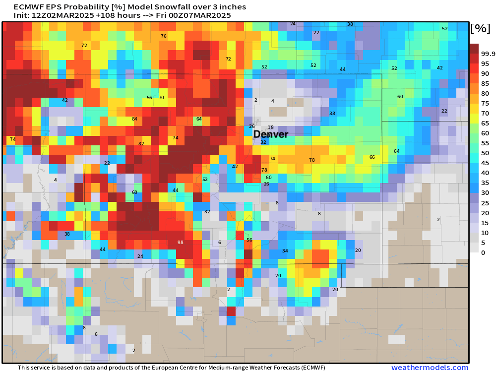
As of Sunday afternoon... odds for Heavy snow north of I-76 look rather bleak, with some questions for Denver proper, and greater odds south and southeast. The ensemble mean at DIA is about 2", so huh... not epic. But, with some wind, nasty nonetheless. For those in the watch the mean is closer to 8", and that with wind will be a total mess.
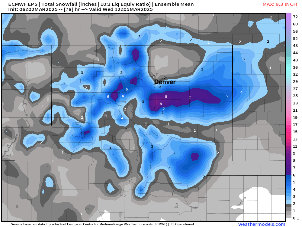
Probabilities are similarly discouraging for Denver and points north, with only about a 20% chance for 3" of snow or more in Denver and lower than that north!
The wind...
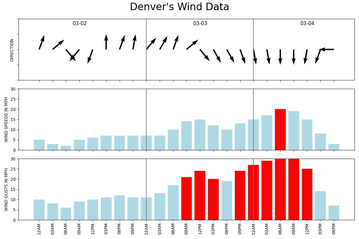
Finally. Snow or no snow it'll be windy.
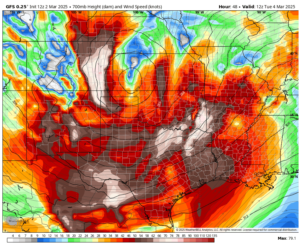
The worst of the wind looks to come late Monday night and Tuesday. The worst of the wind will likely setup just east of the urban corridor, but we'll still feel it in the the cities. The GFS (below) has winds absolutely ripping across the plains Tuesday morning.
TL;DR
Still tracking a strong storm to move through the region Monday into Tuesday. Strong winds and blowing snow look likely for a lot eastern Colorado, but mild temperatures and storm track may limit snowfall impacts for some locals as it does.
Greatest confidence for snow and blowing snow is along the Palmer Divide and adjacent plains, with high uncertainty to how much snow the urban corridor will manage with this system.
Please stay tuned!
