Wind storm moves east, another system moves in Thursday

A bit of a complex storm setup with this last one. A few key features of this took a little too long to ramp up, yielding lower snowfall totals than what was expected. Regardless of snow totals, the wind was an absolute nightmare to deal with on Tuesday.
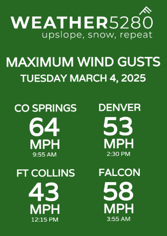
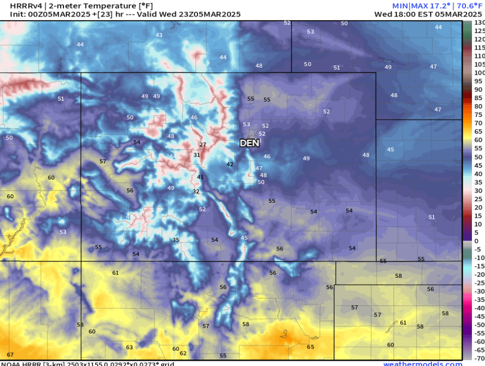
Colorado Springs was the strongest report I was able to find just picking at local airport data. Definitely some wicked stuff out there. The wind will be much calmer today. In fact, this wind AND cold air will be a thing of the past by this afternoon... check out all the 50s setting up around the Denver metro area, with upper 40s and low 50s in the Pikes Peak Region.
Those nice temps don't last forever. We're already eyeing our next storm set to approach Thursday afternoon and into Friday morning.
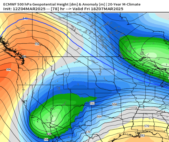
The weather pattern looks to remain active going forward — check out the "wave train" attempting to setup below
Right now, I'd say the Thursday low is just a bit too far south to cause widespread issues on the front range and plains, but the mountains should get some decent snow coverage.
We're going to let the dust settle a bit on this storm before we get into the details on the Thursday system. A quick and dirty analysis show a first burst of snow developing across the the mountains early Thursday morning, with some snow showers attempting to spread east over the northern corridor before moving south over the Palmer Divide early Wednesday morning.
Going to be plenty for us to update you on, in fact, we may have something out later today, but will definitely have something out for you first thing Thursday morning.
See y'all then.
-Luke