Colorado weather: Mild start to the week, but keep an eye on the forecast

We are well into the month of March now – Denver's snowiest month on average – and moving along quickly. Thus far, March 2025 hasn't delivered much of any snow for the Mile High City, and for the next several days at least I don't see a lot of reason to believe that'll change!
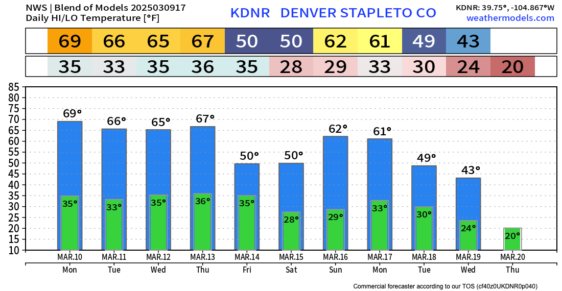
In fact, the next four days or so are set feature absolutely beautiful temperatures along the Front Range, with highs in the mid 60s to low 70s expected through about Thursday.
The blend of models (below) is a bit on the cool side of the range really, with some guidance suggested we land a couple afternoons in the low 70s. Spring-like!
The downside of the forecast is the potential for some periods of gusty winds. Nothing too significant we can hope, but drier weather and gusty winds may lead to some heightened to critical fire danger for some locales over the coming days. Please, no burning! 🔥
Late week system?
Looking at the temperature forecast above you'll note a drop in highs come Friday. That's thanks to our next weather-maker due to arrive late in the week, bringing with it rain, snow, and wind to the state.
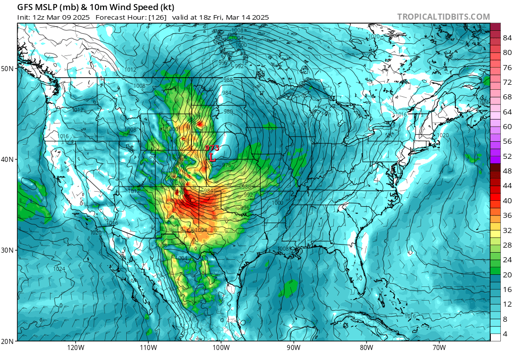
This system, in many respects, looks similar to last. That is, at this range it looks like it might not quite manage to setup right for a classic precipitation event along the Front Range but will be oh-so-close. This system looks quite strong, and like last week, quite windy. The GFS is especially windy, especially as it pulls east of the urban corridor Friday morning:

There a number of issues with the late week system that we need to track (if you're hoping for or worried about snow anyway), one of those being that it may get too far east before strengthening/organizing, which would limit precipitation potential along the immediate Front Range. The others would be temperatures (not terribly cold looking) and speed (it looks fast!).
The GFS and Euro both have the 500mb low a bit further south than last week, which is what we'd want to see for snow, but the surface low is initially pretty far north/northeast in the ensemble means, AND again, it doesn't really get organized drop south until it's pretty far east of our area.
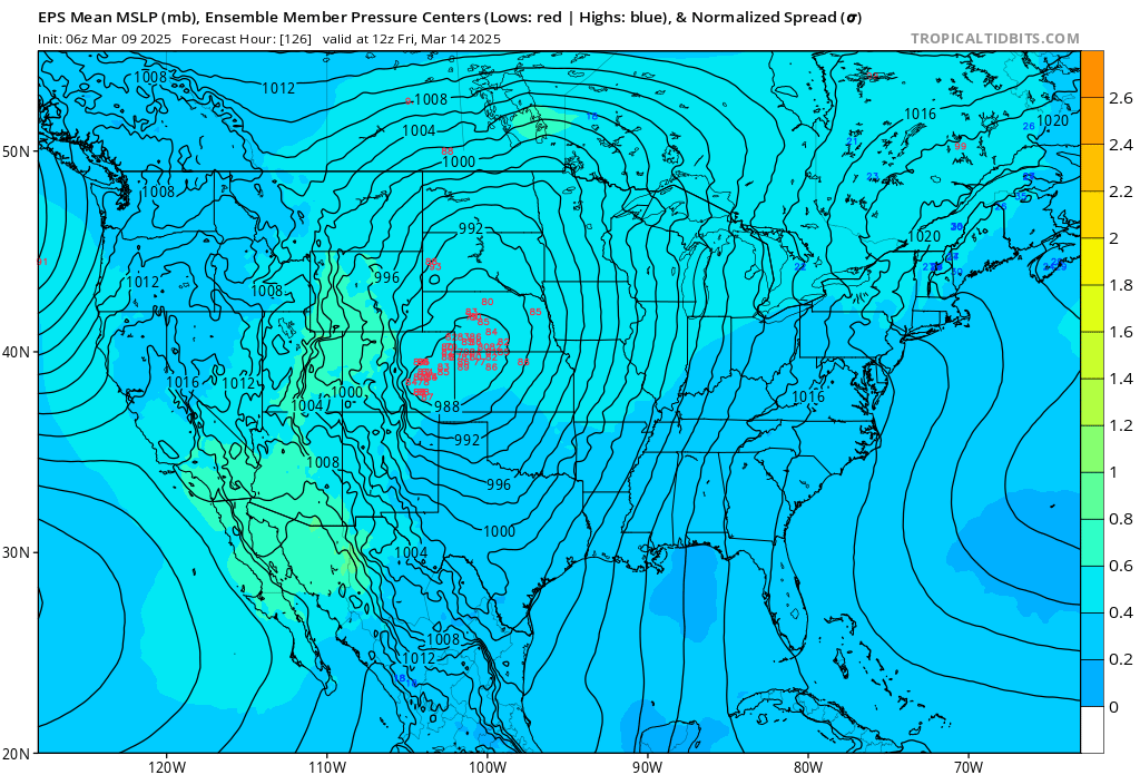
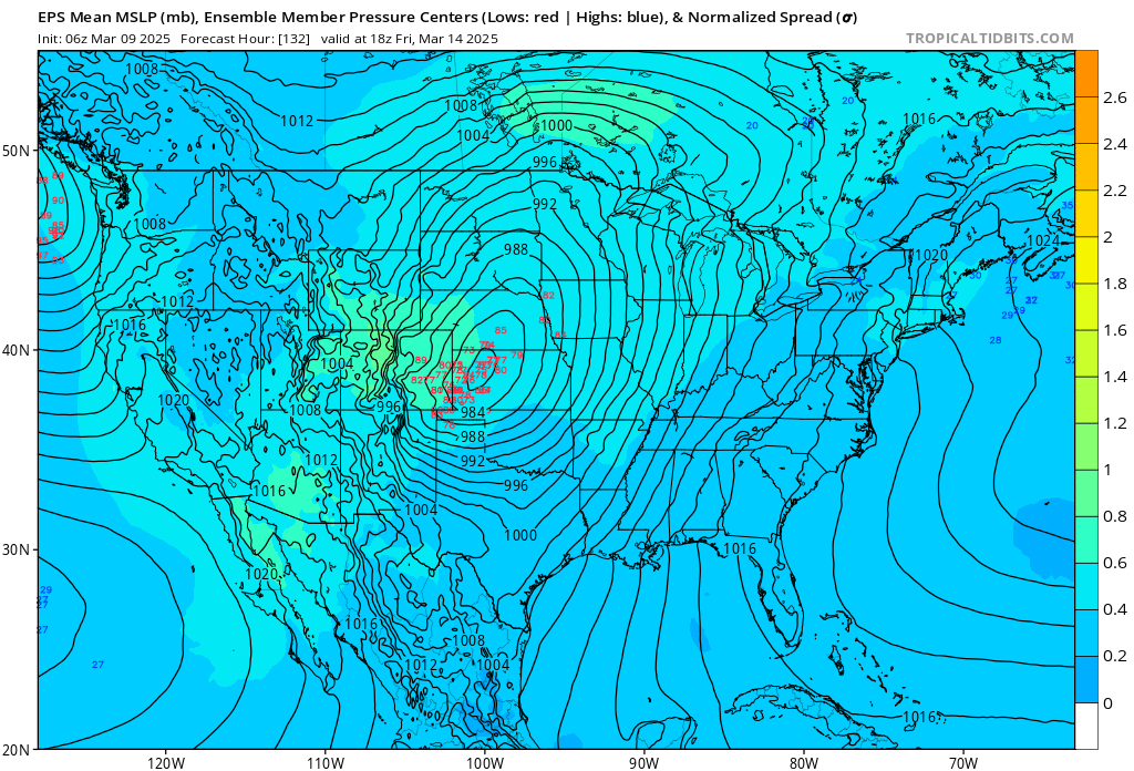
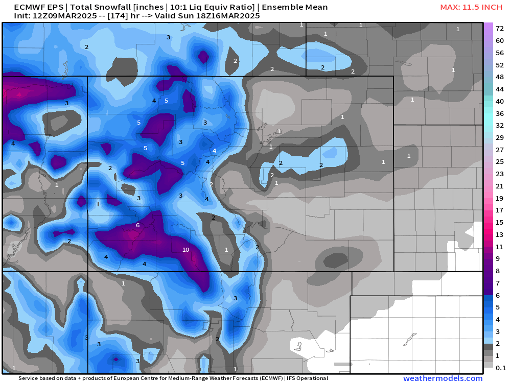
Early ensemble data shows a good round of snow for the high country for the latter half of the week, but not much east of the hills. We'll see how this trend changes (or not) as we move through the coming days.
The bottom line here is – there's a storm system moving through late in the week that we need to keep an eye on, but not be too worried about at this time. For now, enjoy the warm spring weather, and keep one eye on the forecast as we head into the new work week.
Beyond late week?
The pattern remains active. If this one misses, another system awaits next week, so a good time of year to stay-tuned!