Colorado Weather: Fire danger Monday and Tuesday, snow Tuesday night?

Hope y'all had a good weekend! We should stay mild for Monday – unfortunately we'll combine that warmth with some strong winds, leading to widespread fire danger. Wind gusts are ahead of our next cold front which will keep us windy Tuesday, with snow possible Tuesday night into Wednesday morning.
Let's break down the details.
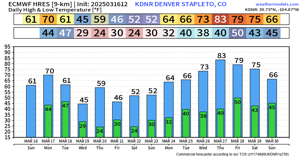
First off: quite the rollercoaster on the 10 day temp charts. You can see the mild air in play early this week. We'll see cooler temps with the front midweek... and way beyond that, there are some indications of a pretty strong ridge late March. Will we really make 70s and 80s? Not impossible... we'll have to see.
For now though, let's focus on those wind gusts. Here's what we've got on the way Monday afternoon. Up and down I-25, into the mountains, and even some steady gusts over the far eastern plains.
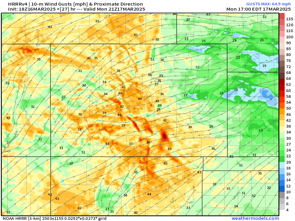
It wasn't even a huge fire day last Friday and we managed to see a significant grass fire east of Colorado Springs. Even though the drought isn't terrible, we do have VERY dry flashy fuels at the moment. Fire risk will peak into the afternoon Monday as relative humidity values drop into the single digits for most.
More wind gusts are expected Tuesday as the cold front approaches from the north. Here's what we have printing out by midday Tuesday:
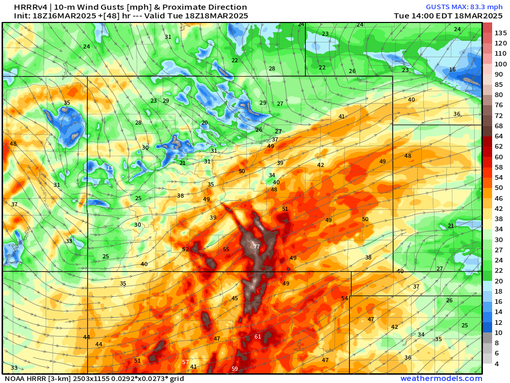
Winds will be especially strong over the southern I-25 corridor. A few spots in the Sangre De Cristos could gust over 80 mph. Plains locations will gust between 35 to 55 mph. Fire danger will be highest to the south east of the Palmer Divide.
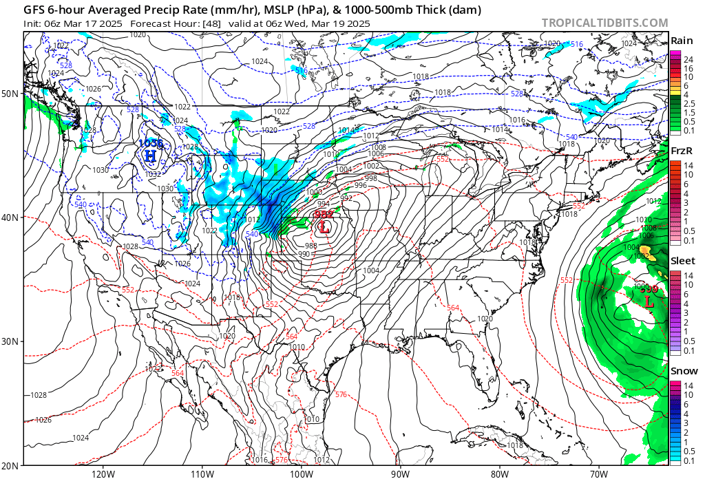
After that, we should filter in more moisture to the region, and that will give us a shot at snowfall Tuesday night into Wednesday.
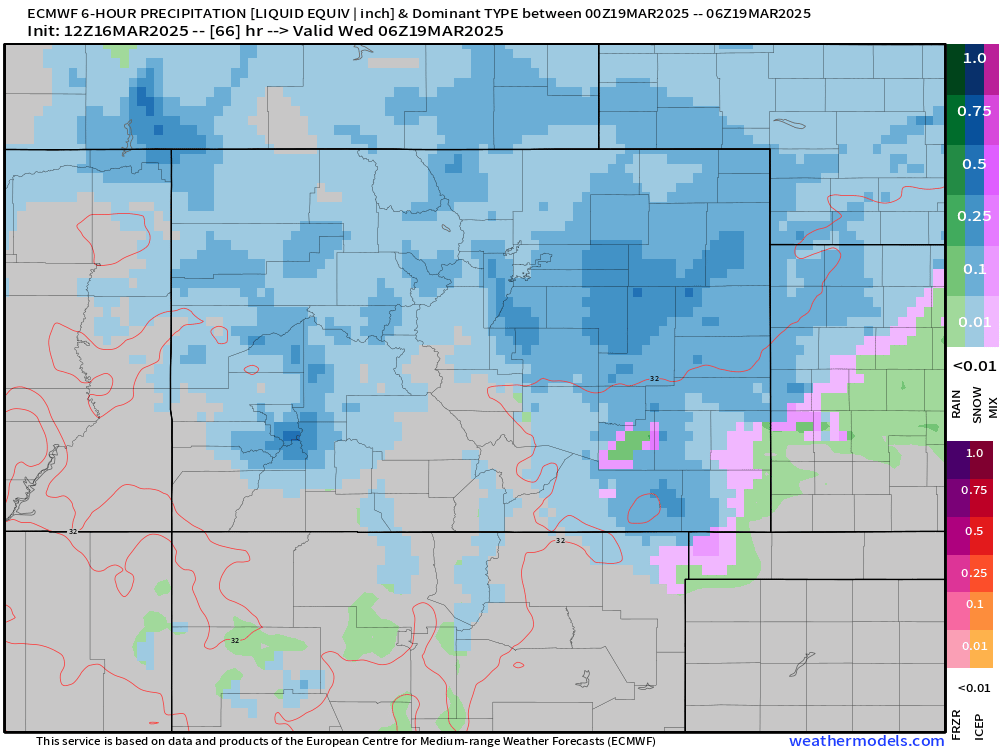
Much like our last system, the speed of this storm limits any major accumulations. However, along the Palmer Divide and east into the Plains, a few inches of snowfall are possible. We'll likely see the best chance for snow after sunset Tuesday, ending before sunrise Wednesday. We could see some slow spots on the Palmer Divide, but, at this time, major Wednesday morning impacts aren't likely.
Where the snow DOES fall over the plains, we'll have to watch for possible blizzard conditions in spots when you factor in wind gusts.
This won't be a very cold storm. We should still manage 40s for most by Wednesday afternoon.
Overall, this isn't a huge deal, but enough to pass some info along. We'll let you know if there are any big changes.
Luke