
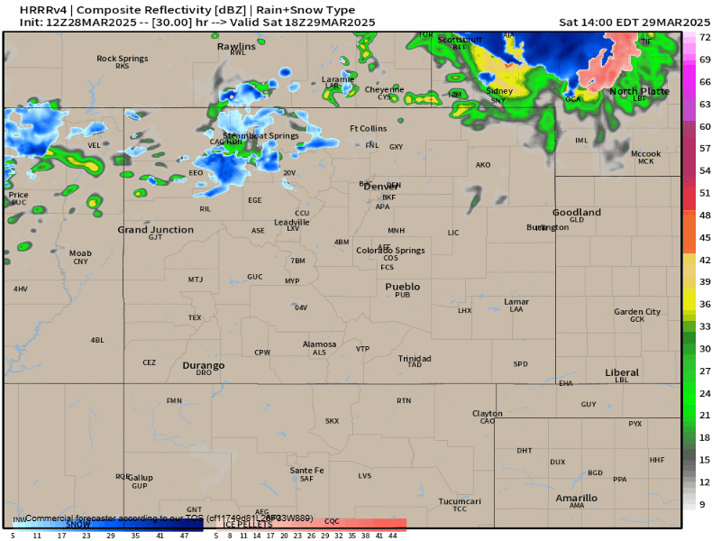
Colorado Weather: Waves of rain, thunder this weekend, some snow possible

Hello weather friends! Our first rainy system of the spring is on the way! If we break down the important bits:
1) Several waves of rain showers are likely
2) Some lightning & thunder is possible
3) SOME snow is possible as the system pivots out Sunday, but those chances seem limited...
Let's get right into it, shall we?
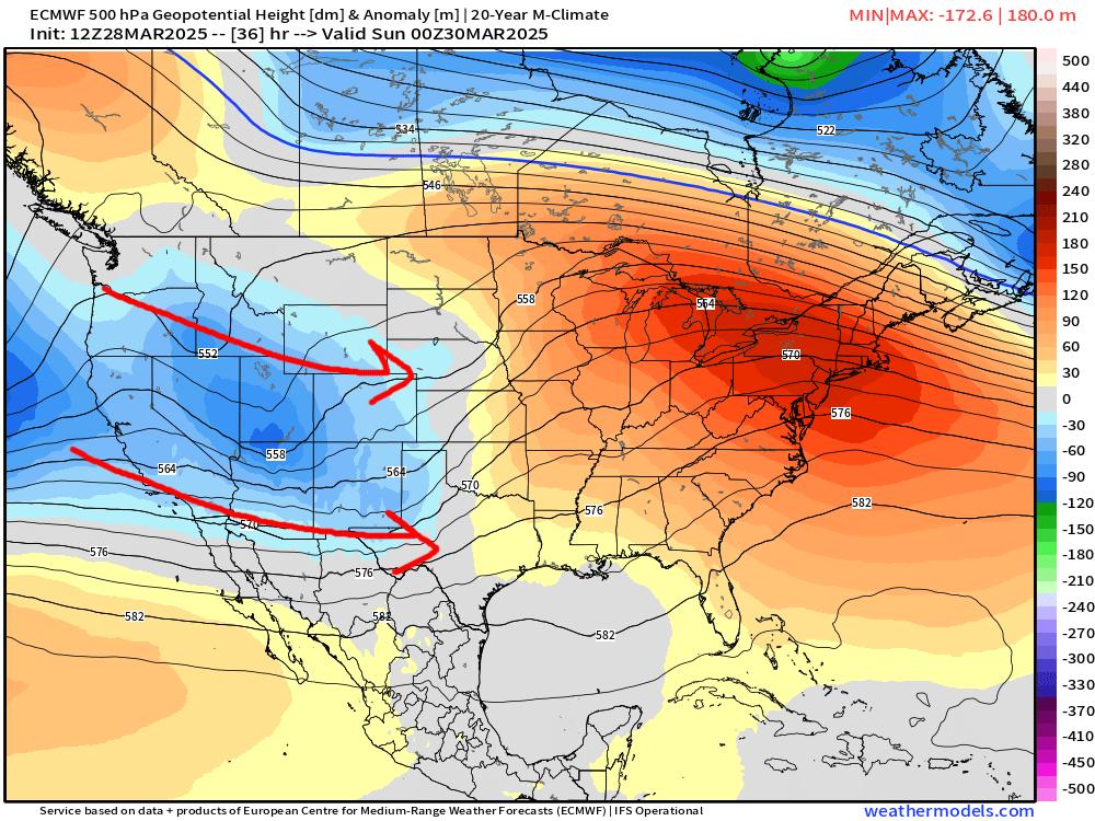
We're kicking things off, as I often like to do, with the 500mb charts. This gives us a very clear indication of where calm vs unsettled weather is planning on taking shape. You'll notice the ripple of energy moving in off the Pacific, which will scoot east across Colorado this weekend. This system will be pretty moisture-rich, which means it won't take a ton of "OOMF" from the atmosphere to lay down some decent rainfall for some.
If you've got plans to be out, this weekend, you'll definitely get some dry time, but it will likely be a bit cooler & cloudier. Let's dig into the timings...
WAVE 1 - FRIDAY 5pm -> SATURDAY 10AM:
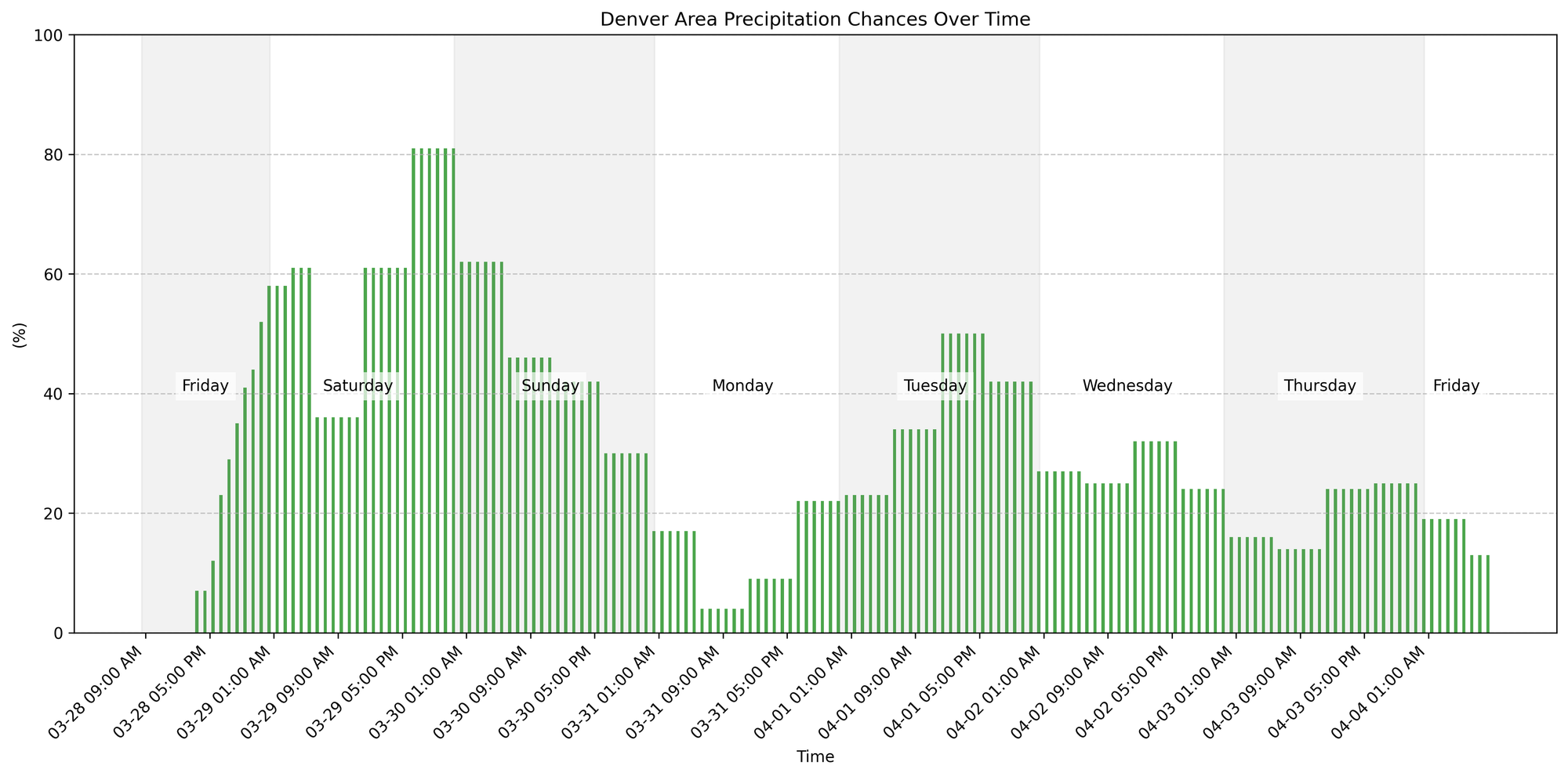
Based on the latest high resolution data, we'll likely see showers increase here on Friday evening across the front range, with rain and snow showers over the higher terrain. Some showers could produce a brief rumble of thunder and gusty winds, along with heavier precip at times.
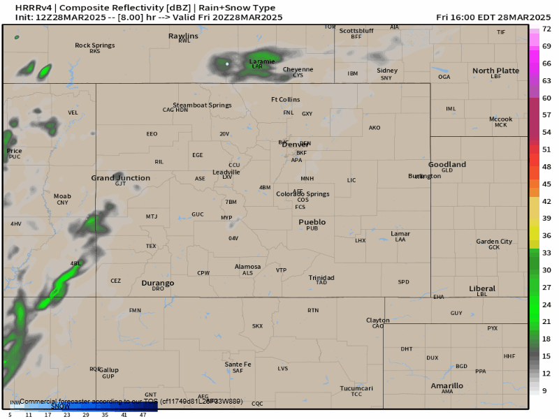
We think these showers will have some legs for most of the night, slowly tapering off as the first wave exits late Saturday morning. Some pockets of sunshine outside of spotty sprinkles is likely our weather setup for most of Saturday afternoon.
The better chances of rain this evening will be north of HWY 24, so for areas around Colorado Springs, you likely don't get as much rain as the Palmer Divide and on north to Denver.
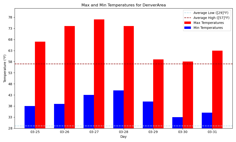
Highs Saturday for most will hang out in the 50s and low 60s.
WAVE 2 - SATURDAY 5pm -> SUNDAY 10AM:
A secondary wave of energy will push through Saturday evening into Sunday night. This could have some slightly colder air to work with – parts of the Palmer Divide could see heavy bursts of snow with this. We'll also have a slightly more robust convective setup, meaning some flashes of lightning and claps of thunder could be more numerous Saturday evening. Nothing severe is expected.
We'll have to contend with heavy bursts of snow in the mountains Saturday night. Prepare for variable travel conditions in the higher terrain during this time.
This second wave looks like it will also favor northeast Colorado vs the southeast corner of the state.
More scattered rain and snow showers are expected on Sunday. Highs will reach the upper 40s and low 50s.
HOW MUCH RAIN COULD WE SEE?
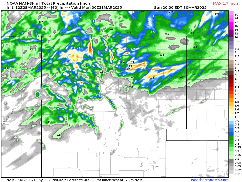
As mentioned above, this is a more favorable setup for northeast Colorado. I think the Hi-res NAM covers the meat and potatoes of this system well. Likely some "streakiness" to the precip pattern, with heavy moisture over localized areas. Still looks like there will be plenty of opportunity though for many folks to stack up to 1/4-1/2" of liquid by the end of the weekend. If you're south of the Palmer Divide, we aren't expecting anything huge – seems a bit too far north at this juncture.
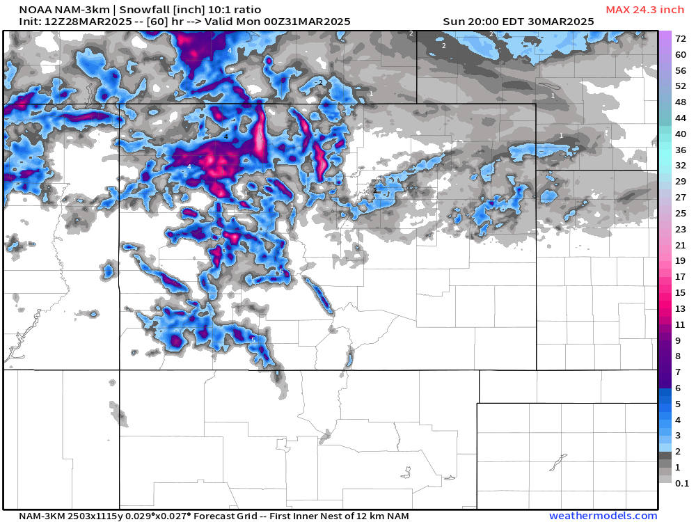
Snowfall totals are generally pretty meager at this stage, outside of higher terrain travel in northwest Colorado.
What's going on after this weekend? We posted a discussion on this for our Insiders this week, right here:
Well, we should moderate temps next week, before our next, potentially impactful storm system moves in next weekend.
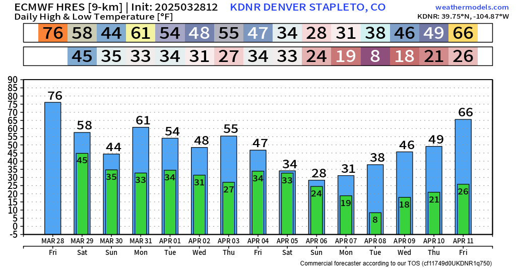
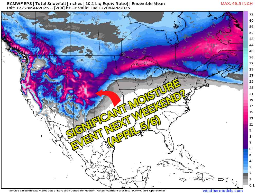
European ensemble data has been BULLISH the last couple days on a system that could bring heavy precip to Colorado the next weekend (April 5 & 6). It's still pretty darn far out to make any reliable calls, but it's definitely something we have on our radar. We'll get a better grasp on this system come early next week, when we should have more updates for you.
Have a good weekend folks!
Luke