
Rain and snow today, weekend system trending down

An active weather pattern continues across Colorado. We're seeing relatively calm conditions this morning, with some scattered snow showers in the southwest quadrant of the state.
This ripple of energy will slowly slide east throughout the day today, eventually setting up showers for the front range and I-25.
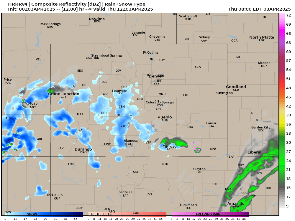
Above is the setup for Thursday morning with moisture pinwheeling in from southwest to northeast.
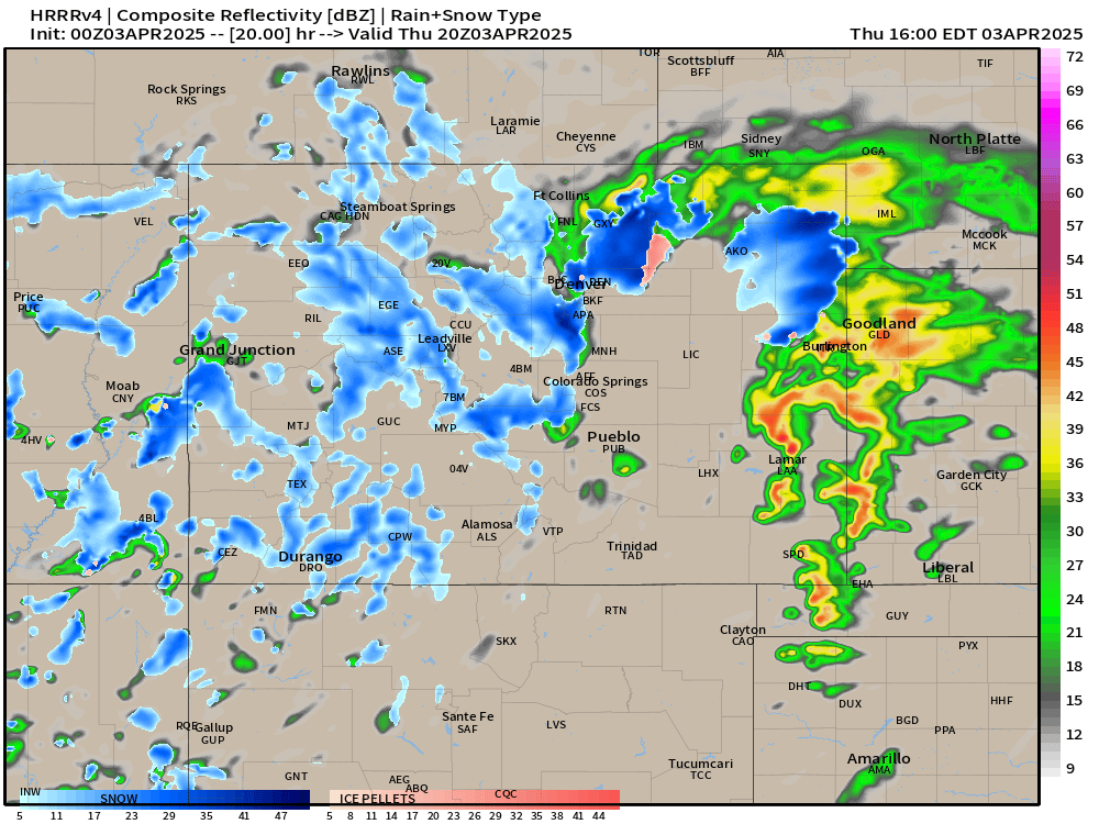
Below is the evolution of the weak shortwave, with some areas of convection that are noteworthy, especially around Denver and with a complex of thunder showers over the eastern plains. That radar imagery is a projection around 3pm today.
Generally there will be some variability to our weather throughout the afternoon, so be aware of changing weather conditions.
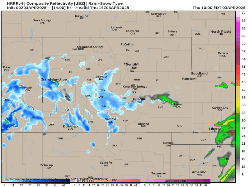
Our window of opportunity for moisture Thursday will be around early lunch time, lasting into the late evening hours. Will it be raining or snowing the ENTIRE afternoon? Probably not, but it's expected to be more unsettled than not for most of the day.
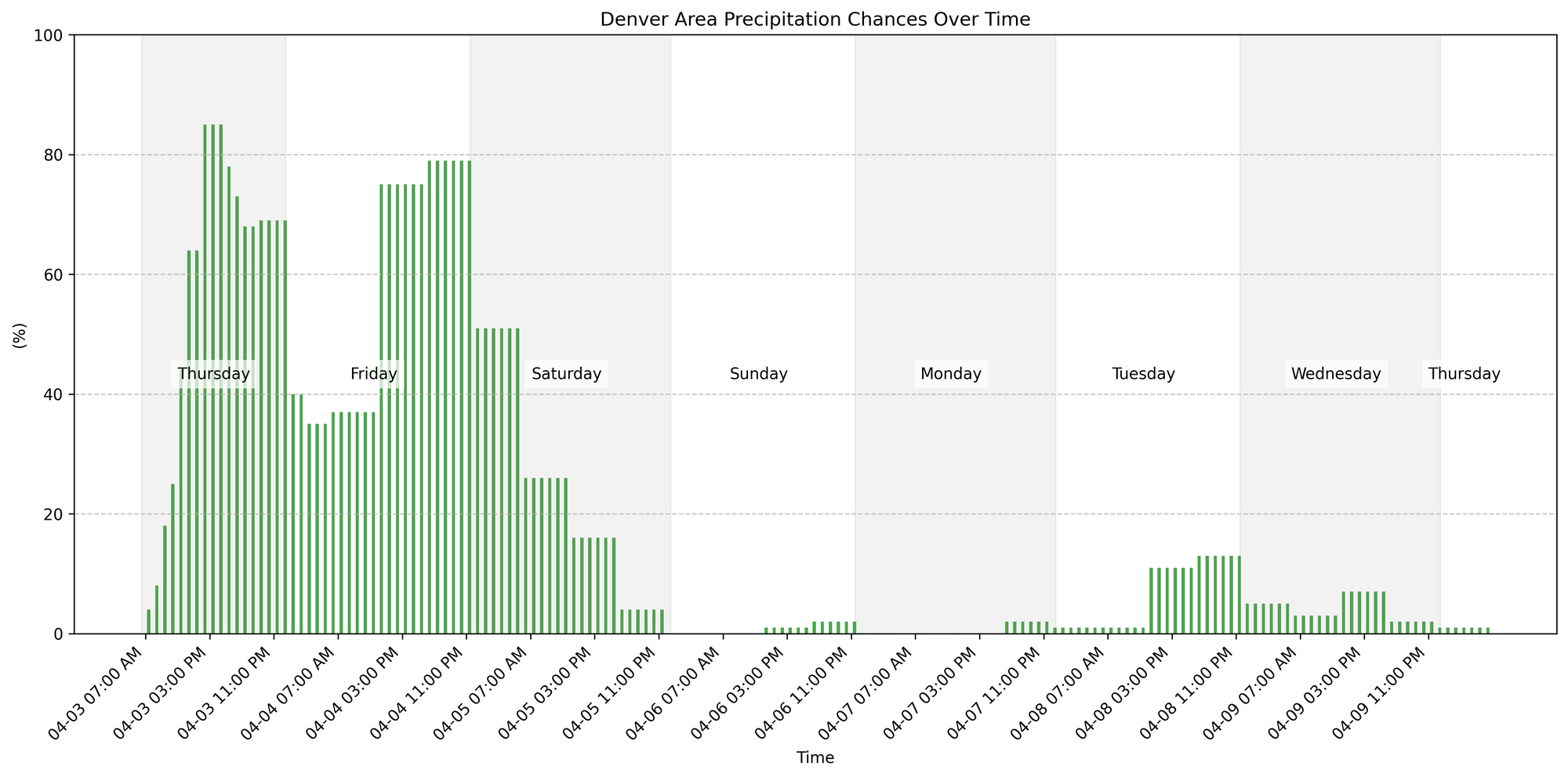
You can see below those precipitation chances ramp up this afternoon, lower a bit early Friday, before increasing again later in the day into Saturday. Our patter quiets down a bit thereafter.
Snowfall totals tomorrow don't seem terribly impressive – but in a convective atmosphere, interesting things can happen... we'll have to keep a close eye out for that.
We'll stay chilly on today, as well as Friday, before our next storm system comes lumbering in. Really it won't be until about Sunday before we start to feel a warming trend...
Now, earlier this week, the Friday evening's storm looked like it could be a pretty promising round of moisture. Unfortunately, We've see a pretty precipitous downward trend in the snowfall data ever since Monday evening.
The reason for the downward trend: location, location, location. Our upper level low which had been centered over the New Mexico/Colorado border, is now MUCH further south in the latest data – essentially over far southern New Mexico.
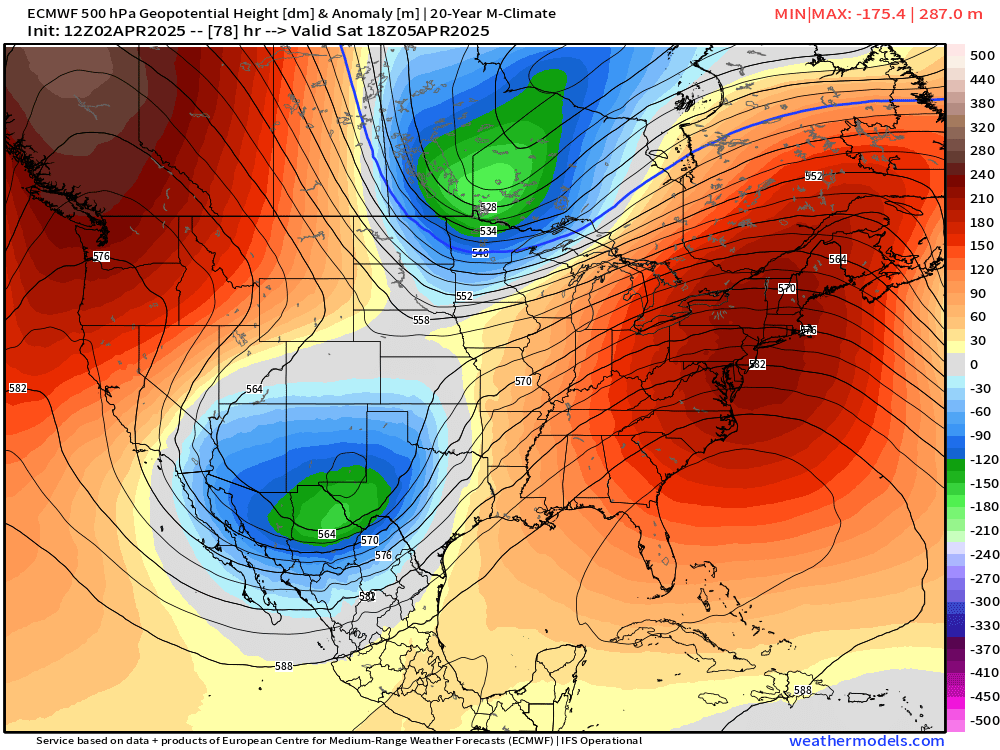
The track of this system does NOT bode well for significant snowfall on the from Colorado Springs north to Denver.
While we still likely see some accumulating snowfall in many cases, it won't be enough to slow you down all too much.
Snowfall Totals
For the incoming moisture today, we're likely not in for a whole lot in terms of snowfall at lower elevations. Generally under and inch for Denver and Colorado Springs.
If we look at totals through Saturday morning we see the foothills west of Denver could pick up some appreciable snowfall, as well as the western Palmer Divide. For most locales at lower elevations the chance for meaningful accumulation is looking low... but keep an eye to the sky (and forecast!) just in case that changes. For areas of heavier snowfall at higher elevations some totals from 6 to 12" are expected!
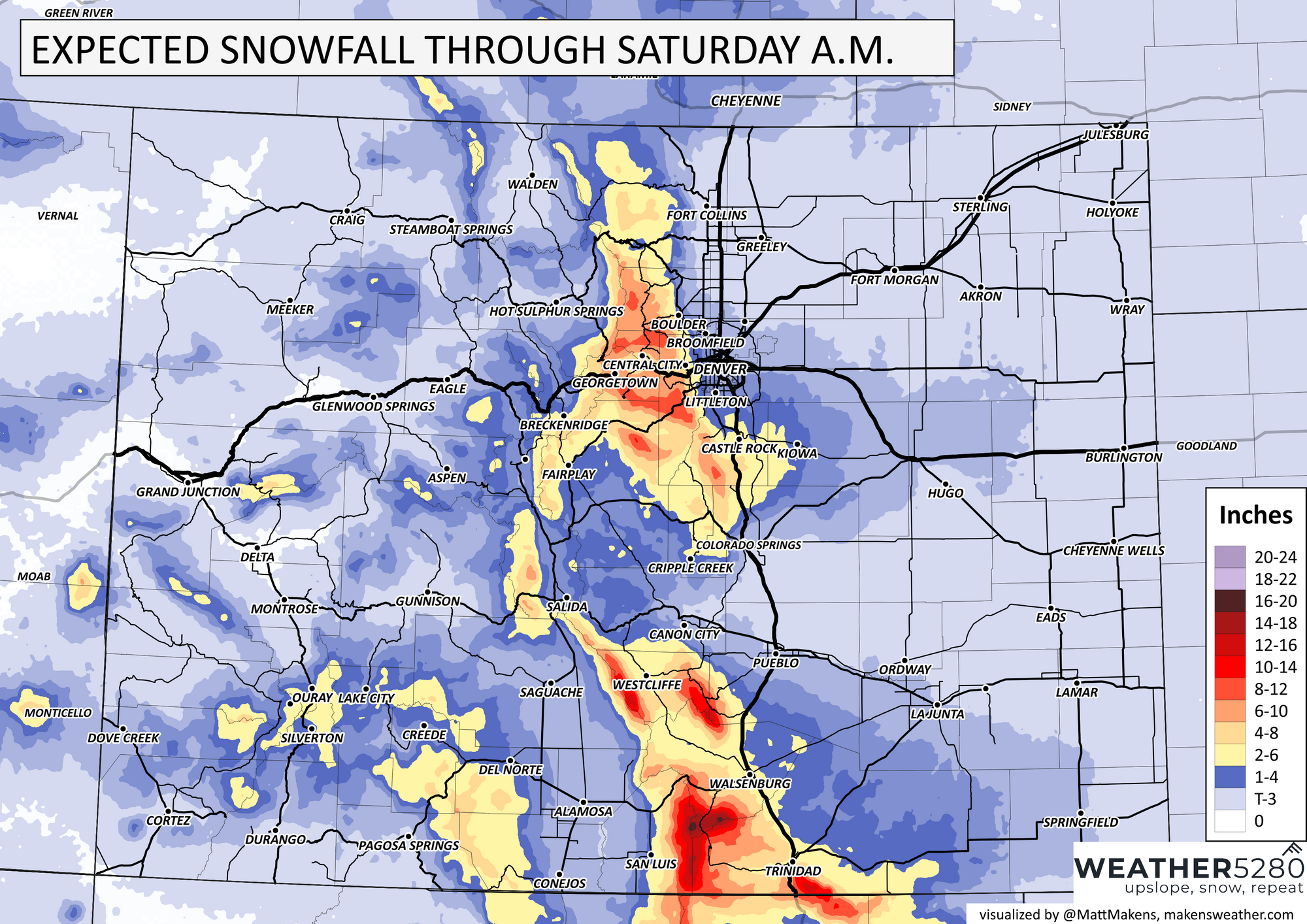
The totals map includes that wave tomorrow night, which for some could be a bit better for a setup for that accumulating snow... we'll see. Let's get round one today and tonight out of the way and see how things are looking in the morning.
Luke