Colorado weather: April "heat wave" on the way

Ok... maybe heat wave is a bit of a stretch... BUT, it will be VERY warm the next few days, continuing into the weekend.
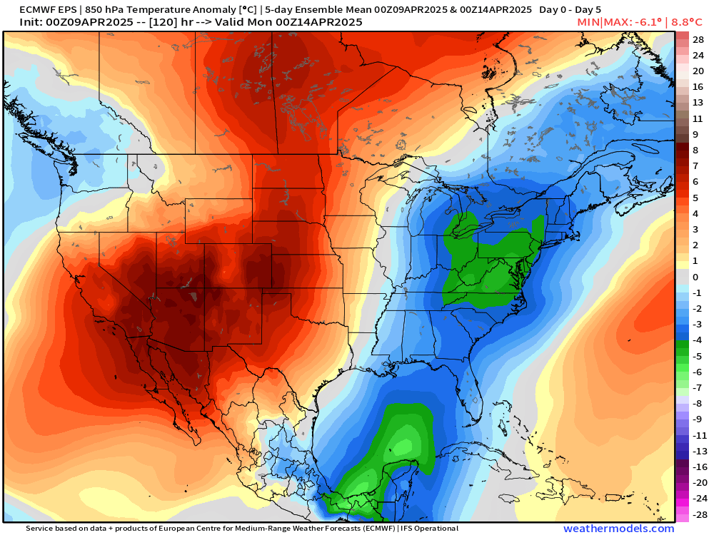
Let's start with the overall setup:

Above is a look at lower-level atmospheric temperatures averaged out over the next 5 days. An impressive ridge will set up bringing several days of well above average temperatures. Our warmest day looks like it will be Saturday, where highs will likely run 15-25 degrees above normal!
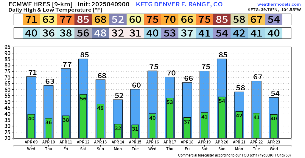
Here are potential high temperatures for Saturday, according to the European model:

Highs around Denver will be in the upper 70s and low 80s. Similar look around Colorado Springs. Over the plains, temps could get well into the 80s, with a few folks along the Arkansas River approaching 90 degrees!
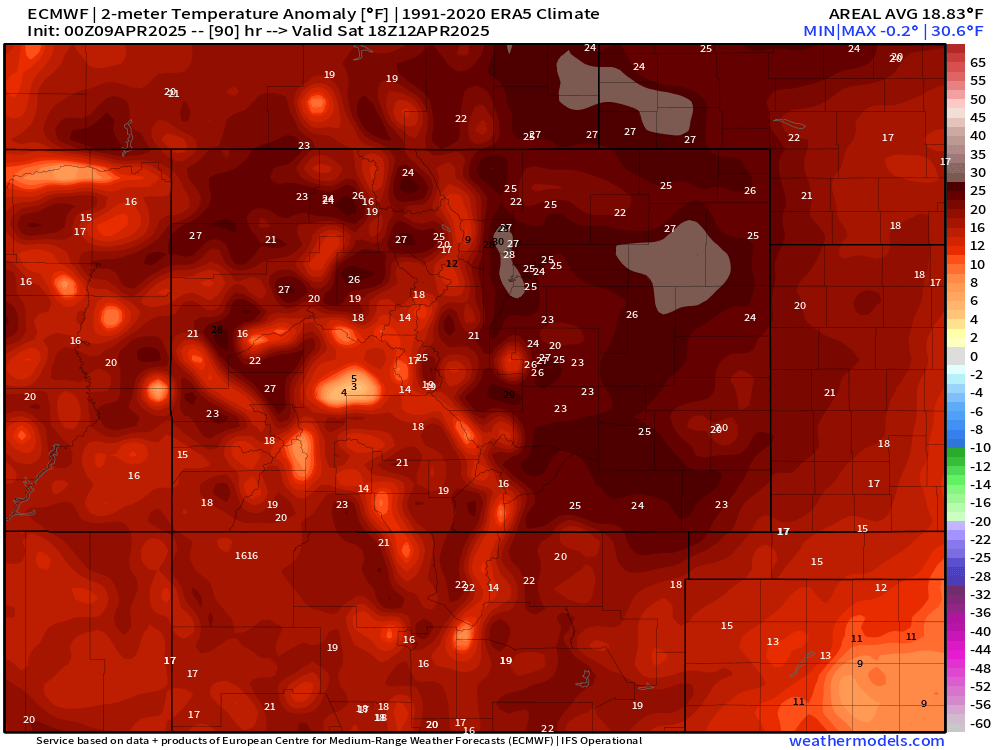
Below are the Saturday high temperature departures from average. Essentially every location along the front range would run 20-25 degrees above normal in this scenario. Impressive for this time of year.
10 day forecast ain't lookin' took shabby either if you've been waiting for a nice warming trend.
Fortunately, the wind won't be all too bad... but we will notice a ramp up into the weekend as the ridge slides away. Regardless – with all this warmth, and how dry we've been, any little wind will ramp up fire danger. We're dealing with that today (Wednesday) with Red Flag Warnings up for most of northeast Colorado.
Other than that, we're not eyeing any major pattern changes at this time. Perhaps a few swings in temperatures here and there... maybe a day or two where thunderstorms could pose a risk. With that in mind, we might not have a ton of updates for you.
Enjoy the warm weather coming up! Be smart with fire risk.
We'll see you in the next one...
Luke