Colorado weather: Weekend heatwave eases Monday, then briefly warmer ahead of end of week chill

We're in rollercoaster season for weather along the Front Range, no doubt about it. We had record heat on Saturday, and spotty banded snowfall early this morning. This afternoon will feel pleasantly like spring, with little memory of snow to be found.
Saturday's high of 86°F in Denver set a new record high for the date, beating the old one of 85°F that was set in 2023.
Denver International Airport observed a high of 86 degrees this afternoon, which is a new record for today. It breaks the previous record of 85F, which was set in 2023. #cowx pic.twitter.com/iVH0ZGukKD
— NWS Boulder (@NWSBoulder) April 12, 2025
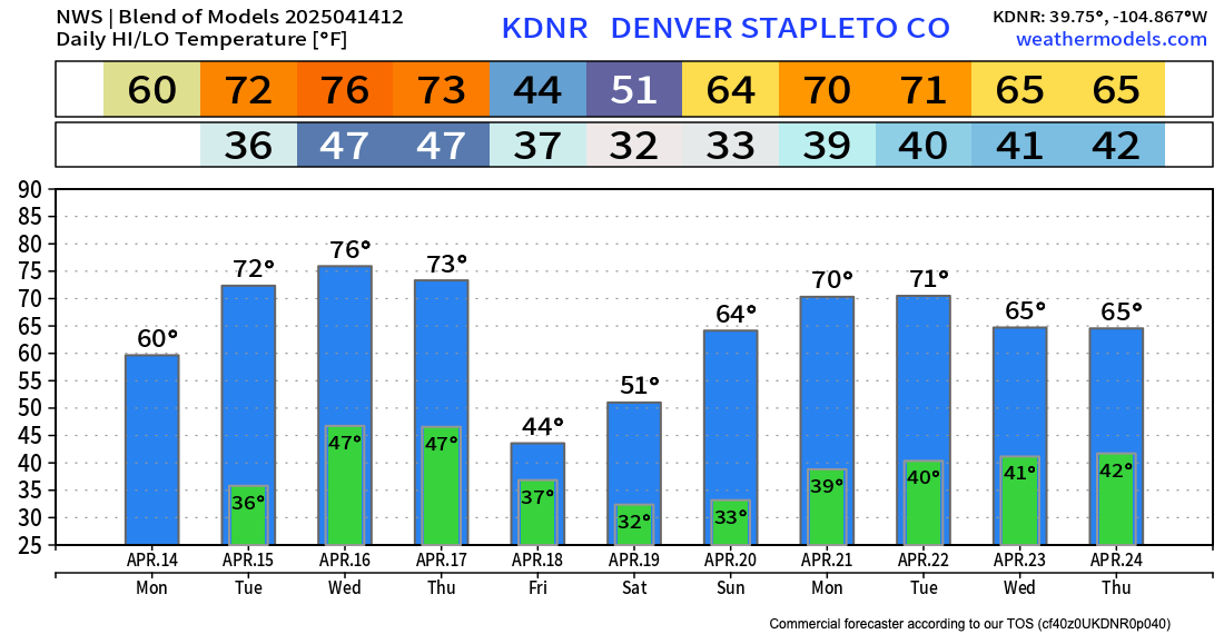
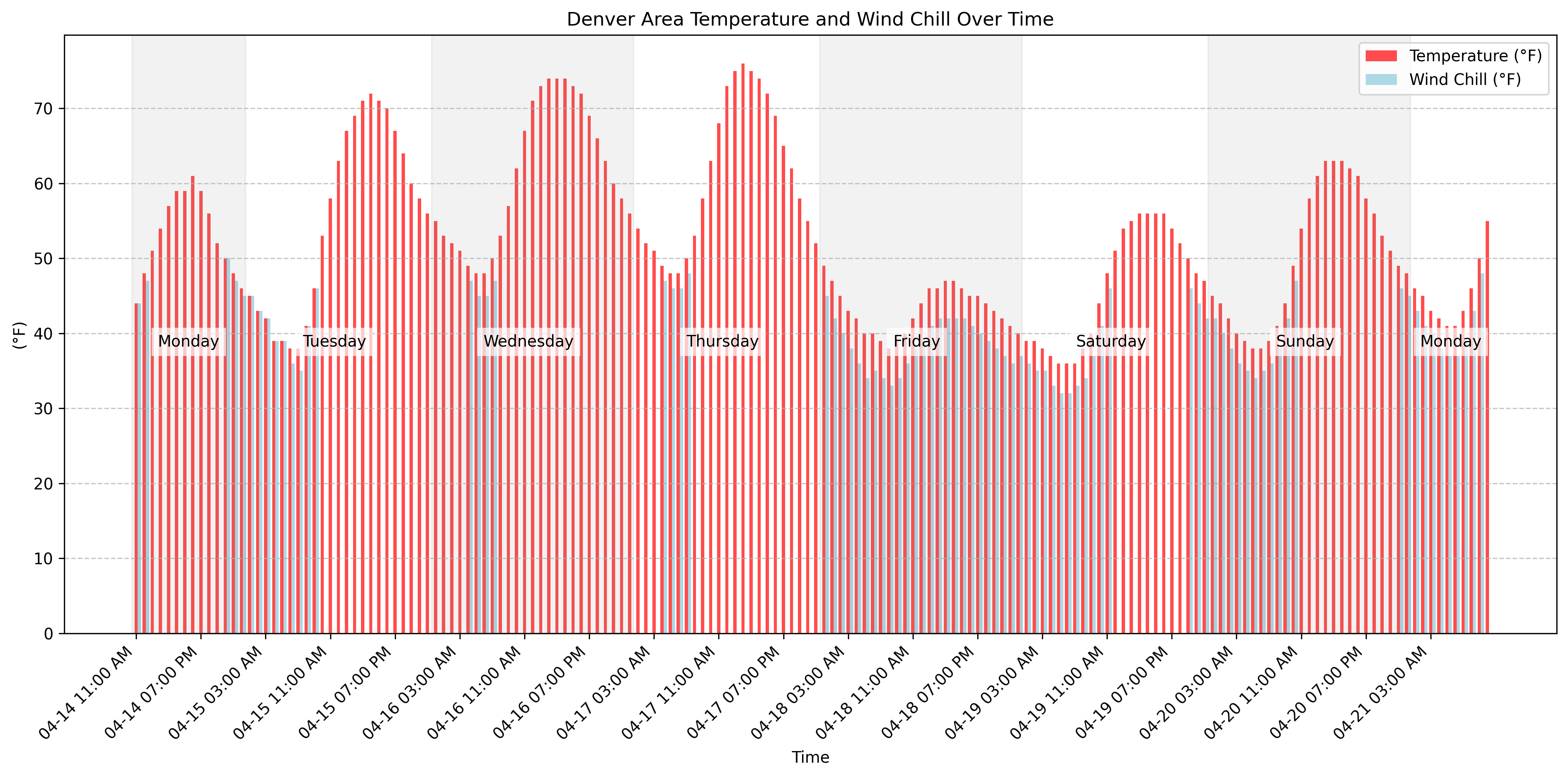
We cooled to about 70°F across the metro area on Sunday, and will cool another 10-degrees or so today with the passage of the cold front overnight. A high of about 60°F is forecast for the Denver metro area on Monday. Tuesday through Wednesday will feature highs in the just-about-perfect 70s for the urban corridor, before a sharp cool down arrives Thursday night into Friday.
This morning's early morning weather was thanks to two pushes of chilly air moving in from the north Sunday, and a jet-streak overhead enhancing banded precipitation (both rain and snow) along the foothills and adjacent plains overnight into early this morning.
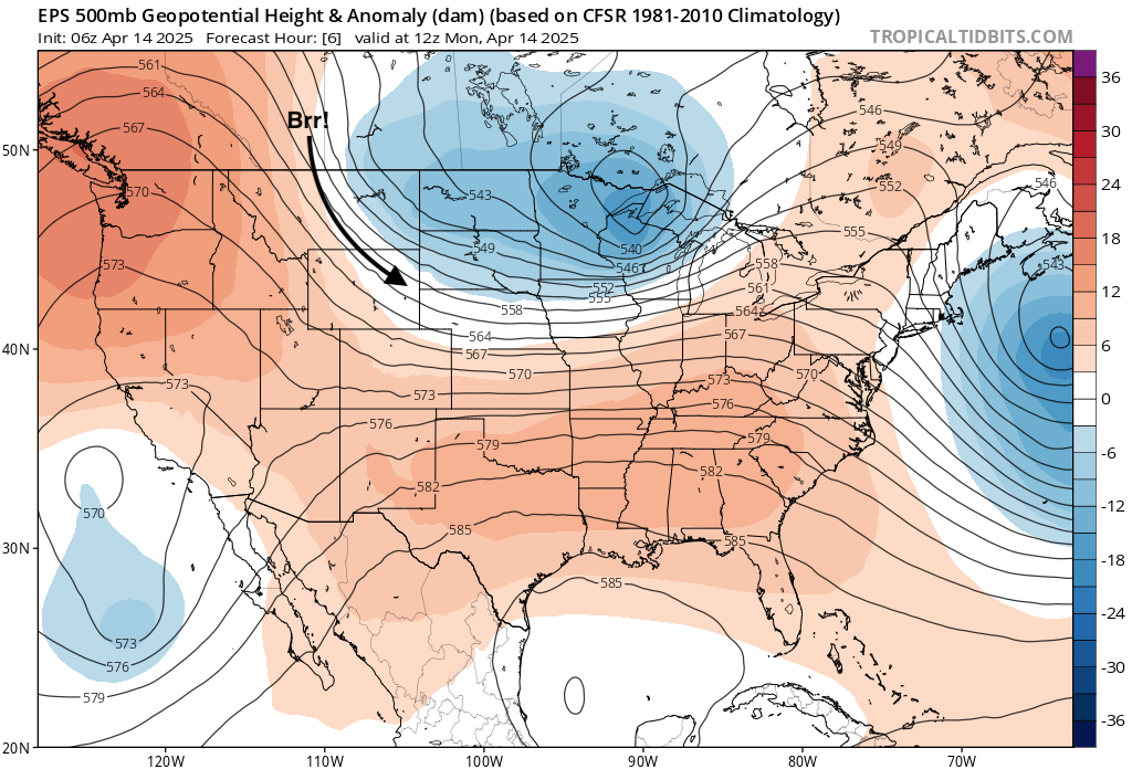
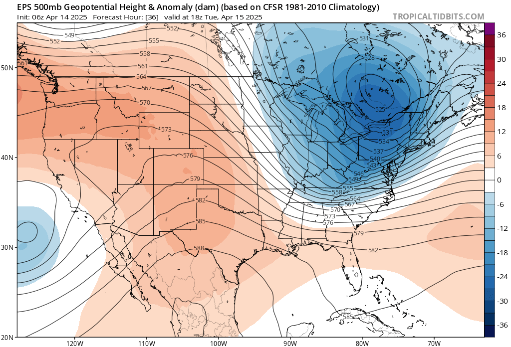
The large trough over the Great Lakes continues to push east today, with ridging reestablishing itself over our area Tuesday, leading to warm afternoons Tuesday and Wednesday across the state:
By Thursday night our next system arrives. As you saw in the temperature outlook above we could see some pretty chilly air with this one for a day or two, and some wet weather is possible as well.
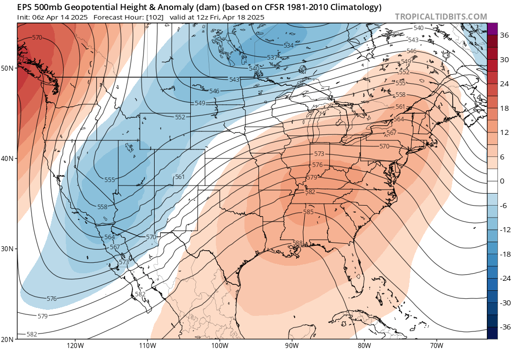
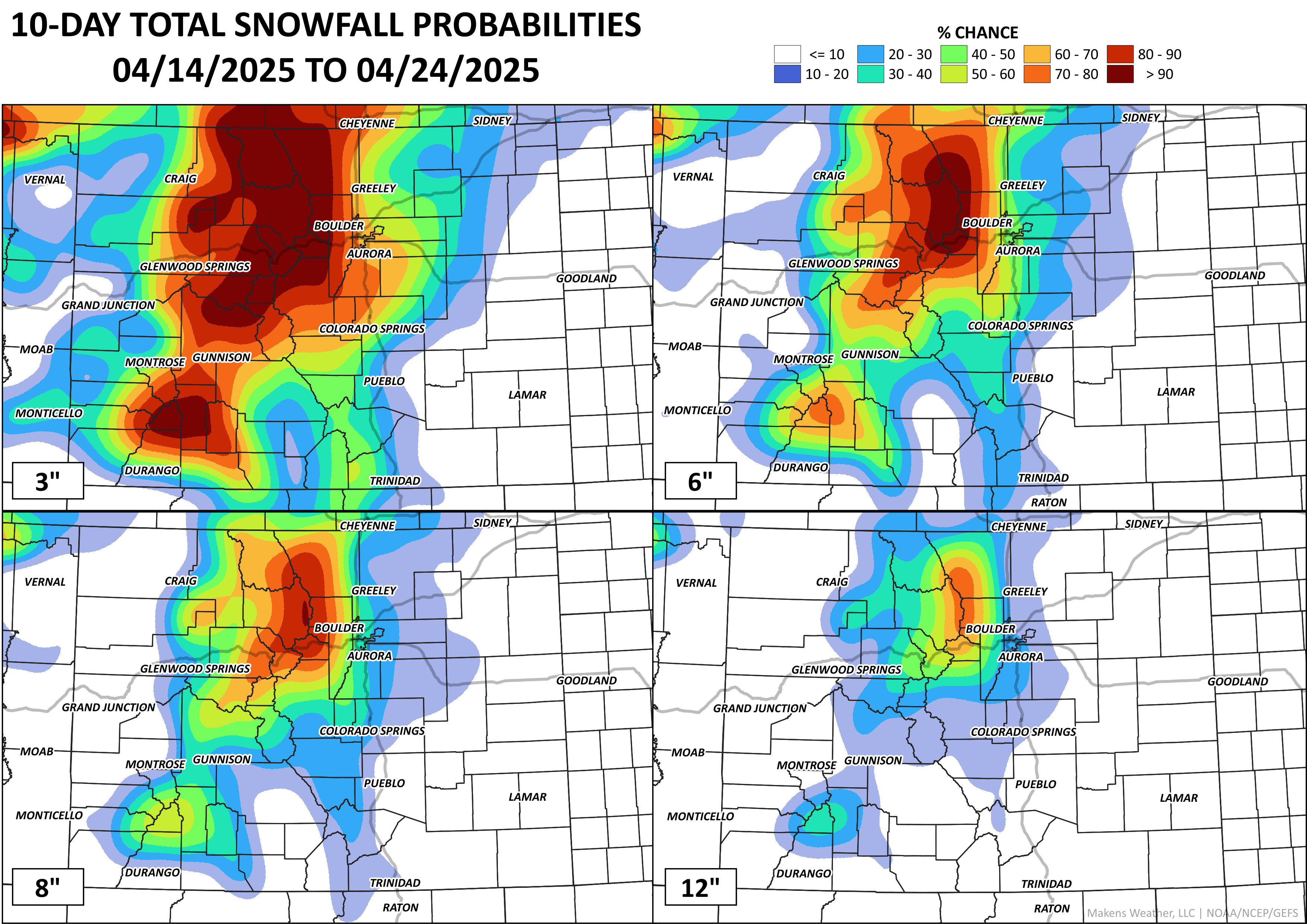
At 500mb kind of not an epic look on the European above if you're hoping for a late-season snow along the urban corridor... but overall a chilly pattern to end the week, and likely some good late-season mountain snow if nothing else.
Models have, at times, been a bit more aggressive with this system, so let's go into the week knowing we should at least keep an eye on things.
Best bet right now is that the northern mountains and Front Range foothills see the best chance at some appreciable April snowfall, with a much higher question mark for precipitation chances at lower elevations.
Here's a look at the week's temperatures, and then precipitation timelines for how it stands today:
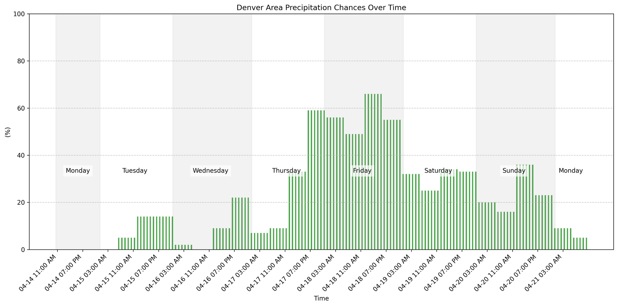
It's that peak in the chances later this week that has our interest. We will keep tabs on total precipitation, how much snow, and where that snowline will form. With that, look for another post soon with greater detail on this potential snow event.