
Denver Area Weather: Spring chill lingers with snowy weather through Saturday, warmer by Easter

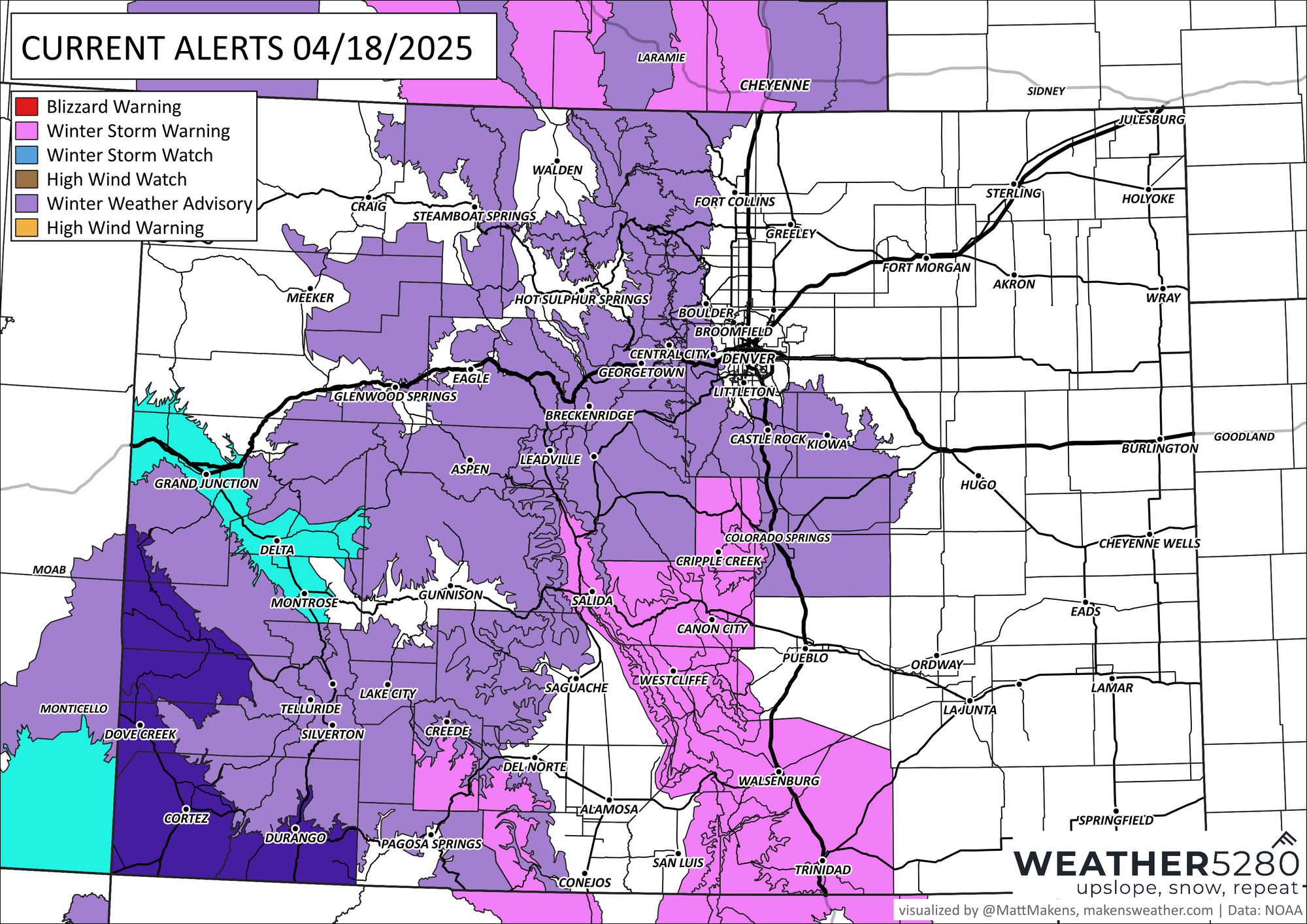
After a stretch of 70s earlier this week, colder weather has made a return just in time for the weekend across the Front Range. A Winter Weather Advisory is in effect from 3 PM Friday through noon Saturday for areas including Castle Rock, where several inches of snow is possible. While the snow won't last long, it will bring travel impacts—especially for the Friday evening commute and perhaps for Saturday morning, too.
🔑 Key Messages for the Weekend:
- Friday PM commute could be slick, especially around Castle Rock and foothill communities.
- A few areas will have several inches of total snow from this system, primarily accumulating through tonight.
- Roads will improve by Saturday afternoon, but dress for chilly, cloudy conditions if you’re out early.
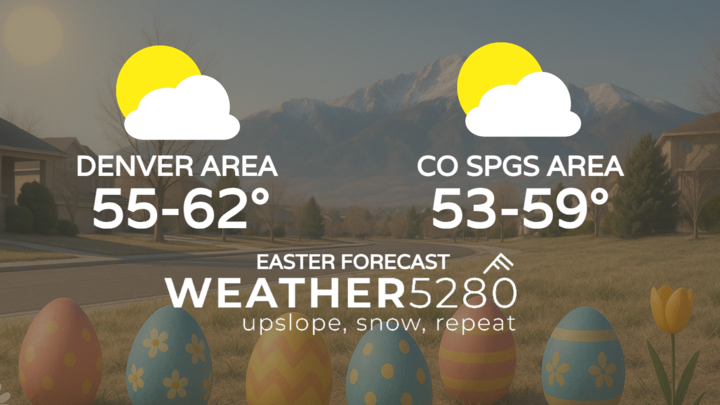
- Easter Sunday looks dry, sunny, and much more comfortable with temperatures rebounding into the 50s and 60s. Sunrise church services will be cold, so prepare for that.
❄️ Friday: Snow with a Sharp Cooldown
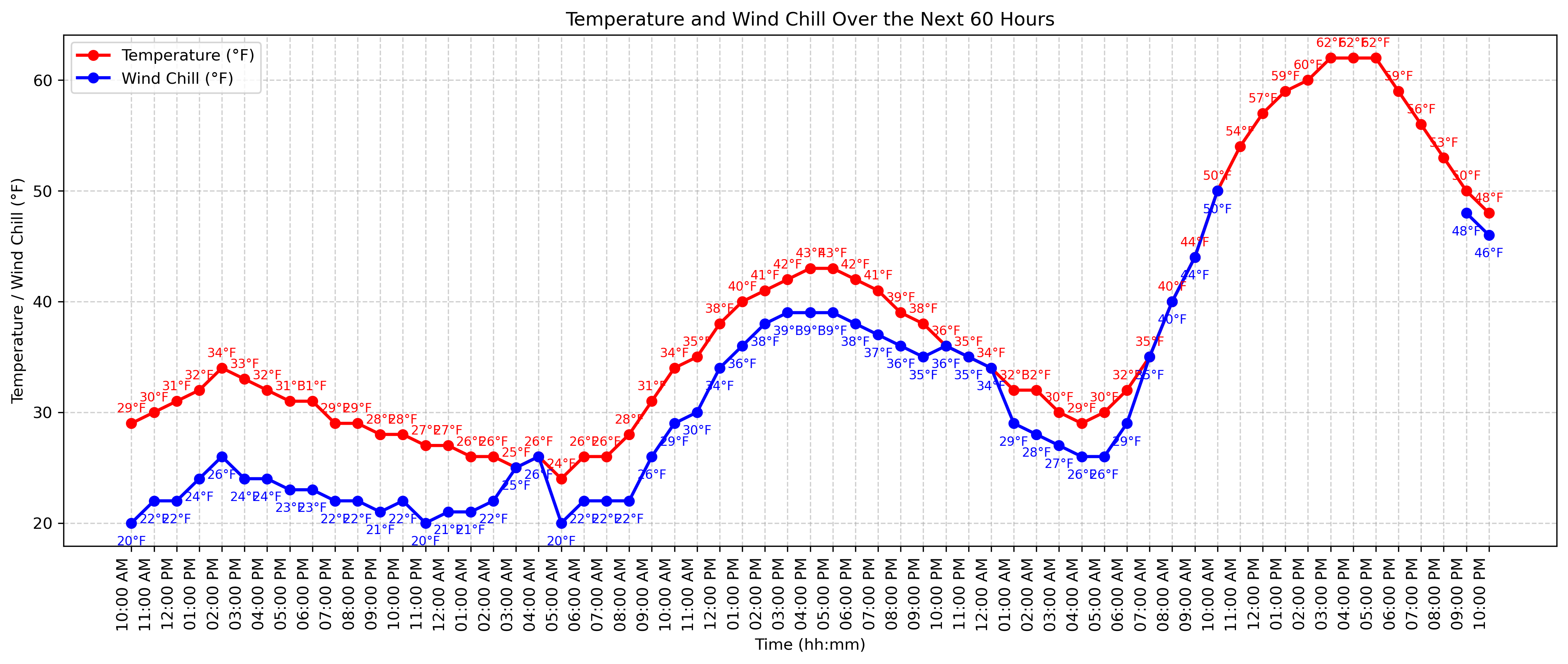
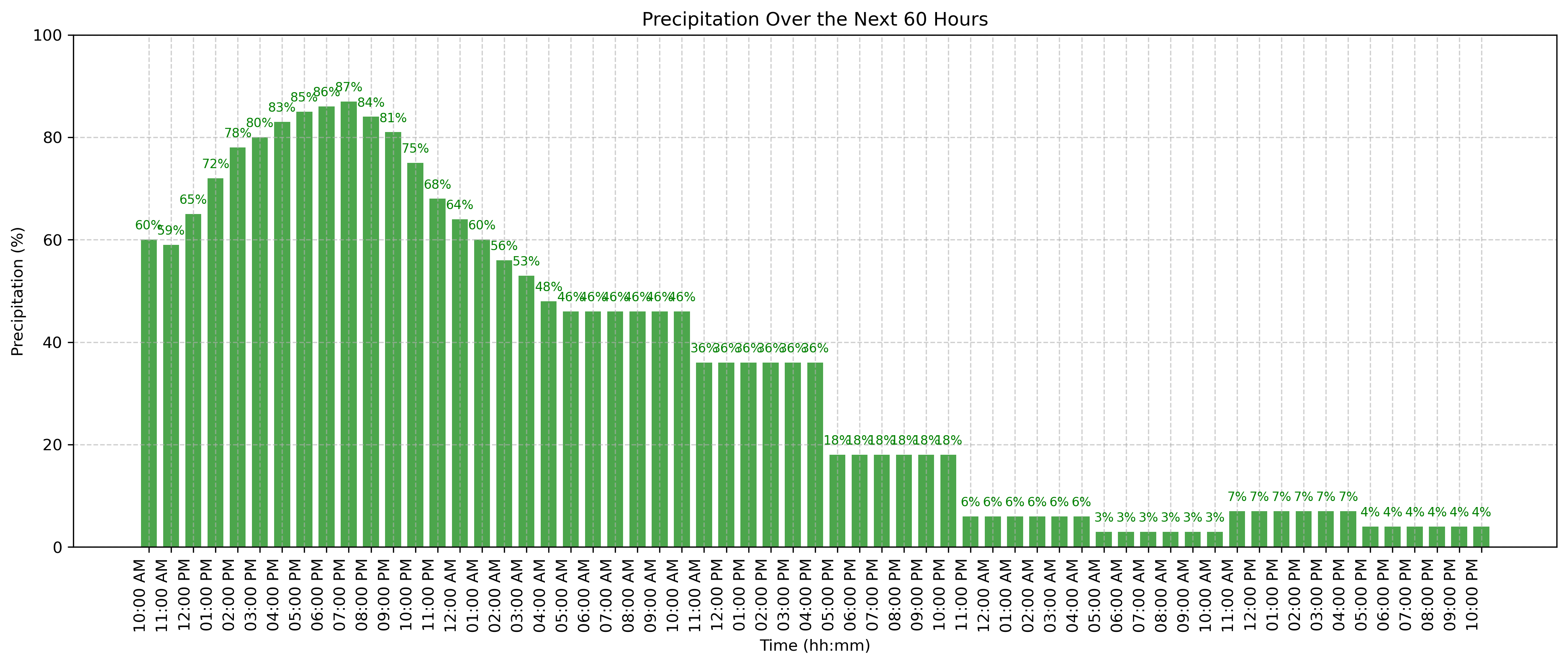
Snow is already falling across much of the Denver and Colorado Springs metro areas today, and it will continue into the evening. Temperatures have plummeted into the 30s, more than 40 degrees colder than yesterday’s highs in the mid-70s. While much of the initial snowfall will melt on roads, expect accumulations on grassy and elevated surfaces through the afternoon and ramping up for some this evening.
As the sun sets and temperatures fall into the low 20s, roadways will become more vulnerable to slushy or icy conditions, especially in the higher terrain west of I-25 and along the Palmer Divide.
🌨️ Saturday: Lingering Snow, Then Clearing
Snow showers will linger through Saturday morning, especially west and south of Denver, before tapering off in the afternoon. Skies remain mostly cloudy, and highs will stay chilly in the mid to upper 30s. While additional accumulation Saturday should be limited (under 1 inch), early slick spots are possible before temperatures climb just above freezing.
By Saturday night, skies begin to clear and temperatures will dip into the mid-20s—cold, but setting the stage for a pleasant turnaround on Easter.
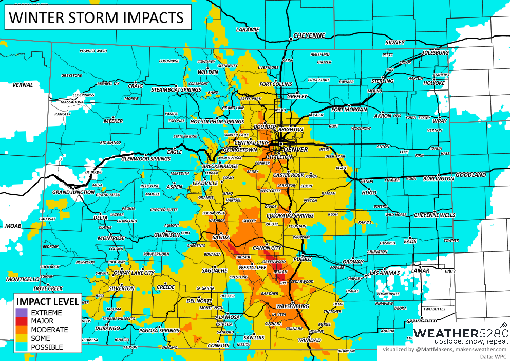
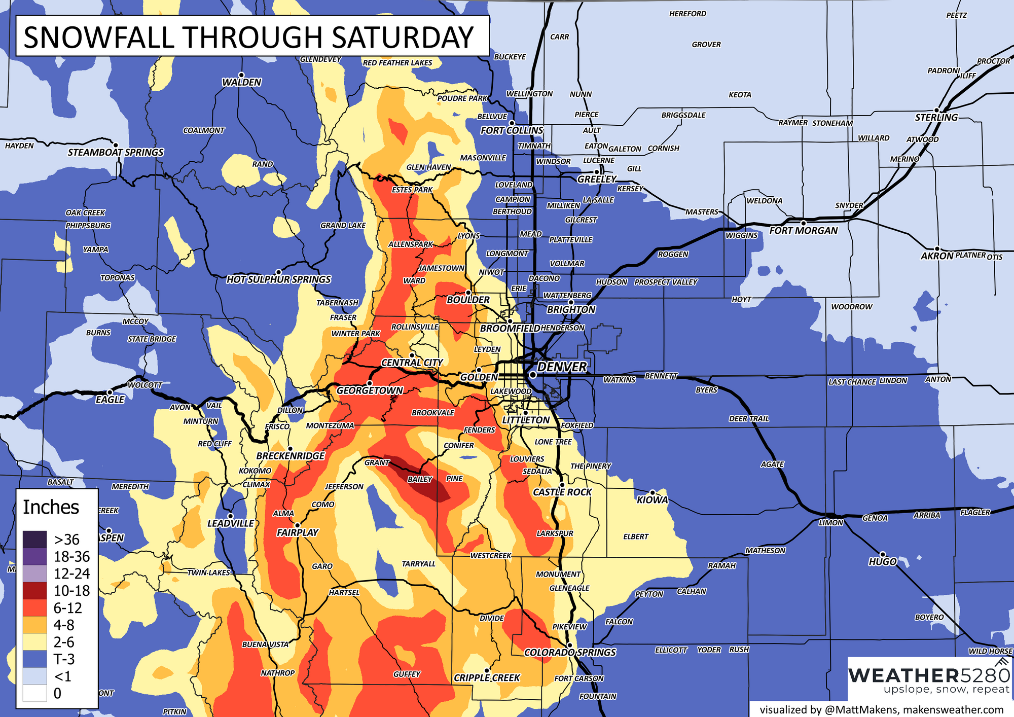
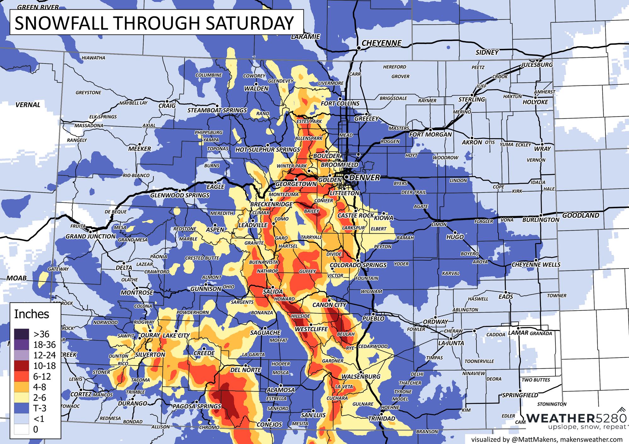
Potential accumulation totals when all is said and done are shown here.
☀️ Easter Sunday: Sunshine and a Spring Rebound
Sunday brings a return to sunshine and milder conditions. Expect a highs in the 50s to lower 60s for the metro areas, with light winds and dry weather. While it's not quite shorts weather (meh, it's always shorts weather though isn't it?), it will feel much more like April again—just in time for Easter egg hunts and family gatherings.
📍 Stay tuned to road conditions if you’ll be traveling through the foothills or along the Palmer Divide Friday night into Saturday morning. And don’t forget your layers for early Easter morning—it’ll still be brisk early even with sunshine. Happy Easter!