Colorado Weather: Severe storms possible Thursday, less likely Friday

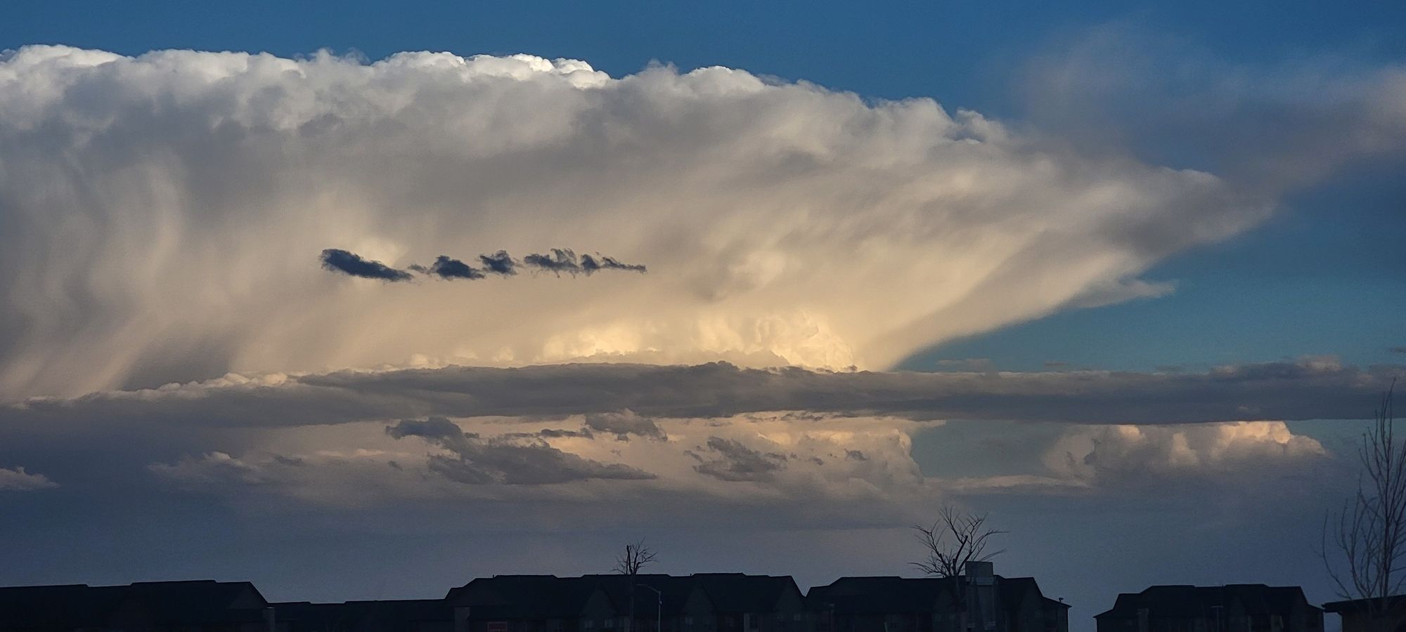
Our first round of severe thunderstorms this spring rumbled over the eastern plains Wednesday afternoon and evening – some of those storms creating picturesque views in the Pikes Peak Region.


We saw a fairly significant supercell that passed along the southern fringe of the Palmer Divide, impacting areas along HWY 24, and eventually moving north towards I-70; this was our one big storm of the day. For a time, it also had a tornado warning to go along with it.
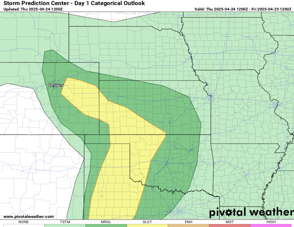
We're not done there either! More severe weather is possible along the front range and plains on Thursday. Below are the risk maps for severe storms today:
And Friday:
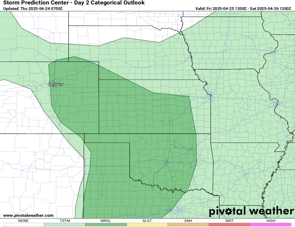
Today looks quite a bit more robust based on some of the latest modeling. The yellow on today's severe risk indicates that we could get several storms to become severe. The dark green typically indicates that 1 or 2 could be possible.
Below are the storm energy charts for Thursday afternoon:

A fairly significant swath of available thunderstorm energy looks to stretch all along the I-25 corridor and would extend southeast towards the panhandles and southwest Kansas. This is a pretty classic "return flow" set up which are common this time of year as we begin to open up the door to Gulf of Mexico moisture.
We'll be watching for leftover boundaries from overnight storms to potentially act as a firing mechanism for storms today. Another good measure for storms around here is the dew point. Charts for dew points look pretty ripe for this time of year... anything above 40° has the potential to get some work done.

At this time, we're expecting 50-60 mph wind gusts, couple with large hail stones... at this juncture, the further east you are from I-25, the better your odds are for some nasty weather, but that's not to rule out a storm becoming severe along the urban corridor either.
Most hi-resolution modeling has these storms firing after 2pm Thursday – hopefully we can split the difference between that and the evening commute... or else things might go downhill quick.
Stay tuned close to radar and updates as storm season can get going fast around here.
Luke