Severe Weather Expected for Several Days

Colorado prepares for several days of hail, wind and tornado threats
Those within Colorado and the surrounding region must be ready for severe weather the next few days. Most especially those in Kansas and Oklahoma.
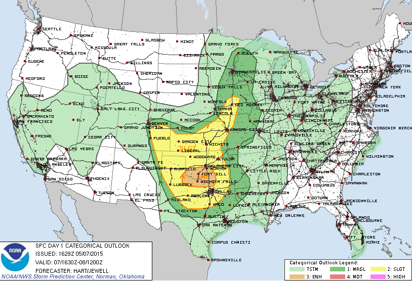
With enough heating today, Colorado will become active shortly after lunch. The SPC has us outlined in an marginal to slight risk for the day. Throughout this posting, note that Denver is on the edge of the severe threat(s); our greater concern is for areas southeast of the city today.
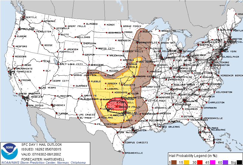
This area includes the risk for hail:
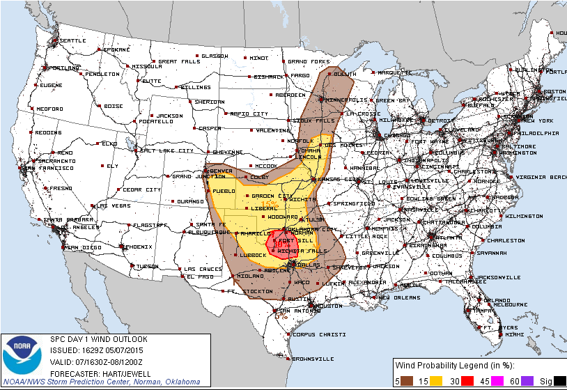
Wind:
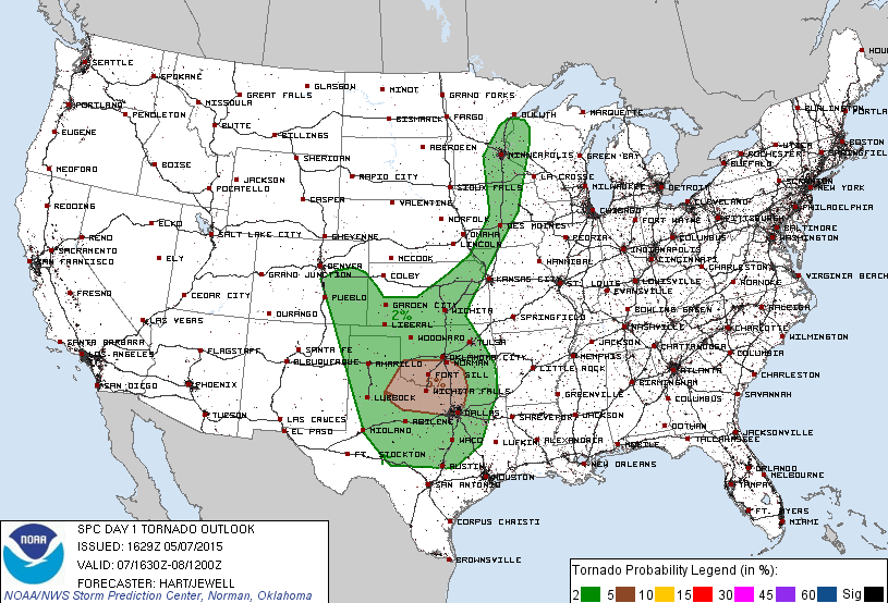
And, tornadoes:
Breaking the tornado threat down for the state, let's begin with CAPE. CAPE is a measure of energy available to fuel thunderstorms. There is correlation between CAPE and tornado potential, if other factors are also present. Here is the CAPE projected by the HRRR model for the mid-afternoon.
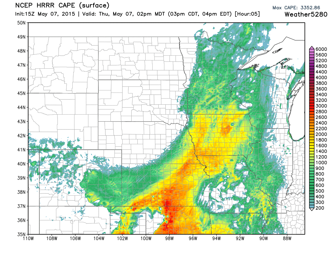
The Plains states certainly have the highest values, which explains the SPC outlook's enhanced threat level for those areas of higher CAPE. Let's zoom down into Colorado for a closer look.
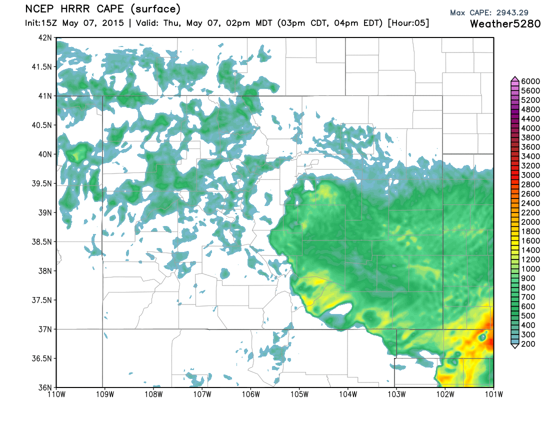
No, the values aren't nearly as high in Colorado, as say Oklahoma. However, Colorado doesn't need the higher CAPE values for tornado formation. Historically, tornadoes can form in Colorado with as little as 500J/kg. That value is may be reached over many counties by this afternoon. These values do not reach that level for Denver proper, however are noted for southern sections of the greater metro area over the Palmer Divide -- such as, Douglas, Elbert, Lincoln Counties and southward.
A limiting factor for the state may very well be the available natural "spin" in the air. There is plenty of that shear for the Plains states east of us, but that is limited for Colorado. In order for tornadoes to be a legitimate threat today, the shear will have to develop from a source other than the atmosphere aloft. The terrain will aid in that. As the afternoon surface air begins to respond to thunderstorms, we will see shear values increase due to terrain involvement. That's why I wouldn't be at all surprised to see some development along the Palmer Divide and south/eastward for the afternoon and evening. Colorado's terrain-induced shear/spin explains why we can have lower CAPE values and yet still see tornadic development.
Granted, there are multiple factors needed for tornadic development, however, I'm keeping it to the basics for the purpose of this post.
Today's storm timeline will be the typical one of afternoon and evening. The storm motion will be generally easterly to northeastly.
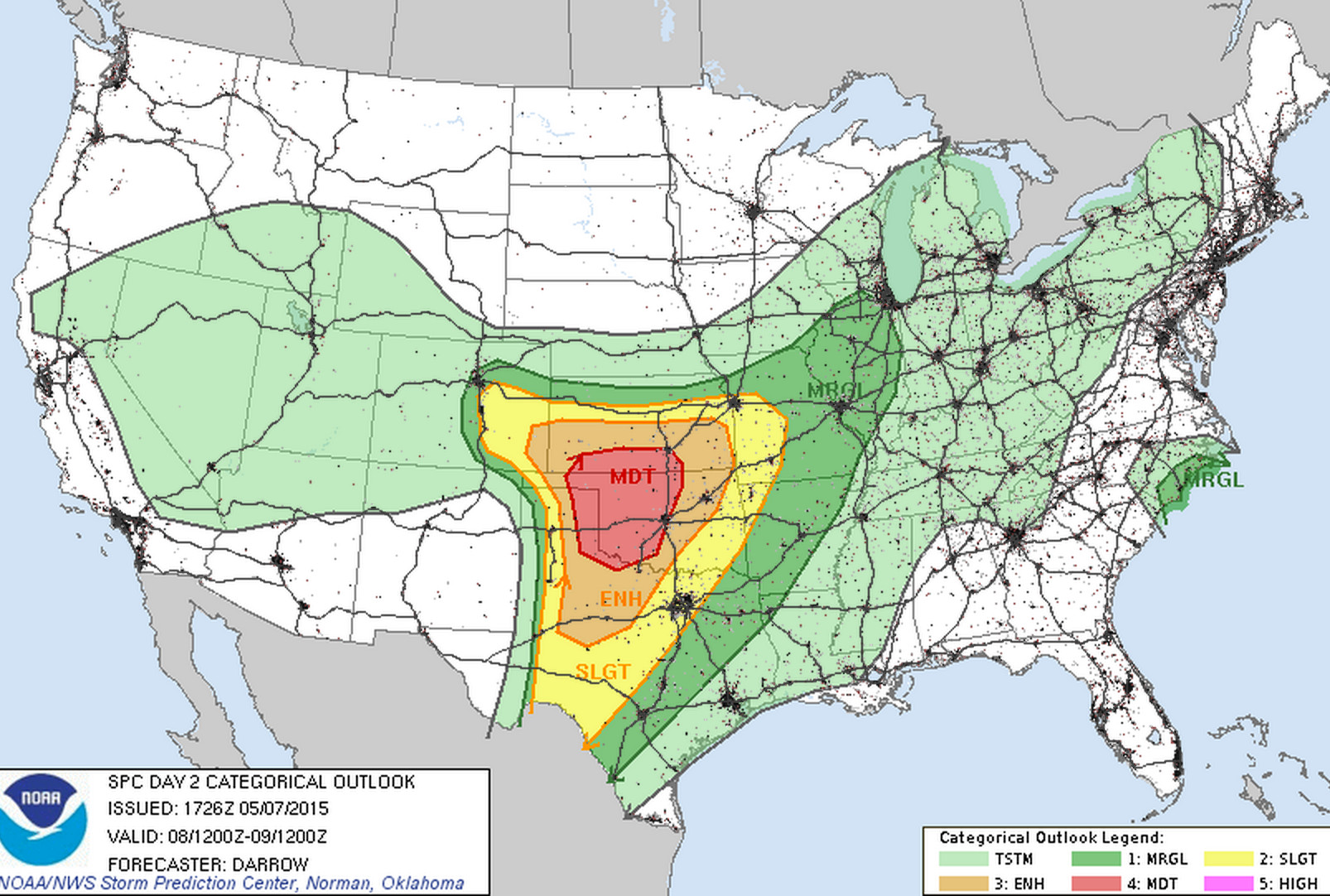
Friday's Outlook
We will need to remain weather-aware Friday, too, with severe storms possible across southeast Colorado, and a moderate severe risk for portions of Oklahoma, southern Kansas, and norther-central Texas:
Saturday's Outlook
Saturday will likely be a very busy day of severe storm reports, including tornadoes. The SPC outlook should catch everyone's attention within our region:
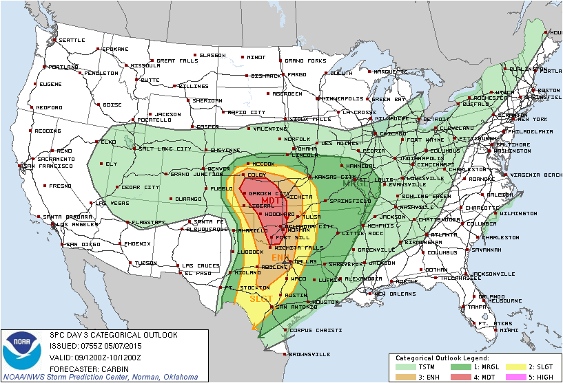
Still several days out so this outlook may change a bit. While the greatest threat will certainly be across Kansas and Oklahoma, as we've been discussing all week that severe threat may extend a bit further back into northeast Colorado for Saturday than shown above. Something we'll need to watch for.
More to come on our weekend system in a future post. A very active time for weather across the region, be sure to subscribe to Weather5820 to keep up with all the latest.
