Travel Troubles Already, Another Round of Heavy Snow Tuesday PM
If Tuesday morning's drive is any indication of how the rest of the day will play out, stay home!
Tuesday morning had an initial push of heavy snow across the region ahead of another push of snow expected later Tuesday all the way through Wednesday morning, for some.
All modeling from late Monday and Tuesday early morning had the morning snowfall for the northern Front Range and mountains for the morning drive, but to seemingly trivial amounts –– outside of Fort Collins which was progged to have 1 to 3" for the morning drive. Areas south that have picked up several inches of snow now through mid morning were progged to have lower totals by this time in most of the modeling.
That said, the timing was well forecast. The Winter Storm Warning went into effect at 6am this morning. The snow, while in some cases heavier than expected, was forecast to be
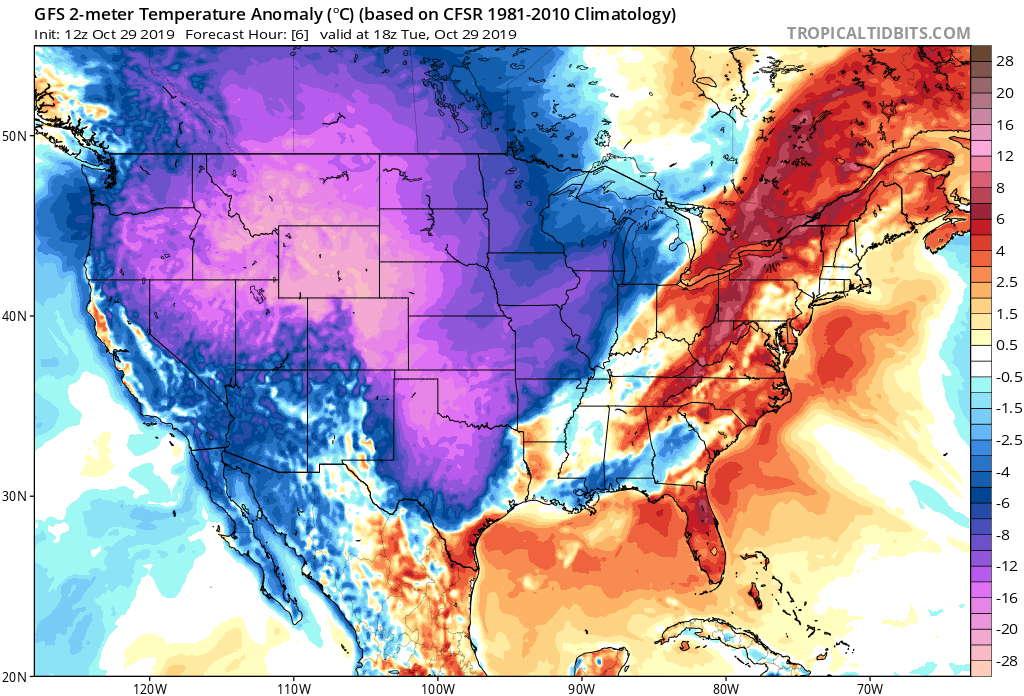
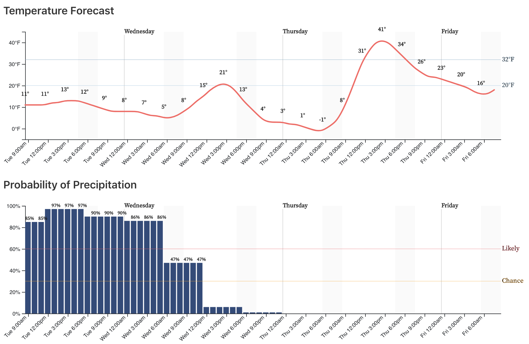
Did you know? As of 9am the high for Denver today is 19°F. This is likely as "warm" as DIA will get for the remainder of the day, and if so will blow the old record low high for the date of 25°F, set back in 1993, out of the water.
For most areas it wasn't about the amount of snow this morning, but rather how easily it compacted and turned to ice on the roadways. Travel has been a mess since early this morning and won't improve across the region in most cases until Wednesday.
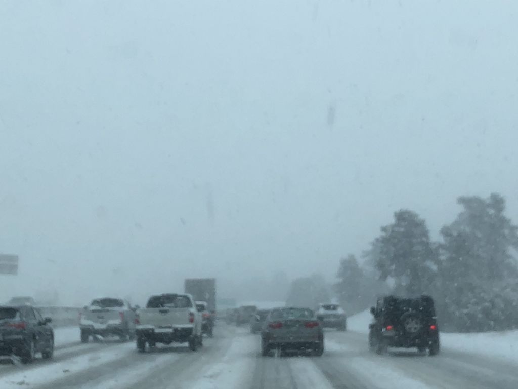
This is the view from Happy Canyon and Castle Pines at 8 am Tuesday from Hillary Pfeiffer.
The COTRIP.ORG travel speed map from the morning was starting to improve at 9 am as the snow showers moved east to begin working over areas near Bennett.
![]()
The morning snow band will push east-southeast and weaken into much light snow. The main storm system will ramp up snow showers into the afternoon and evening across the metro areas. This is when the accumulation will be notable.
So, stay home - the afternoon, evening, overnight, and morning drive are potentially awful.
Timing
Snow is likely through Tuesday night across most of eastern Colorado. Snow will be heavy at times, particularly Tuesday afternoon through about midnight for Northeast Colorado as the main energy arrives and banded snowfall reforms across the region. Here's the latest hourly outlook for Denver, surrounding areas all follow a similar outlook:
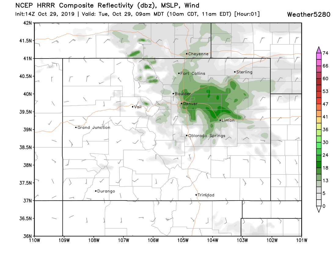
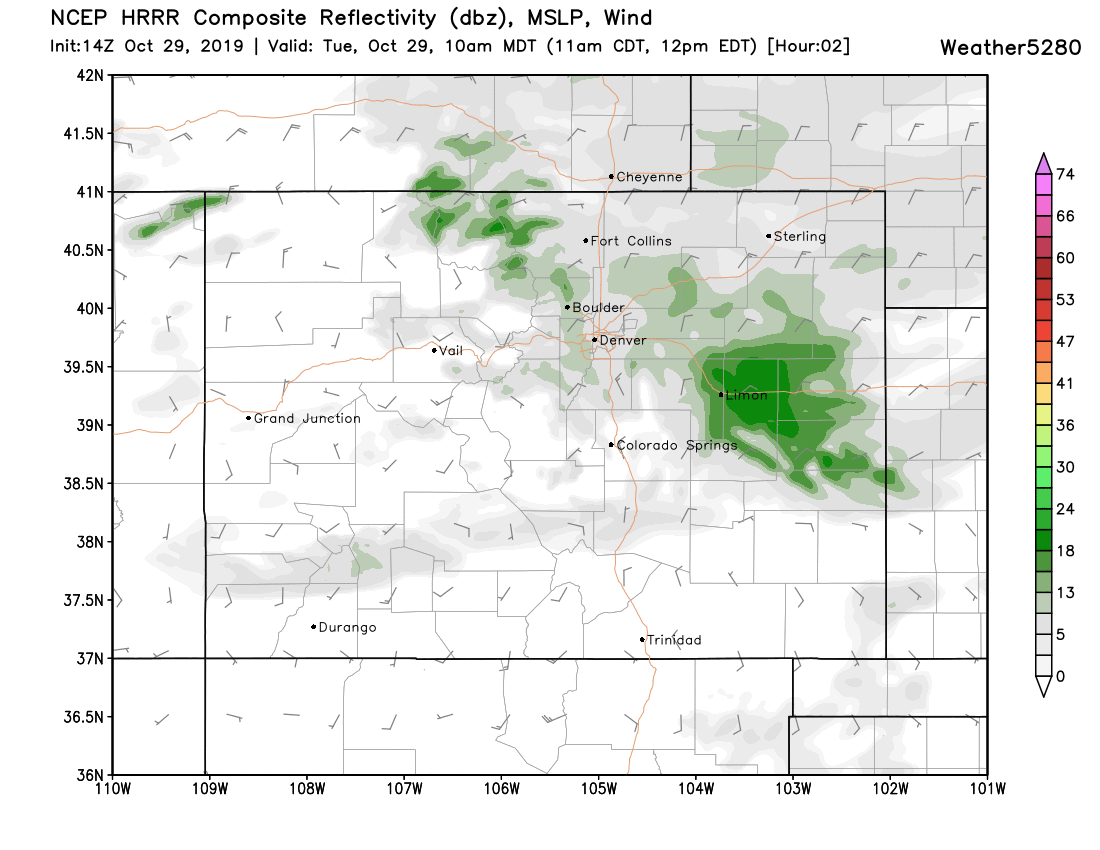
9am hour heavy snow pushing east of Denver:
Late morning generally light snow across the urban corridor:
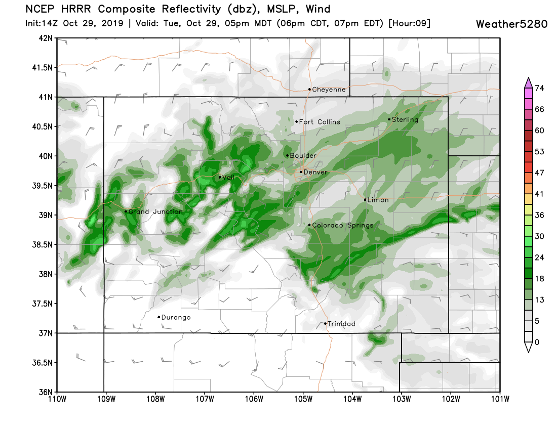
By the evening rush more heavy bands of snow pushing off the Rockies extending east over the Plains:
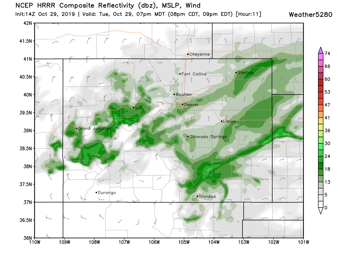
By 7pm still dealing with pockets of heavy snow across the greater Denver area:
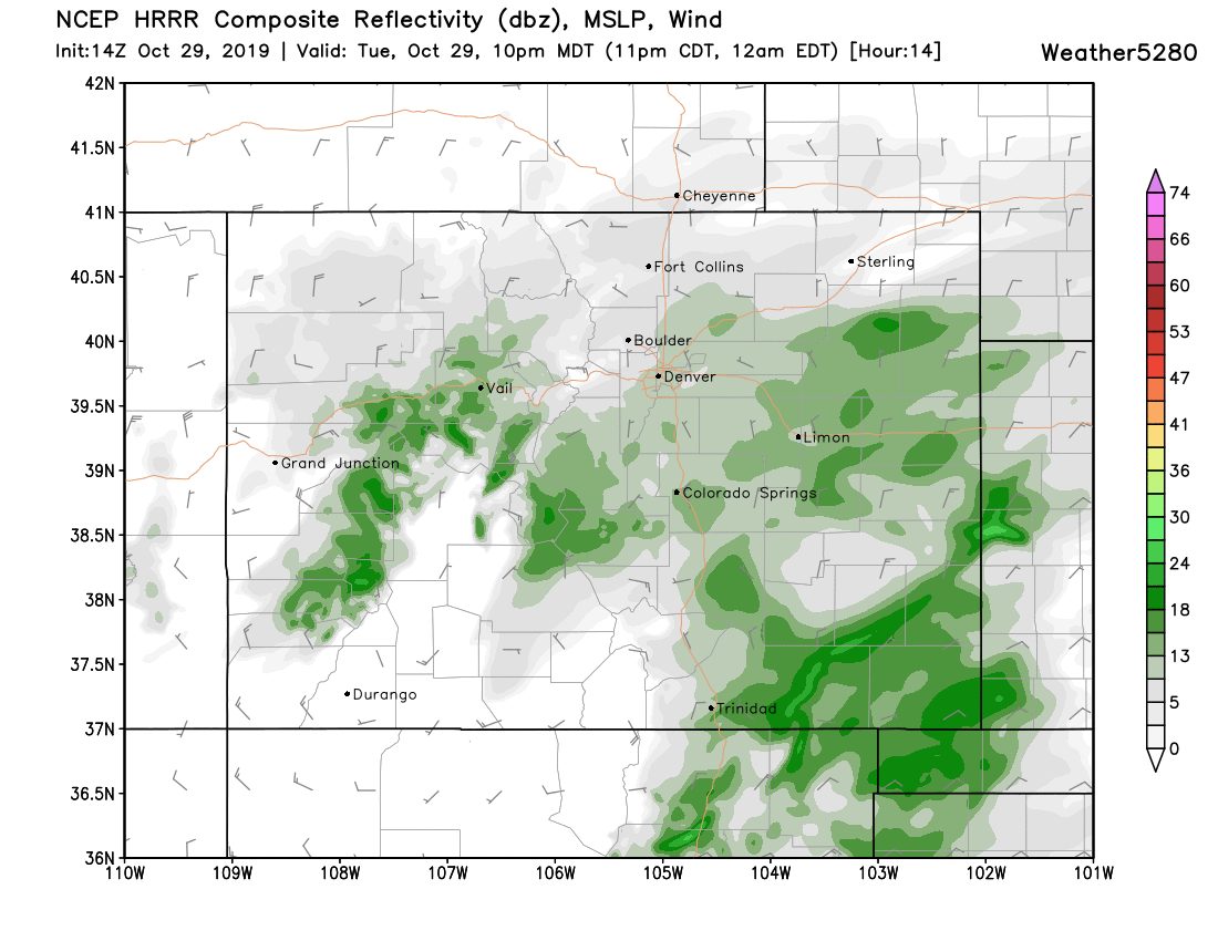
Overnight snow gradually becomes lighter, heaviest moves east-southeast across the plains:
Totals
No doubt some areas will see a boom from this storm with the help of the snow this morning. Overall our forecast should hold okay, with 4 - 8" across the greater Denver area, and 6 - 12" for eastern Denver and points east across the Plains as we outlined yesterday.
Some folks in our 4 - 8" zone are likely to see more than this, especially if some of the heavy bands tonight stall in a given location for any significant amount of time. Locally a foot seems absolutely doable, but we aren't going to change our forecast at this point.
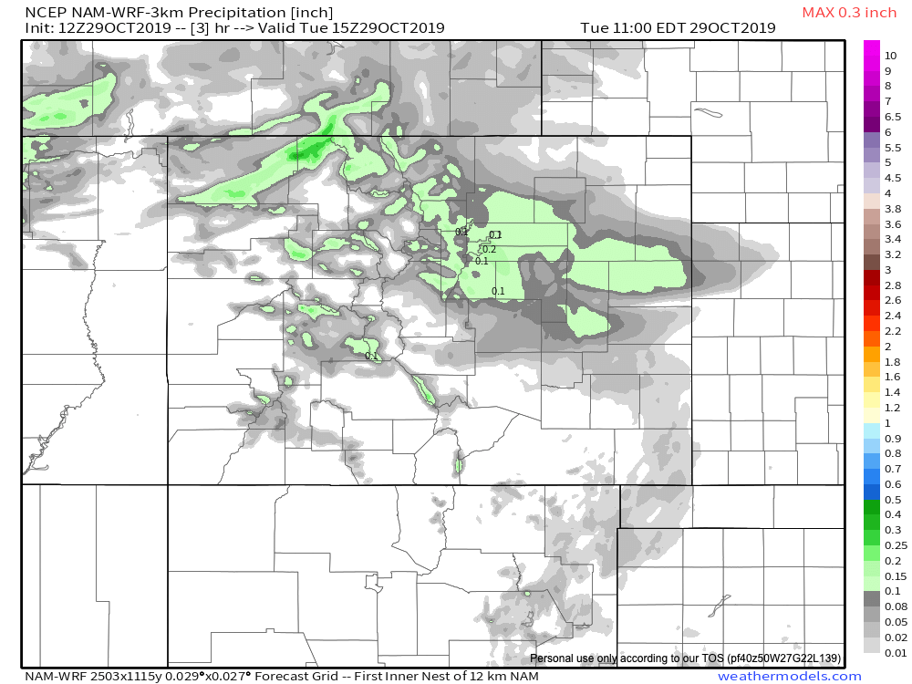
A lot of you are asking if this morning's snow means more snow than anticipated. Again, quite possibly... but overall we think things are on track. A look at the morning 3km NAM showed this for precipitation across the Denver area through 9am –– roughly 0.1 to 0.25", which matches up pretty well with the 2 - 4" reports we've seen so far.
By Wednesday here are its totals:
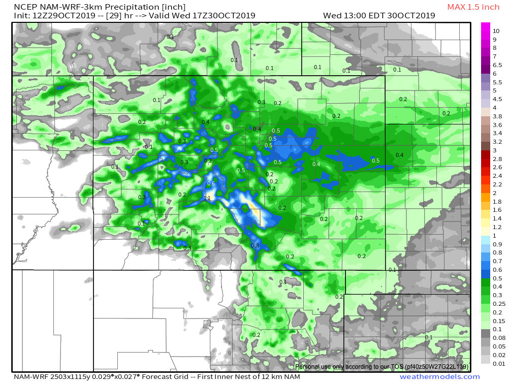
This would indicate another 0.2 to 0.3" for the urban corridor later today/night, and perhaps a bit more east/southeast of Denver. IF this model is to be believed, our forecast would still hold up okay, but certainly on the high-end of the 4 - 8" range we have.
Scenarios we see that could cause boom totals? If models are under doing QPF of afternoon/evening snow bands (possible), and or if the closed low stalls at all this evening. In both of these scenarios it'd be possible to see our high end totals not hold up across the board. We shall see.
In the end, the IMPACT remains the same. Roads will be a mess, temperatures will be awfully COLD, and travel will not be advised through the night.