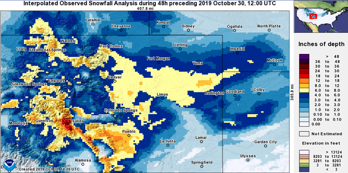
Snowfall totals across Northeast Colorado, October 30, 2019

What a wild run of weather its been over the last several days. The snow is moving out this morning, but the cold will linger for another night.
Our forecast high today takes us into the low 20s across the region, with overnight lows early Halloween morning dropping to near 0°F. Halloween will be warmer, but still chilly –– with highs near 40°F Thursday afternoon, dropping to near freezing for trick or treating.
The hourly planner for Denver below shows the snow is all but done here this morning, and the cold temperatures expected through the remainder of the day and tonight. While climbing above freezing for the first time in four days tomorrow will feel comparatively warm... the anomalous cold will stick with us through the end of the week:
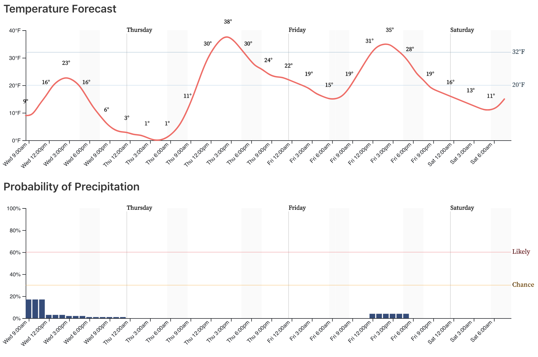
The scope of this October cold snap in the west is like no other on record. Today the last of the warmth holds on in the east before these colder temperatures finally deliver a taste of fall out there tomorrow as well:

For snow totals... The storm total for DIA from round two was 7.7", beautifully in our 4 - 8" range we had forecasted.
At our station on Denver's west side, we picked up an additional 4.25" yesterday and today, bringing the two storm total to 10.25".
Most other areas ended up right in the forecast range, as well. Southeast Denver did best with yesterday's/last night's snow, as expected. The Fort Collins area also did better with round two, which was good to see.
Here's a look at 48-hour snowfall totals from across the region:
And here are 72-hour totals, a pretty remarkable snowfall map for October!
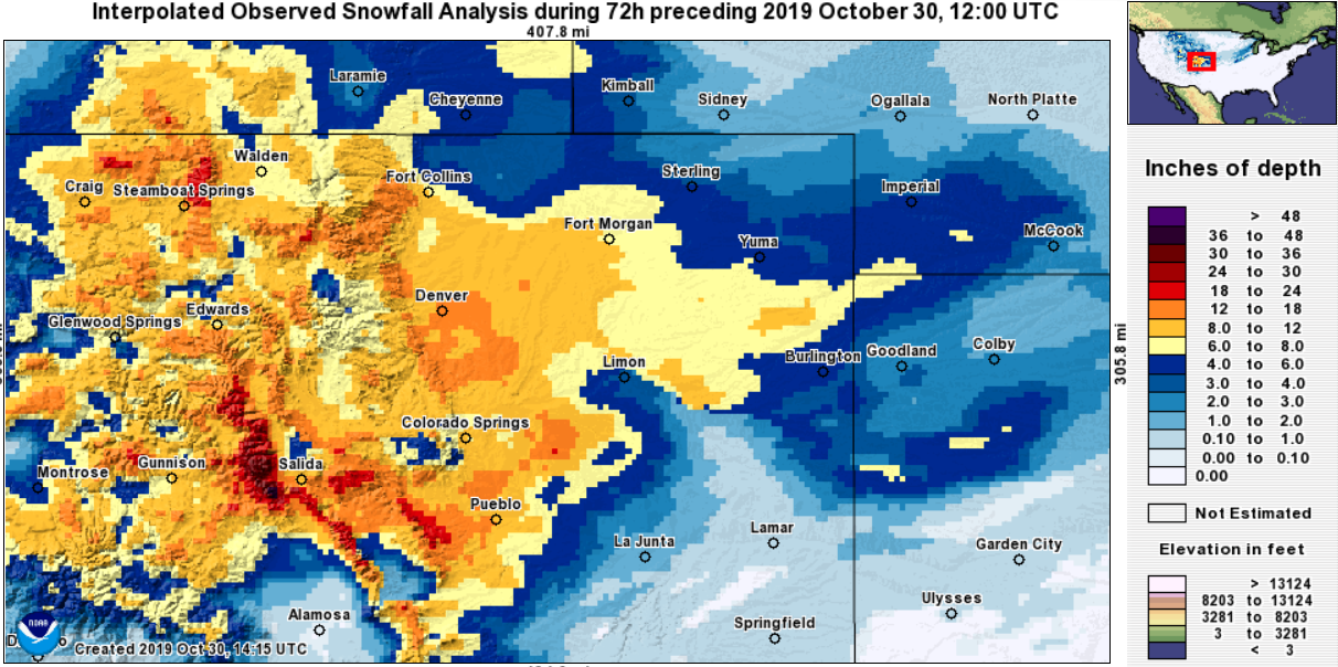
And finally, here's a link to an interactive map for totals from the National Weather Service (screen capture below). As expected, the totals in the 8 - 12" range ended up on the east side, with lower totals west. Generally 4 - 6" along and west of I-25 from Denver north, with totals in the 8 - 12" range south and east:

Stay warm out there.