Another severe weather day across Eastern Colorado, large hail possible

The last couple of severe weather days haven't panned out to produce all that many storms. The latest of which was on Sunday, where the strongest storms of the afternoon ended up southeast of Colorado Springs, with very little storm coverage (let alone anything severe) across the northern urban corridor.
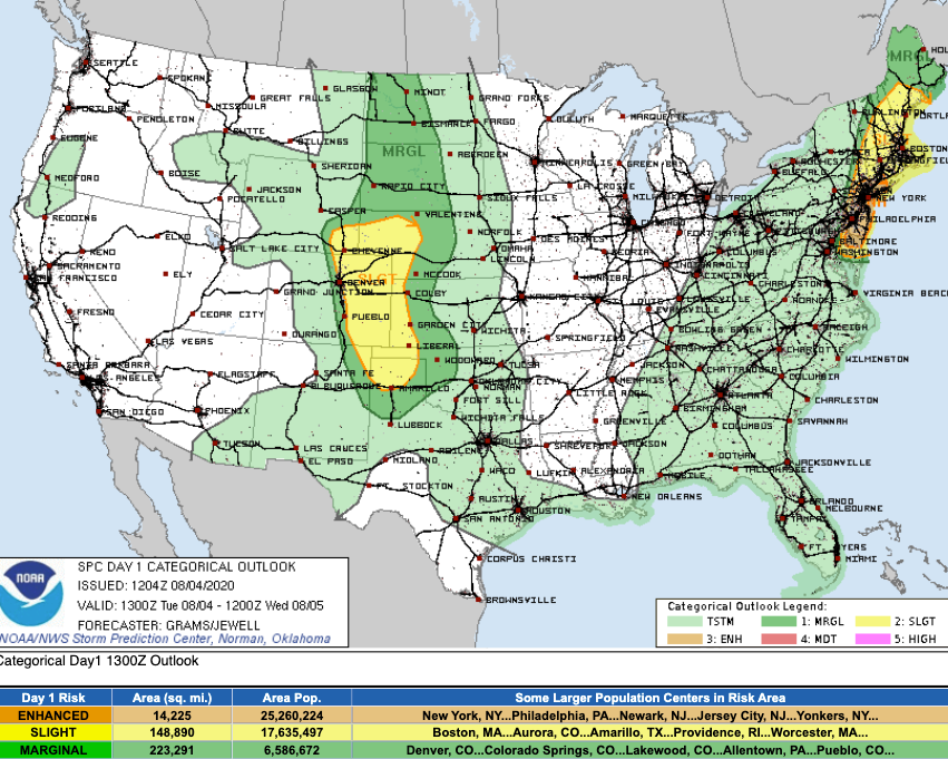
Today we once again see a heightened chance of storms to become severe across Eastern Colorado this afternoon and evening. The greatest risk for these storms to develop and become severe looks to be along and east of I-25.
Here is the latest outlook from the SPC, showing a Slight Chance for severe storms across most of Eastern Colorado, especially east of I-25:
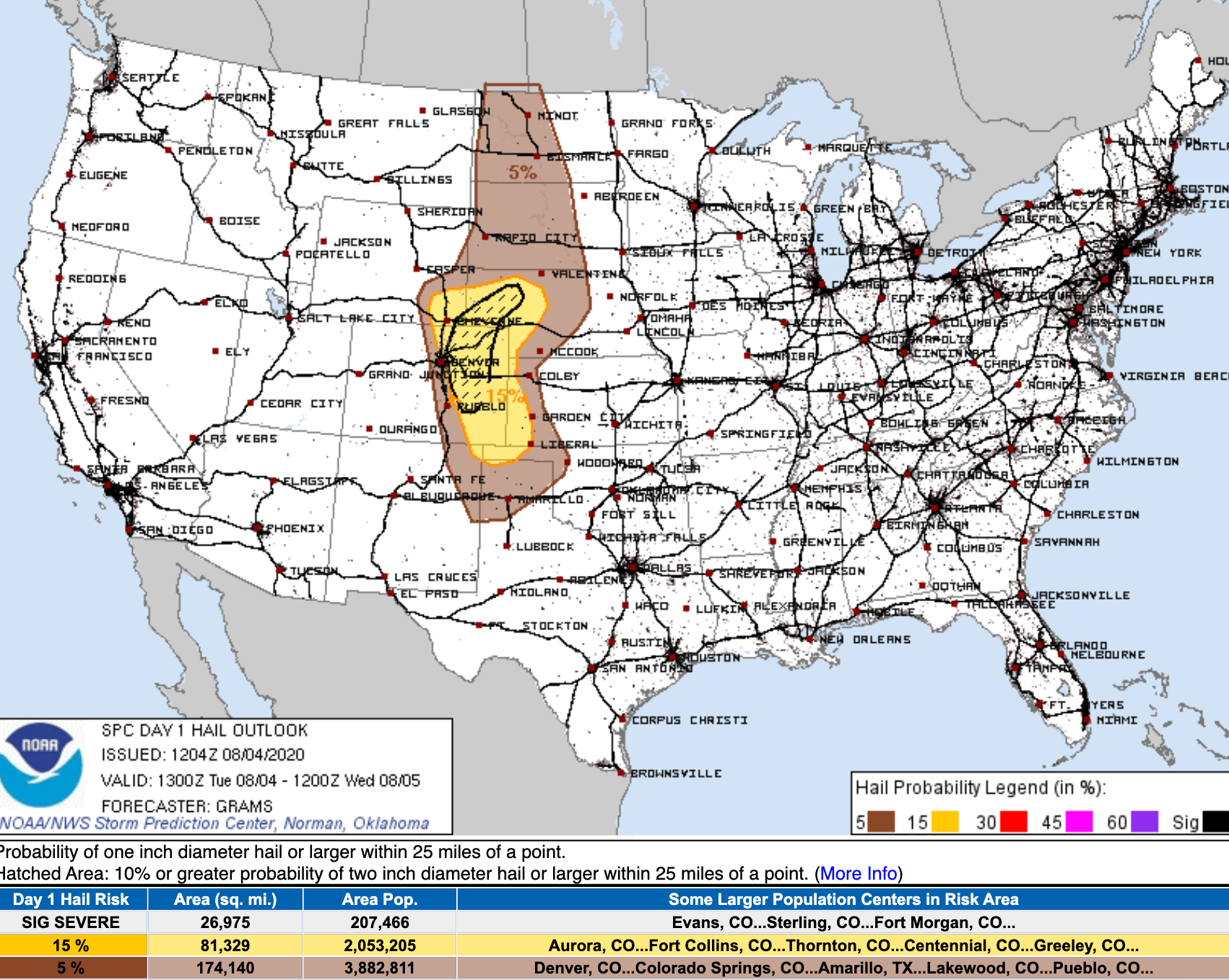
As on Sunday, the primary threat from these storms will be for damaging hail. The hatched area in the graphic below indicates a 10% or greater probability of two inch diameter hail or larger within 25 miles of a point. This area does not include I-25, but is awful close:

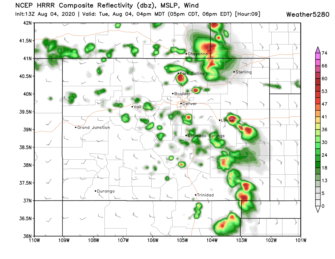
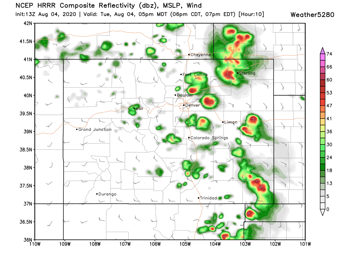
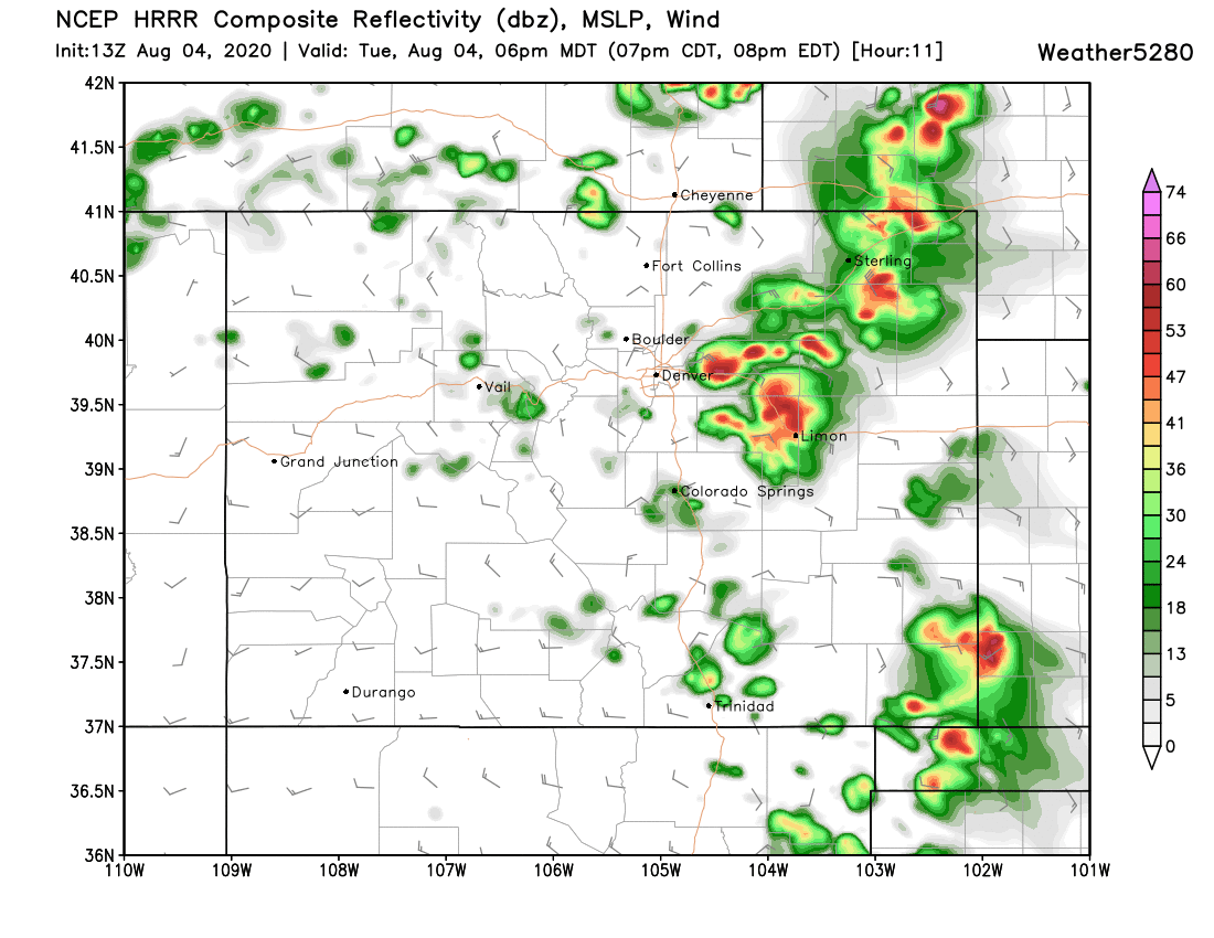
A look at the latest run from the HRRR is in pretty good alignment with this outlook, showing the greatest storm development developing north of Denver, then sliding east/southeast through the late afternoon/evening. This particular model run misses Denver proper altogether –– which is of course a possibility –– but not necessarily a reality. The greatest probabilities will be first north then east of downtown, but we cannot rule out a storm cruising through town either.
If we look at our probabilities, we see the greatest probabilities for measurable precipitation ending up just east of I-25 as well:
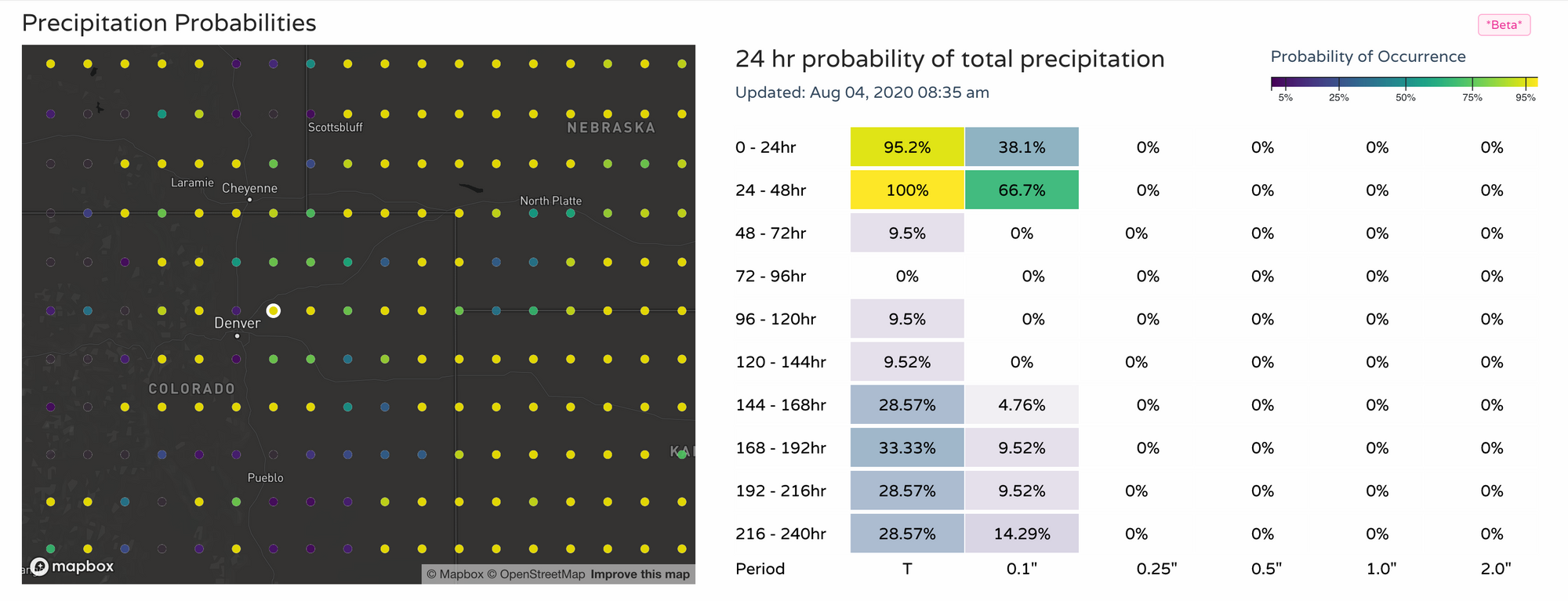
You'll also note probabilities looking pretty good for tomorrow as well. This is reflected in our hourly planner below – with 30 to 40% storm chances for Denver today, and 4o to 50% probabilities tomorrow:

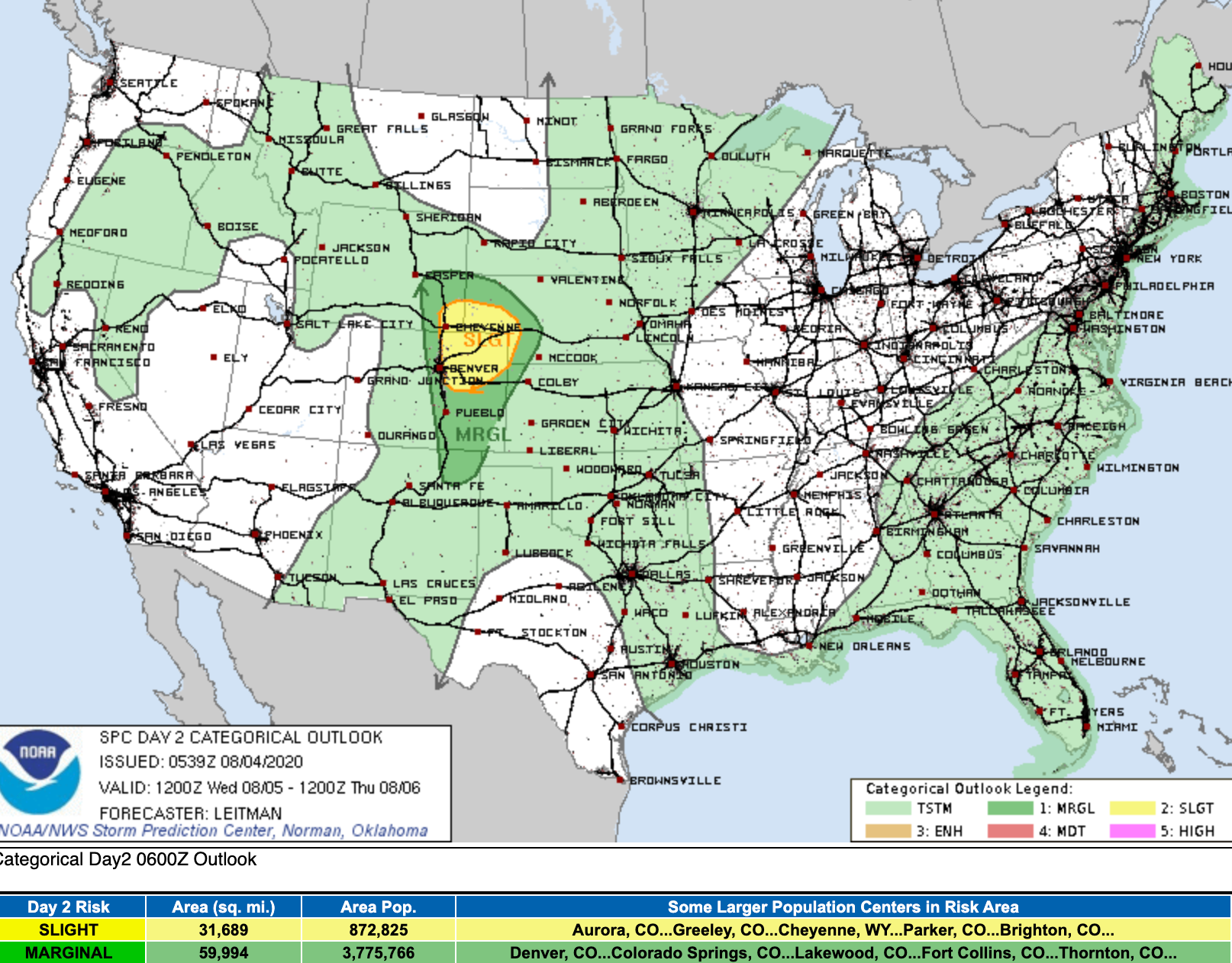
Storms that develop Wednesday will also be capable of becoming severe. A similar setup to today, with the SPC already indicating a Slight Chance for severe storms across Northeast Colorado on Wednesday:
Stay weather aware!
